Extreme Weather News

Jump to a Year

2022 | 2021 | 2020 | 2019 | 2018

2017 | 2016 | 2015 | 2014 | 2013

2012 | 2011 | 2010 | 2009 | 2008

2007 | 2006 | 2005 | 2004 | 2003

2002

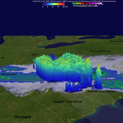
IMERG Measures West Virginia's Deadly Flooding Rainfall

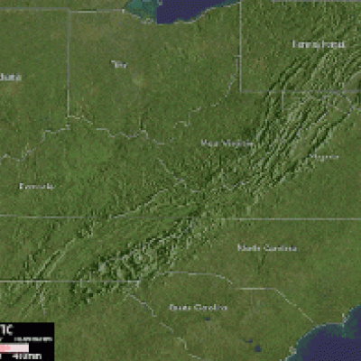
Since last Thursday over two dozen people have been reported killed and hundreds of homes have been destroyed by flooding in West Virginia. The governor of the state declared a federal disaster after the worst flooding in a century. The prevalence of rough terrain in West Virginia has amplified the effects of flooding rainfall. The National Weather Service predicted that thunderstorms were going to fall in the area again today. More flash flooding with streams again coming out of their banks has been predicted. NASA's Integrated Multi-satellitE Retrievals for GPM (IMERG) data were used in this

Slow-moving Frontal System Triggers Storms, Flooding Across Ohio Valley

A slow-moving frontal boundary draped across the central US from the Central Plains across the Middle Mississippi and Ohio Valleys and into the Mid-Atlantic region has been providing the focus for numerous showers and thunderstorms the past few days while an associated East-West oriented, upper-level jet stream located near the front has helped to organize and strengthen the storms. This has lead to severe weather and flooding across the region. The latest episode began when thunderstorms formed and organized into a line across northern Illinois and southern Lake Michigan on the evening of

Danielle Hits Mexico And Weakens

Tropical Storm Danielle started weakening after making landfall north of Tuxpan, Mexico on Monday evening just before June 21, 2016 at 0000 UTC (June 20, 2016 7:00 PM CDT). As Danielle weakened the low level circulation quickly became disorganized. The GPM core observatory satellite passed above rapidly weakening Danielle on June 21, 2016 at 0421Z (June 20, 2016 11:21 PM CDT). The approximate center of Danielle's circulation at the time of this GPM pass is shown with a red tropical storm symbol. A rainfall analysis from GPM's Microwave Imager (GMI) and Dual-Frequency Precipitation Radar (DPR)

GPM Sees Tropical Storm Danielle Forming

A tropical depression (TD4) in the southwestern Gulf of Mexico was designated tropical storm Danielle by the National Hurricane Center (NHC) this morning at 1500 UTC (1000 AM CDT). Danielle is the earliest fourth-named tropical storm to form in the Atlantic Basin. Danielle's life as a tropical storm is predicted to be short because it is moving almost due west and is predicted to move over the east coast of Mexico later today or tonight. Heavy rainfall is expected to cause flash floods and mudslides over eastern Mexico over the next few days. The GPM core observatory satellite flew above the

IMERG Sees Onset Of Possibly Wetter India Monsoon

On June 8 the nodal weather agency of India (IMD) declared the arrival of the 2016 Southwest Monsoon over the Indian state of Kerala. This season is expected to be rainier than recent years. The El Nino conditions which have been blamed for recent disappointing monsoons has weakened to ENSO-neutral conditions. ENSO-neutral conditions are expected to transition to La Nina in the northern hemisphere by the fall and winter of 2016-17. La Nina conditions normally result in beneficial wetter and cooler monsoons in India. An animation of weekly rainfall totals was derived from NASA's Integrated