
GPM Sees Tropical Storm Danielle Forming
A tropical depression (TD4) in the southwestern Gulf of Mexico was designated tropical storm Danielle by the National Hurricane Center (NHC) this morning at 1500 UTC (1000 AM CDT). Danielle is the earliest fourth-named tropical storm to form in the Atlantic Basin. Danielle's life as a tropical storm is predicted to be short because it is moving almost due west and is predicted to move over the east coast of Mexico later today or tonight. Heavy rainfall is expected to cause flash floods and mudslides over eastern Mexico over the next few days.
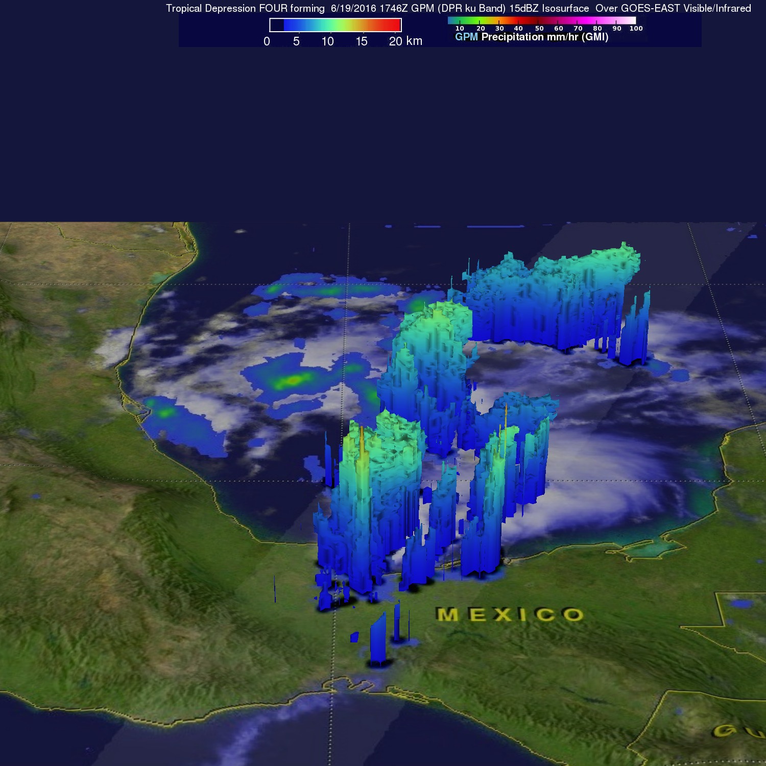
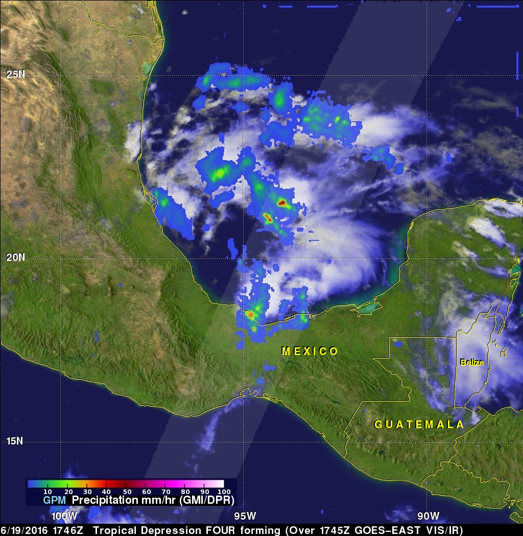
The GPM core observatory satellite flew above the Gulf Of Mexico on June 19, 2016 at 1746 UTC (12:46 PM CDT). The area where Danielle formed was examined by GPM's Microwave Imager (GMI) and Dual-Frequency Precipitation Radar (DPR). DPR data showed intense showers falling at a rate of over 87 mm (3.4 inches) per hour in thunderstorms along the southern Gulf Of Mexico coast. GPM's radar (DPR) measured a few storm tops in that area reaching heights above 15.6 km (9.7 miles) and showers within the storms returned radar reflectivity values of over 53dBZ to the satellite.