Extreme Weather News

Jump to a Year

2022 | 2021 | 2020 | 2019 | 2018

2017 | 2016 | 2015 | 2014 | 2013

2012 | 2011 | 2010 | 2009 | 2008

2007 | 2006 | 2005 | 2004 | 2003

2002

IMERG Shows Heavy Rainfall From Southwest India To Northeast India JacobAdmin Fri, 06/02/2017
In the past couple weeks rainfall has had a significant impact on Sri Lanka, southwestern India, Bangladesh and eastern India. Monsoon rainfall caused widespread flooding, devastating mudslides and displacements of many thousands of people in Sri Lanka. Over 200 people's deaths have now been attributed to this disaster. Then cyclone Mora formed in the Bay Of Bengal on May 27, 2017. Heavy rain from Mora and it's remnants moved over southeastern Bangladesh and northeastern India. Monsoon rainfall also started to move into southern India. This rainfall analysis was derived from NASA's Integrated
Cyclone Mora Examined By GPM JacobAdmin Wed, 05/31/2017
The GPM core observatory satellite passed over cyclone Mora on May 30, 2017 at 1121 UTC. Mora had passed into southeastern Bangladesh less than six hours earlier. Maximum sustained winds within Mora were estimated to be about 55 kts (63 mph) when GPM passed above. Data received by GPM's Microwave Imager (GMI) and Dual-Frequency Precipitation Radar (DPR) instruments revealed the location and intensity of rainfall around the dissipating cyclone. GPM's radar swath, shown in lighter shades, covered the area west of the dissipating cyclone's center. GPM's DPR found that rain was still falling at a

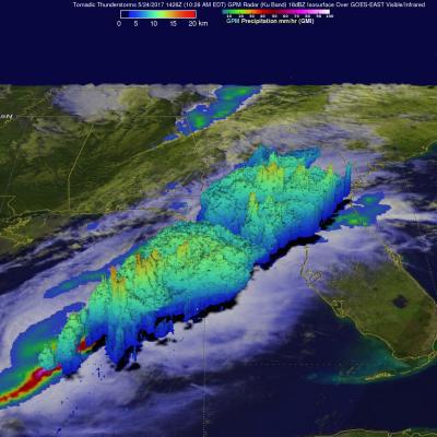
Heavy Rainfall Induced Landslide Observed By IMERG

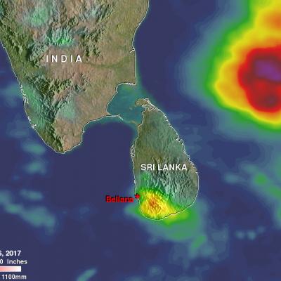
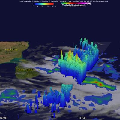
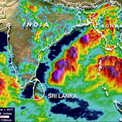
More than 90 people have been reported killed and over 100 missing due to a landslide in the village of Bellana, in the Kalutara district of Sri Lanka. Heavy monsoon rainfall over the past few days caused the disaster. Heavy rainfall is shown over the southwestern Bay Of Bengal in this analysis of rainfall accumulation using NASA's Integrated Multi-satellitE Retrievals for GPM (IMERG) data. This IMERG analysis included the period from May 23 to early May 26, 2017. The maximum IMERG rainfall accumulation estimates in this area were shown in the Bay Of Bengal to the northeast of Sri Lanka where

Tornado Spawning Storms Examined By GPM Satellite

On Wednesday May 24, 2017 severe weather affected a large area of the eastern United States. Tornadoes were reported in Florida, Georgia, South Carolina, North Carolina and Ohio. The GPM core observatory satellite flew above a line of tornado spawning storms that were moving through the Florida panhandle on May 24, 2017 at 10:26 AM EDT ( 1426 UTC). GPM's Microwave Imager (GMI) and Dual-Frequency Precipitation Radar (DPR) instruments collected data showing that very heavy downpours were accompanying some of these storms. The violent storms moving through the Southeast were strong but GPM's

GPM Sees Powerful Storms With Advancing Monsoon

The GPM core observatory satellite passed over the Bay Of Bengal on May 23, 2017 at 0251 UTC. GPM flew almost directly above very strong convective storms that were located east of Sri Lanka. These powerful storms were associated with the approaching South-West monsoon. The amount and timing of monsoon rainfall is very important to the economy of India. GPM's Microwave Imager (GMI) and Dual-Frequency Precipitation Radar (DPR) instruments collected data that showed the location and intensity of rainfall in the southern Bay Of Bengal. Very heavy rainfall was detected within this cluster of