

Field Campaigns
Ground Validation observations for statistical validation of GPM products are made in a series of investigator-led field measurement campaigns, known as Extended Observation Periods (EOPs). EOPs last several months and are punctuated by one or more Intensive Observation Periods (IOPs).
Completed Field Campaigns
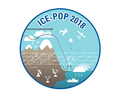 ICE-POP
The International Collaborative Experiments for Pyeongchang 2018 Olympic and Paralympic Winter Games (ICE-POP 2018) takes place during the Winter Olympics (February-March) of 2018 and focuses on the measurement, physics, and improved prediction of heavy orographic snow in the PyeongChang region of South Korea. ICE-POP is led by the Korean Meteorological Administration (KMA) as a component of the World Meteorological Organization’s (WMO) World Weather Research Program (WWRP) Research and Development and Forecast Demonstration Projects (RDP/FDP). The goals of ICE-POP are:
-
Improvement of our understanding on severe weathers (snowfalls, visibility, rapid wind changes and gusts,) over complex terrain - Specially focus on the microphysical processes over complex terrain as well as the impact of the ocean on snow to extend the experience from SNOW-V10 and FROST- 2014.
-
Improvement of the predictability of nowcasting and very-short-range forecasting with a few kilometer horizontal resolution - Development of NWP-based nowcasting, multi-scale data assimilation and time- lagged ensemble for VSRF, and radar reflectivity and visibility data assimilation
-
Improvement of verification and evaluation methods for high resolution model considering complex terrain - Development of verification methods for high spatial and temporal variables with remote-sensing observation and non-traditional variables (visibility and precipitation type, etc) to consider benefit for social and economic effect
 OLYMPEX
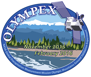
The Olympic Mountain Experiment (Olympex) was held on the Olympic Peninsula of northwest Washington State. OLYMPEX represents the last in a series of larger GPM GV-led field campaign efforts and concentrated on the following (McMurdie et al. 2015; Houze et al., 2016):
-
Physical validation of GPM satellite-based precipitation (rain and snow) estimation algorithms for both the GMI and DPR.
-
Relation of mid-latitude frontal precipitation mechanisms and their modification by terrain to GPM rainfall estimation uncertainties.
-
Quantifying the accuracy and uncertainty of the GPM precipitation data and impacts on hydrologic applications.
-
Merger of numerical modeling and satellite observations to optimize precipitation estimation in hybrid weather monitoring systems of the future.
-
Further descriptions of the campaign and links to data can be found at https://ghrc.nsstc.nasa.gov/home/field-campaigns/olympex, http://olympex.atmos.washington.edu/, and https://gpm-gv.gsfc.nasa.gov/
 IPHEX
IPHEX
Integrated Precipitation and Hydrology EXperiment (IPHEX) sought to characterize warm season orographic precipitation regimes, and the relationship between precipitation regimes and hydrologic processes in regions of complex terrain. IPHEX included two major activities:
- The development, evaluation and improvement of remote-sensing precipitation algorithms in support of the Global Precipitation Measurement Mission (GPM) through NASA GPM ground validation field campaign: IPHEX-GVFC
- The evaluation of Quantitative Precipitation Estimation (QPE) products for hydrologic forecasting and water resource applications in the Upper Tennessee, Catawba-Santee, Yadkin-Pee Dee and Savannah river basins: IPHEX- HAP (H4SE). NOAA HTM has synergy with this project.
 IFLOODS
Iowa Flood Studies (IFloodS) was a ground measurement campaign that took place in eastern Iowa from May 1 to June 15, 2013. The goals of the campaign were to collect detailed measurements of precipitation at the Earth's surface using ground instruments and advanced weather radars and, simultaneously, collect data from satellites passing overhead. The ground instruments characterized precipitation -- the size and shape of raindrops, the physics of ice and liquid particles throughout the cloud and below as it falls, temperature, air moisture, and distribution of different size droplets -- to improve rainfall estimates from the satellites, and in particular the algorithms that interpret raw data for the Global Precipitation Measurement (GPM) mission's Core Observatory satellite, which launched in February 2014
. GCPEX
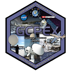
GCPEX
GPM Cold-season Precipitation Experiment (GCPEX) was conducted in cooperation with Environment Canada and NASA's CloudSat mission from January 17 through February 29, 2012. The experiment used instrumented NASA DC-8 and NASA-funded University of North Dakota Cessna Citation aircraft for flights over ground sites located in and around the Environment Centre for Atmospheric Research Experiments (CARE) located in Egbert, Ontario. The DC-8 aircraft flew high above clouds and precipitation with instruments similar to those on the GPM Core satellite. The Citation aircraft flew through snowing clouds to measure snowflake properties in situ. Ground-based equipment was also be used to measure precipitation. Data from the experiment will be used to develop and validate snow and frozen precipitation retrieval algorithms used in the generation of data products for GPM, CloudSat and future polar precipitation missions planned by the European Union.
 MC3E
MC3E
he Mid-latitude Continental Convective Clouds Experiment took place in the spring of 2011. This campaign was conducted in cooperation with the Department of Energy's (DoE) Atmospheric Radiation Program (ARM). The field campaign occurred in south-central Oklahoma and sampled a broad variety of precipitation types and intensities, including many cases of severe thunderstorm systems, using two aircraft (NASA/ER-2 and UND/Citation) and an extensive array of ground instruments over a 6-week period. The campaign contributed to the improvement of radar and microwave precipitation retrieval algorithms over land. [MC3E Science Plan]
 LPVEx
LPVEx
GPM GV participated in the fall 2010 Light Precipitation Verification Experiment (LPVEx) hosted by the Finnish National Meteorological Institute (FNMI). The CloudSat project led the overall coordination of the LPVEx field campaign including the planning, execution, and subsequent analysis and archival of results. GPM led the installation and operation of numerous additional ground assets including rain gauges and disdrometers to augment and extend the volumetric use of existing in situ rainfall sensors on the ground. Other collaborators include Environment Canada, the United Kingdom National Environmental Research Council, Vaisala Inc. and the University of Helsinki. For more information, visit the LPVEx Campaign Homepage at CSU. [LPVEx Science Plan]
CHUVA and Pre-CHUVA
A collaboration with the Brazilian space program, this project carries out field experiments at seven sites to investigate the different precipitation regimes in Brazil. To study these precipitation regimes, the field campaigns make use of dual polarization radar, lidar, microwave radiometers, disdrometer, radiosonde and various other instruments. The analysis is performed focusing on the microphysical evolution and cloud life cycle, different precipitation estimation algorithms, the development of thunderstorms and lightning formation, processes in the boundary layer and cloud microphysical modeling. This project extends the knowledge of cloud processes to reduce uncertainties in precipitation estimation, mainly from warm clouds and, consequently, improving knowledge of the water and energy budget and cloud microphysics.
C3VP
GPM GV participated in the winter 2007/2008 Canadian CloudSat/CALIPSO Validation Programme (C3VP) hosted by Environment Canada at the Meteorological Service of Canada's Centre for Atmospheric Research Experiments (CARE). More information can be found at the official C3VP website.