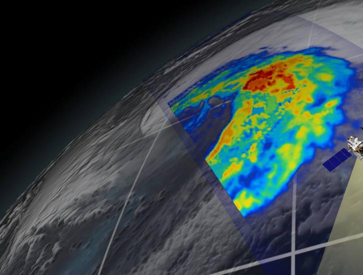
Precipitation Radar (PR)
The Precipitation Radar was the first spaceborne instrument designed to provide three-dimensional maps of storm structure. These measurements yield invaluable information on the intensity and distribution of the rain, on the rain type, on the storm depth and on the height at which the snow melts into rain. The estimates of the heat released into the atmosphere at different heights based on these measurements can be used to improve models of the global atmospheric circulation.
The Precipitation Radar has a horizontal resolution at the ground of about 3.1 miles (five kilometers) and a swath width of 154 miles (247 kilometers). One of its most important features is its ability to provide vertical profiles of the rain and snow from the surface up to a height of about 12 miles (20 kilometers). The Precipitation Radar is able to detect fairly light rain rates down to about .027 inches (0.7 millimeters) per hour. At intense rain rates, where the attenuation effects can be strong, new methods of data processing have been developed that help correct for this effect. The Precipitation Radar is able to separate out rain echoes for vertical sample sizes of about 820 feet (250 meters) when looking straight down. It carries out all these measurements while using only 224 watts of electric power—the power of just a few household light bulbs. The Precipitation Radar was built by the National Space Development Agency (JAXA) of Japan as part of its contribution to the joint US/Japan Tropical Rainfall Measuring Mission (TRMM)
Technology Challenges and Advances
Among the three primary instruments on TRMM, the most innovative is the Precipitation Radar. Other instruments similar to the TRMM Microwave Imager (TMI) and the Visible and Infrared Scanner (VIS) VIRS have operated in space before, but to date there has not been any radar in space for the purpose of measuring rainfall.
Although weather radars on the ground have been used ever since World War II to estimate rainfall, there were many technical challenges that had to be overcome before an instrument of this kind could be used from space.
Power
A fundamental requirement is ensuring that the spaceborne radar has enough power to detect the weak return echo from the rain drops when seen from TRMM’s orbital height of 250 miles (402 kilometers) above the Earth.
3-D Resolution
Another challenge is to gather high resolution three-dimensional maps of the rain during the brief time that the satellite overflies local storms. To meet these demands, Japan’s Communications Research Laboratory elected a radar frequency about three times higher than that of a typical ground-based radar. Despite the restrictions on the size of the antennas in space, the use of a higher frequency provides good resolution and high quality images of storms. An active-phased array antenna, and sophisticated signal- processing techniques are used to scan the antenna beam electronically and rapidly, while ensuring that the transmitted and received radar pulses are synchronized. Solid state power amplifiers (128) are used both to conserve power and to provide a design that is robust.
Focusing the Radar Beam
Another problem to be overcome for the spaceborne radar was the need to produce a narrow radiating beam so that the target area would be small enough to bring out the features of interest on the ground— that is, good ground resolution. And still another problem was to be able to make the beam sweep out a path on the ground that would be wide enough to give good coverage as the satellite moves along its orbit. All of these design considerations were met through developments at Japan’s Communications Research Laboratory. Both the narrow beam size and the ability to steer the beam are achieved through the design of a “phased array” antenna, which uses electronic steering of the beam.

