Extreme Weather News

Jump to a Year

2022 | 2021 | 2020 | 2019 | 2018

2017 | 2016 | 2015 | 2014 | 2013

2012 | 2011 | 2010 | 2009 | 2008

2007 | 2006 | 2005 | 2004 | 2003

2002

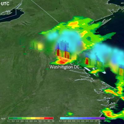
GPM Flies Over Flooding Rainfall in Washington DC

Washington DC experienced extreme rainfall the morning of July 8th, 2019 when a cluster of slow-moving thunderstorms moving through the area tapped into a very moist airmass to produce extremely heavy rains, which resulted in flash flooding throughout the region. The storms were triggered by a nearby frontal boundary. The GPM Core Observatory passed over this storm system at 8:51am ET, with its Dual-frequency Precipitation Radar measuring rainfall rates in excess of 100 mm/hr in some areas. Reagan National Airport (DCA) also reported receiving 80 mm of rainfall in one hour, corroborating the

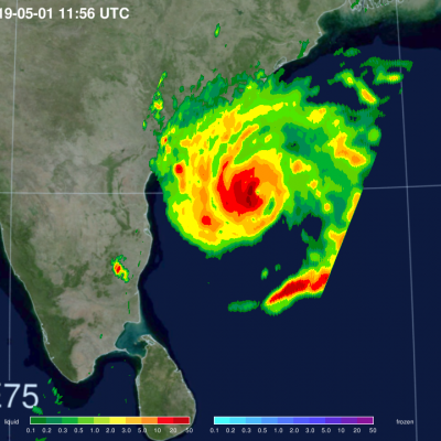
NASA Reveals Heavy Rainfall in Tropical Cyclone Fani

Satellite data revealed heavy rainfall in powerful Tropical Cyclone Fani before it made landfall in northeastern India. Fani brought that soaking rain to the region and continues to drop heavy rainfall on May 3, as it moves toward Bangladesh. NASA’s GPM or Global Precipitation Measurement mission satellite provides information on precipitation from its orbit in space. On May 1 at 7:56 a.m. EDT (1156 UTC), the GPM Core Observatory captured an overpass of the powerful storm as it continued strengthening and moving toward landfall. A 3D image and a color-enhanced rainfall image were created at

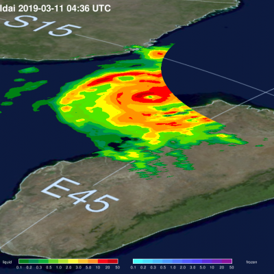
GPM Flies Over Developing Tropical Storm Idai Twice

Intense Tropical Cyclone Idai started as a tropical depression on the 4th of March, 2019, off the coast of Mozambique. After making landfall over Mozambique it turned back over the Mozambique Channel and strengthened to become a tropical cyclone on the 10th of March. The GPM satellite captured the cyclone with both the GPM Microwave Imager (GMI) and the Dual-frequency Precipitation Radar (DPR) on the 11th of March at 04:36 UTC when the storm was in the middle on the Mozambique Channel. The DPR captured a well-developed eye, seen at the center of the image. It flew over the storm once again at

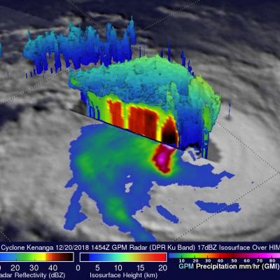
GPM Examines Weakening Tropical Cyclone Kenanga

Tropical cyclone Kenanga has started to weaken as predicted. The GPM core observatory satellite had an excellent view of Kenanga on December 20, 2018 at 1454 UTC when the tropical cyclone's maximum sustained winds had decreased to about 90 kts (103.5 mph). That GPM pass also showed that the eye that was so prominent a day earlier had filled. Data collected by the satellite's Microwave Imager (GMI) and GPM's Dual-Frequency Precipitation Radar (DPR) instruments revealed through the overcast that powerful storms south of Kenanga's center of circulation were still producing very heavy rainfall

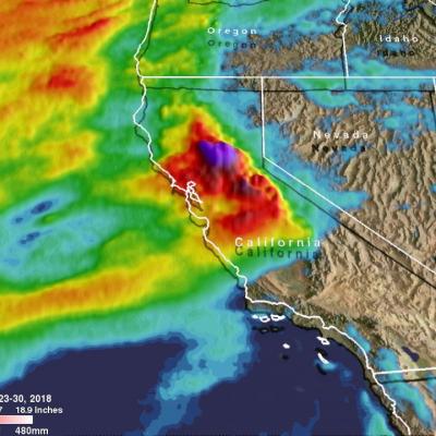
IMERG Measures Flooding Rainfall In Deadly California Wildfire Areas

Heavy precipitation has been falling in areas of California that were recently devastated by deadly wildfires. This flooding rainfall has resulted in evacuations in burn scarred areas such as Butte County where the deadly Camp Fire hit this month. Flash floods, debris flows and mudslides are now predicted in areas where deadly wildfires stripped away vegetation. On a positive note these Pacific storms are expected to dampen wildfires and replenish the Sierra Nevada snowpack. This snowpack is an important source of water for California's streams and rivers. NASA's Integrated Multi-satellitE