
TRMM Sees Severe Weather
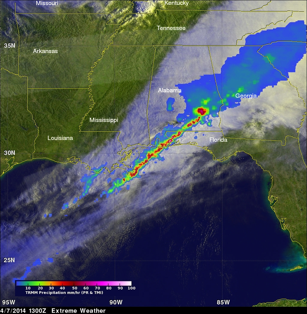
The TRMM satellite flew over the southeastern United States on April 7, 2014 at 1300 UTC (9:00 AM EDT) when a line of intense thunderstorms was moving through the area. Tornado watches were in effect over much of the area. A possible tornado, associated with the same weather system, caused destruction and injuries when it moved through southern Mississippi earlier at about 2 AM EDT.
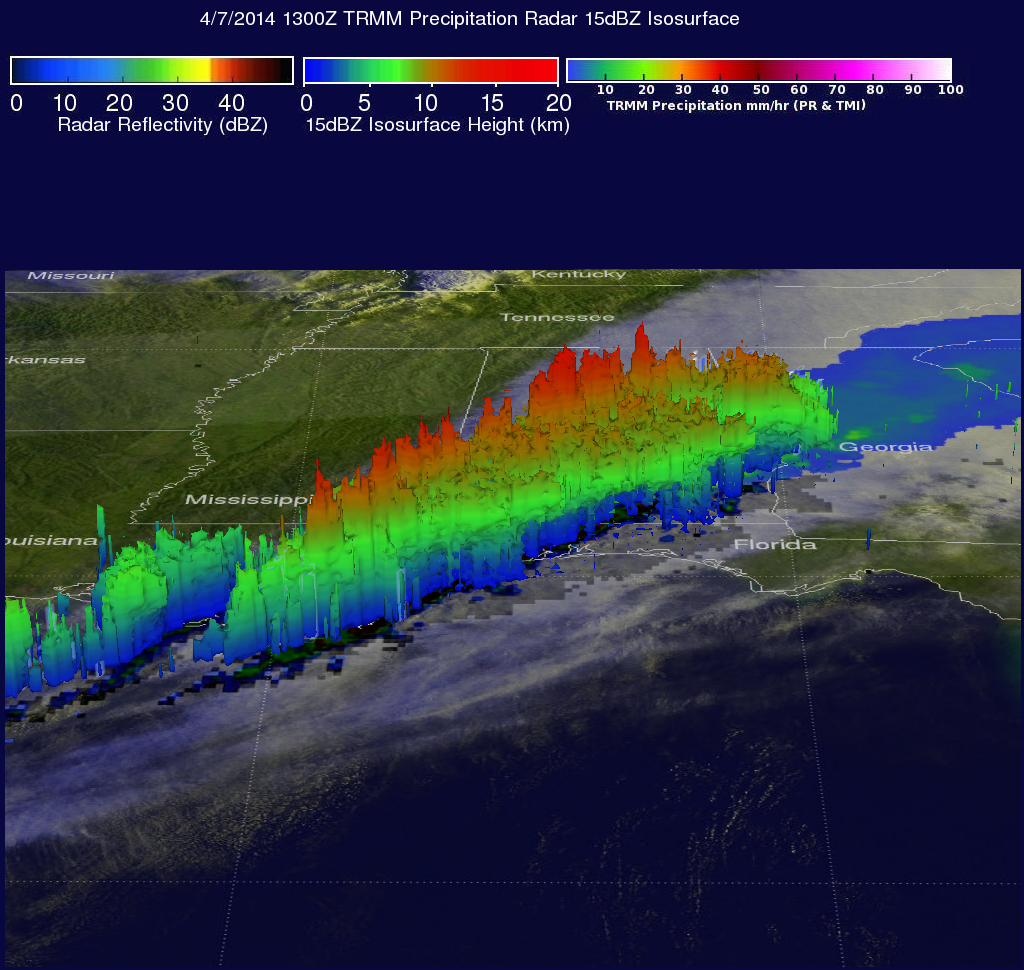
TRMM's Precipitation Radar (PR) data revealed that rain was falling at a rate of over 130mm/hr (about 5.1 inches) in one severe thunderstorm near the Alabama and Florida panhandle border. A radar reflectivity value of over 58dBZ was returned to the satellite from the same area. The image above shows a simulated 3-D view of this line of powerful thunderstorms. TRMM data in this image are shown overlaid on a visible/infrared image from a GOES-EAST satellite image captured at 12:45 UTC (8:45 AM EDT).
Click here to see a Low Resolution 640x360 simulated 3-D (Quicktime) flyby animation using TRMM PR data.
Click here to see a Low Resolution 640x360 simulated 3-D (MPEG) flyby animation using TRMM PR data.