
TRMM Sees New Tropical Storm Arthur
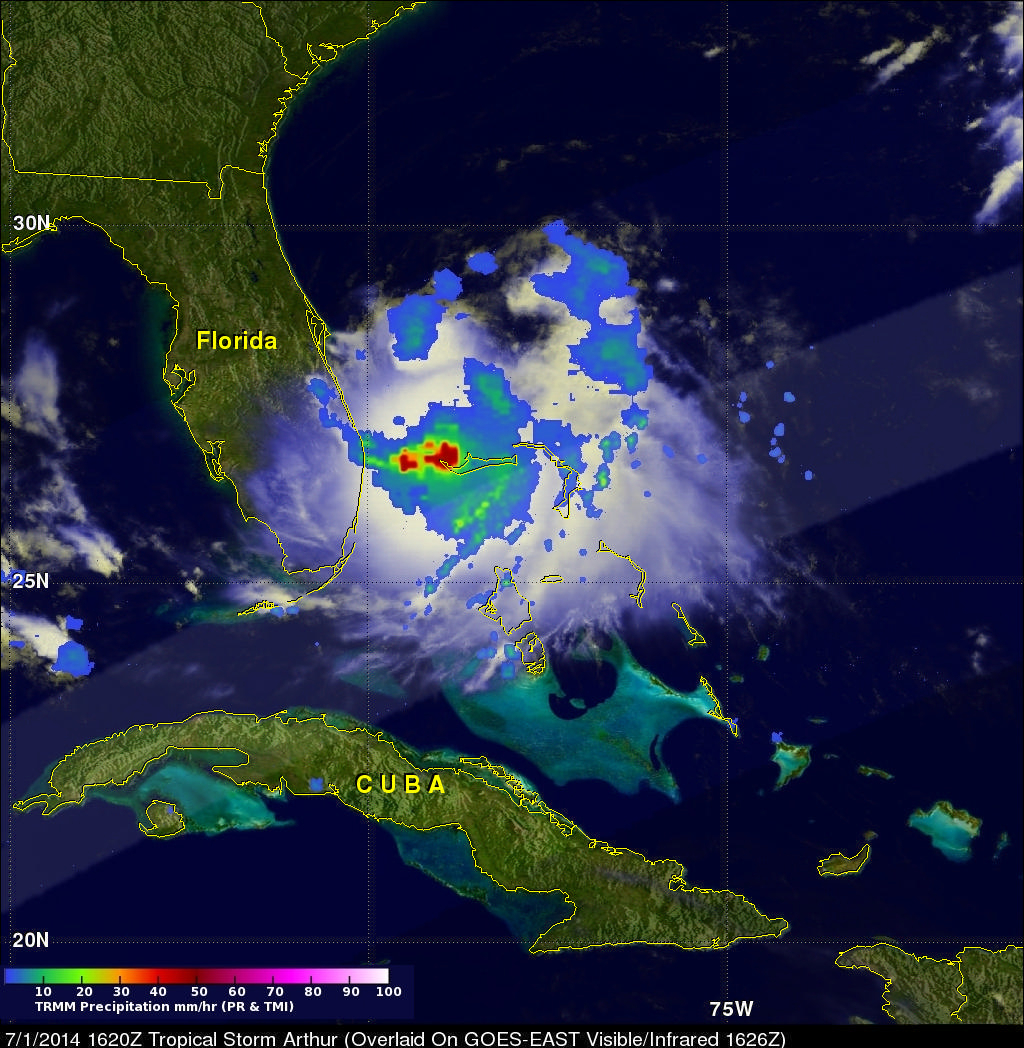
The TRMM satellite had a good daylight look at tropical storm Arthur on July 1, 2014 at 1620 UTC (12:20 PM EDT) less than two hours after it was upgraded from a tropical depression. Rainfall from TRMM's Microwave Imager (TMI) and Precipitation Radar (PR) data are shown overlaid on a GOES-EAST infrared/visible image collected at 1626 UTC (12:26 PM EDT).
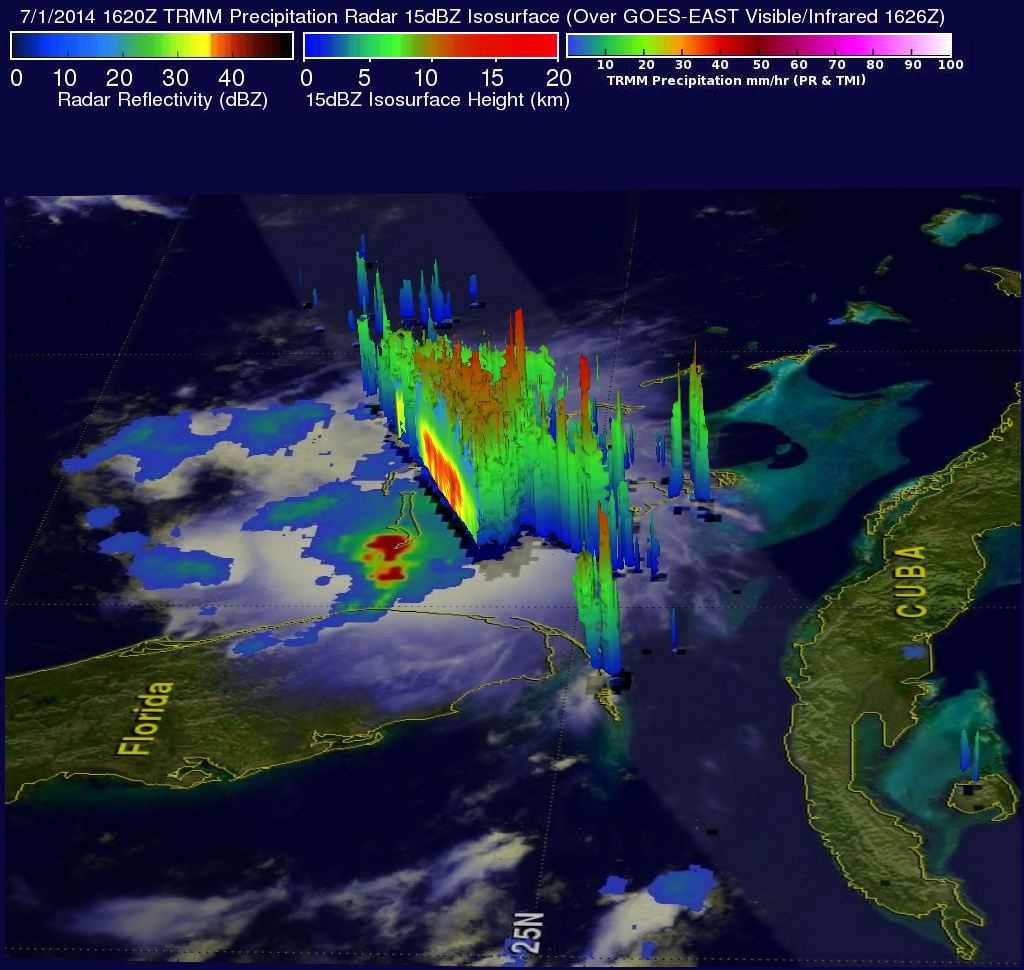
The location of very heavy rainfall around Arthur's center was shown using TMI data. TRMM PR data sliced through the southern half of the tropical storm. A 3-D view (from the west) using those data is shown above. Radar reflectivity values greater than 50 dBZ were found in that area where strong convective storms reached heights above 15.5 km (about 9.6 miles).