
Hurricane Cristobal Poised to Head Out to Sea
Cristobal, still a minimal Category 1 hurricane on the US Saffir-Simpson scale, has been slowly making its way northward up from the southeastern Bahamas on a track generally parallel to the eastern seaboard. The storm now appears poised to recurve away from the US East Coast and head for the central Atlantic as it begins to feel the effects of an approaching shortwave trough embedded in the westerlies that's moving eastward out of the Great Lakes region.
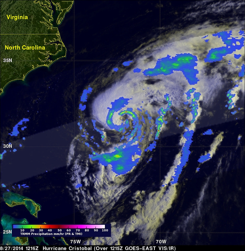
TRMM made an overpass of Cristobal this morning, which is shown in this image taken at 12:16 UTC (8:16 am EST) 27 August 2014. At the time, the center was located about 330 miles southeast of Cape Hatteras, NC and approximately 420 miles west- southwest of Bermuda. At this time, Cristobal still has an eye in the infrared image (IR), but the rain intensities from TRMM show that there is only a partial eye wall, which is indicated by the band of moderate intensity rain (green semicircle) along the northern edge of the storm's center. Several long rain bands of mostly light (indicated in blue) to moderate rain wrap mainly around the eastern side of the storm and are evidence of the storm's large cyclonic circulation.
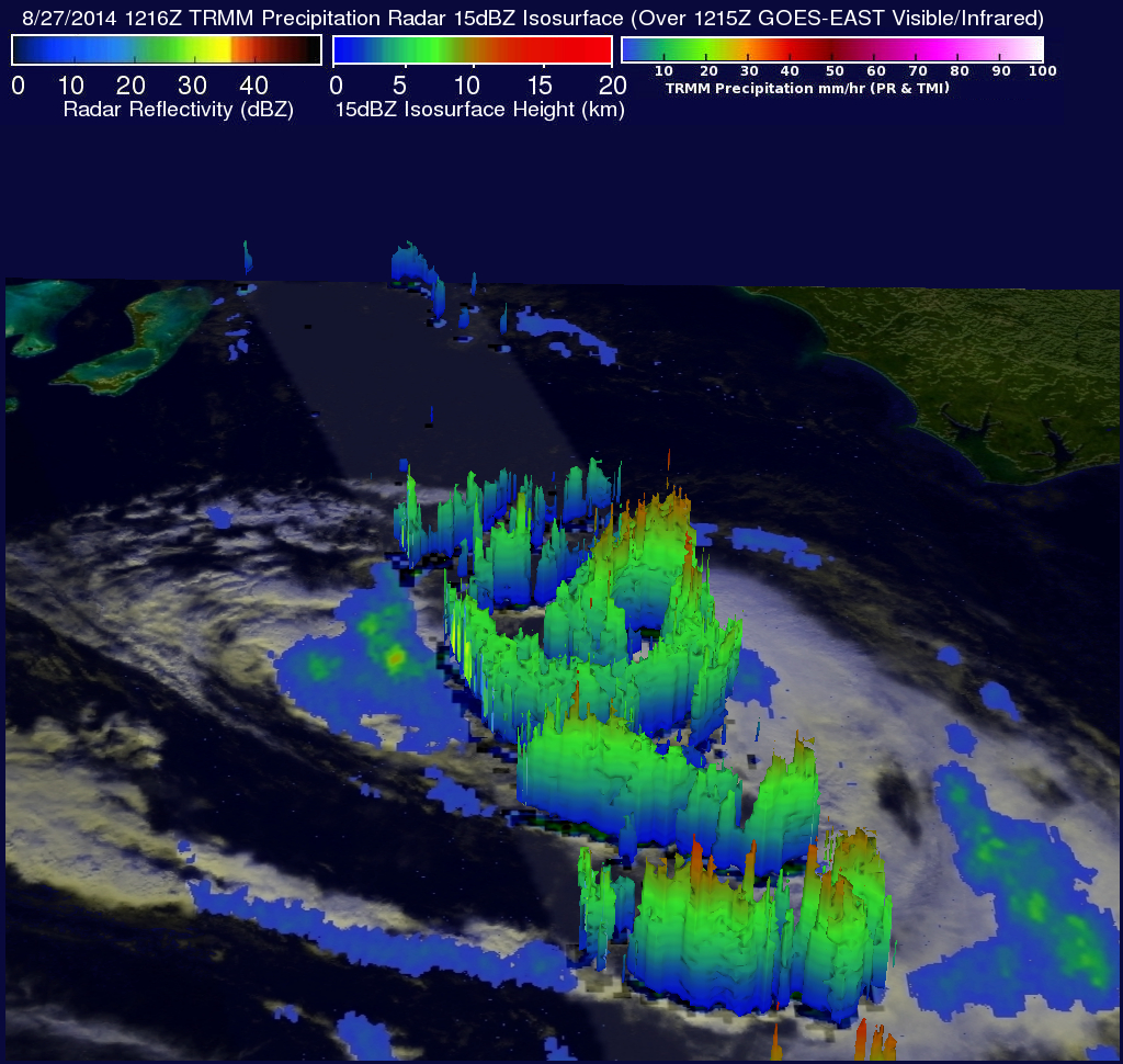
These rain bands are also very well defined in this 3D image of Cristobal (taken at the same time), which shows the height of precipitation echoes within the storm courtesy of the TRMM PR--view looking west. The asymmetry in the rain as well as the IR cloud fields, however, suggest Cristobal is feeling the effects of southwesterly wind shear ahead of the approaching shortwave trough, which should begin to steer the storm in a more northeasterly direction. With the system now devoid of heavy rain and approaching cooler waters, Cristobal should start to lose its tropical characteristics and transition into an extratropical storm over the next few days. At the time of this image, Cristobal's sustained winds were reported at 70 knots (~80 mph) by the National Hurricane Center and the storm was still moving north at 12 mph. Cristobal is forecast to begin moving northeast away from the US East Coast and pass well north of Bermudabefore heading into the central North Atlantic as a rather potent extratropical cyclone.
Click here to see a Low Resolution 640x360 simulated 3-D (Quicktime) flyby.
Click here to see a Low Resolution 640x360 simulated 3-D (MPEG) flyby.