
Gillian Has Second Life
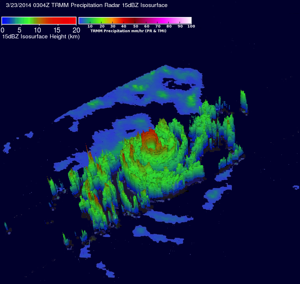
Tropical cyclone Gillian re-generated in the South Indian Ocean south of Indonesia on March 21, 2014. Gillian had peak wind speeds of about 140 kts (about 173 mph) on March 23, 2014 making it a Category 5 hurricane on the Saffir-Simpson Scale. The TRMM satellite flew above GILLIAN when the tropical cyclone was intensifying on March 23, 2014 at 0304 UTC. Data from TRMM's Microwave Imager (TMI) and Precipitation Radar (PR) instruments were used in the rainfall analysis on the above left. TRMM PR revealed that Gillian had very intense storms in a well defined eye wall producing rain at a rate of over 100mm/hr (about 3.9 inches). TRMM PR showed that some of the tall storms on the southwestern side of Gillian's eye were reaching heights of about 14km (about 8.7 miles).
Gillian has started to weaken as it heads toward the southwest. Tropical cyclone Gillian has been generating waves that may hamper the search in the South Indian Ocean for a missing Malaysia Airlines jet.
|
Click here to see a Low Resolution 640x360 simulated 3-D (Quicktime) flyby animation using TRMM PR data. Click here to see a Low Resolution 640x360 simulated 3-D (MPEG) flyby animation using TRMM PR data. Click here to see earlier TRMM information about tropical cyclone Gillian. |
| Images and Captions by Hal Pierce (SSAI/NASA GSFC) |