Tropical Storm Neoguri Soaks Southern Japan
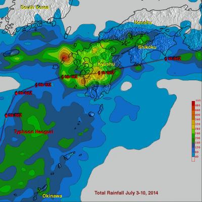
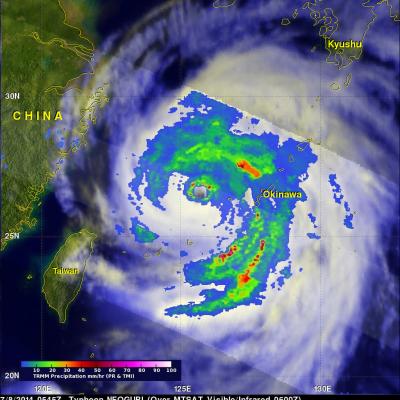
Once powerful typhoon Neoguri is dropping copious rainfall as it passes over southern Japan as a tropical storm. Heavy rainfall from Neoguri fell on land that was already soaked earlier this month by a slow moving seasonal frontal system. Flooding and mudslides from Neoguri have caused the deaths of three people in Japan this week. The TRMM Multi-Satellite Precipitation Analysis (TMPA), produced at Goddard Space Flight Center, combines the rainfall estimates generated by TRMM and other satellites (3B42). The analysis above shows a near-real time Multi-satellite Precipitation Analysis (TMPA)