Tropical Cyclone Batters and Drenches Samoan Islands
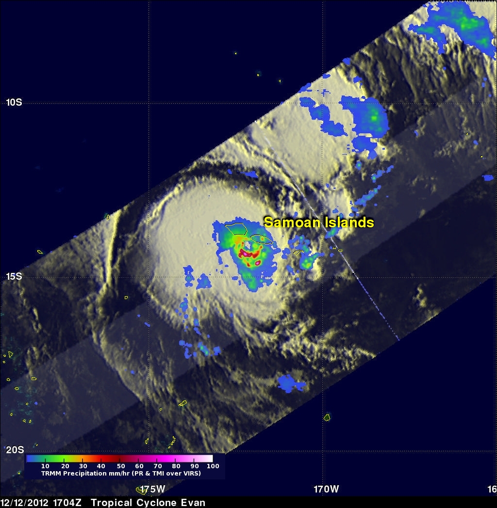
The TRMM satellite had an excellent view of tropical cyclone Evan on December 12, 2012 at 1704 UTC when it was battering the Samoan Islands with hurricane force winds. Evan is predicted by the Joint Typhoon Warning Center (JTWC) to intensify and have winds of 130kts (~150 mph) while remaining close to the islands. This wind speed would make it a strong Category 3 storm on the Saffir-Simpson Scale. A storm surge of 4.5 meters (14 feet) was reported along the Samoan coast.
Evan's rainfall was analyzed using TRMM's Microwave Imager (TMI) and Precipitation Radar (PR) data. This analysis shows that the heaviest rainfall of over 80mm/hr (~3.1 inches) was occurring in intense bands within Evan's clearly shown eye wall.
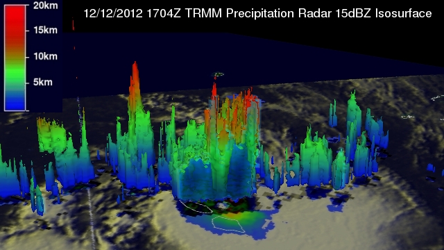
TRMM's Precipitation Radar (PR) data sliced through Evan and were used to provide the 3-D cut-a-way view looking at Evan's northern side. The vertical side surface of Evan's clearly defined eye is shown. Several towering thunderstorms are shown reaching to heights of greater than 16.5 km (10.25 miles) within Evan's eye wall. These tall storms called "Hot Towers" near the center of a tropical cyclone are often seen prior to intensification.


