
Possible Eastern Pacific Tropical Cyclone Formation
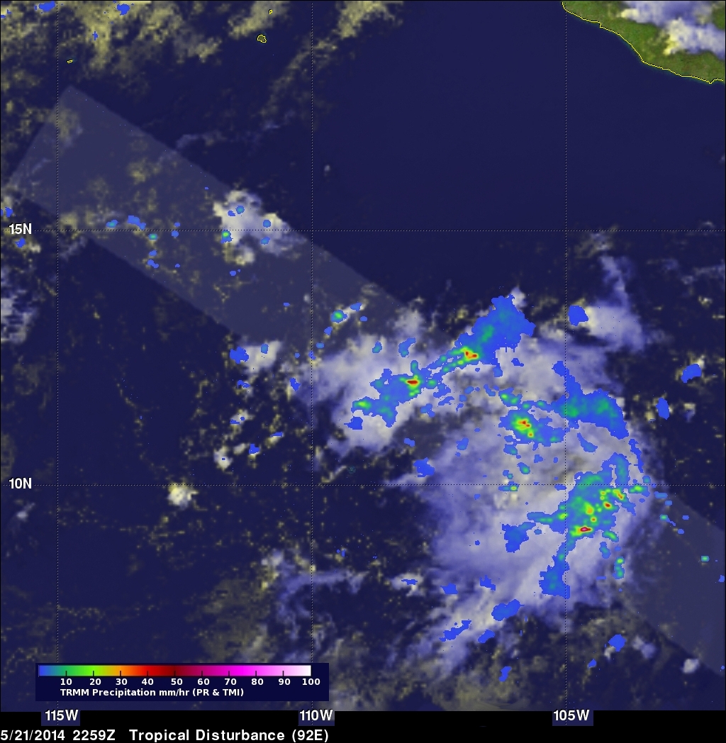
The Eastern Pacific hurricane season began on May 15, 2014 and today a potential tropical cyclone is forming south-southwest of Manzanillo, Mexico.
The TRMM satellite collected data as it flew above this area on May 21, 2014 at 2259 UTC. TRMM's Precipitation Radar (PR) found rain falling at over 102.5 mm/hr (about 4 inches) in some convective showers and thunderstorms in this area. A GOES-WEST image was overlaid with a rainfall analysis from TRMM PR and TMI.
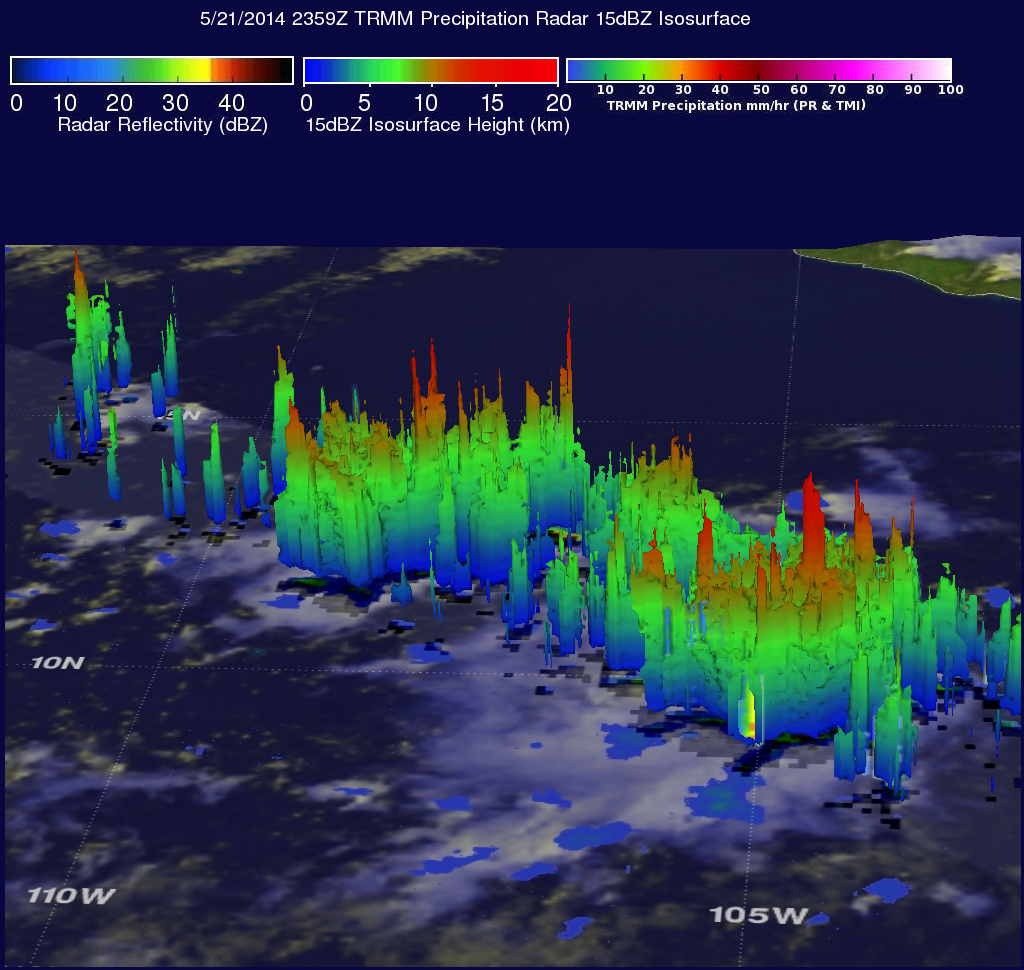
TRMM's Precipitation Radar (PR) data were used to show a 3-D view of the rainfall structure in this disturbed weather. A few strong thunderstorms were found to reach altitudes of 16.5 km (about 10.2 miles). These tall thunderstorms are often a sign that a tropical cyclone is forming or strengthening.