
GPM Sees Tropical Depression Bonnie In The Atlantic
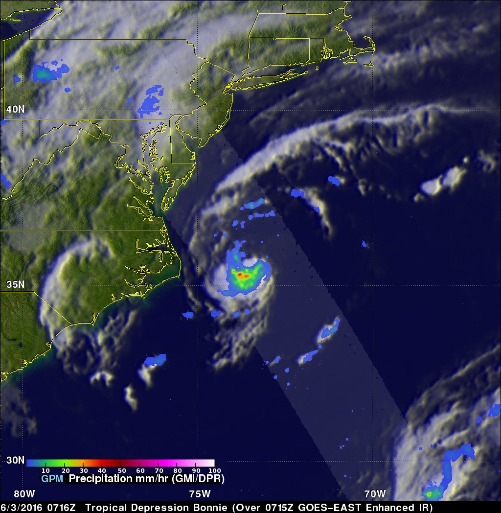
The GPM core Observatory had another good look at revived tropical Depression Bonnie on June 3, 2016 at 0716 UTC (3:16 AM EDT). Rainfall calculated from data received by GPM's Microwave Imager (GMI) and and Dual-Frequency Precipitation Radar (DPR) instruments are shown in the first image. Those instruments found that Bonnie was dropping rain at a rate of over 65 mm (2.6 inches) per hour in storms south of the depression's center of circulation.
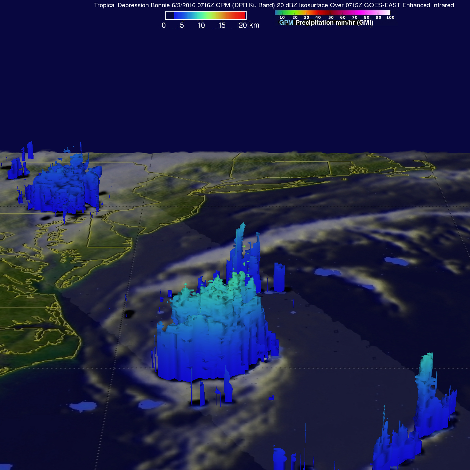
GPM's Radar (DPR Ku Band) again measured the 3-D structure of rainfall within Bonnie and found that some storms were reaching heights of over 13 km (8.1 miles).
Bonnie is passing over the warm waters of the Gulf Stream today so warmer water and a generally low-shear environment may allow the depression to become a tropical storm for a short time. Bonnie is expected to weaken into a post-tropical cyclone on Saturday.