
GPM Sees Gert Approaching Hurricane Intensity
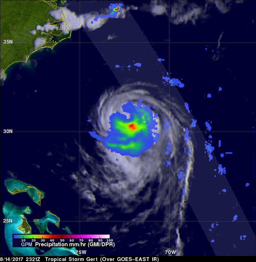
Tropical storm Gert was upgraded to a Hurricane on 1100 PM EDT Monday August 14, 2017 at 11:00 PM (August 15, 2017 0300 UTC). The GPM core observatory satellite flew over the intensifying tropical storm on August 14, 2017 at 7:21 PM EDT (2321 UTC). With winds of about 69 mph (60 kts) Gert was getting close to hurricane intensity. Data collected by GPM's Microwave Imager (GMI) and Dual-Frequency Precipitation Radar (DPR) instruments showed heavy rainfall south of Gert's partial eye. GMI showed that rain was falling at a rate of over 1.6 inches (40 mm) in that area. GPM's Radar scanned through only part of Gert's northeastern quadrant but found intense storms in that area dropping rain at a rate over over 4.4 inches (113 mm) per hour.
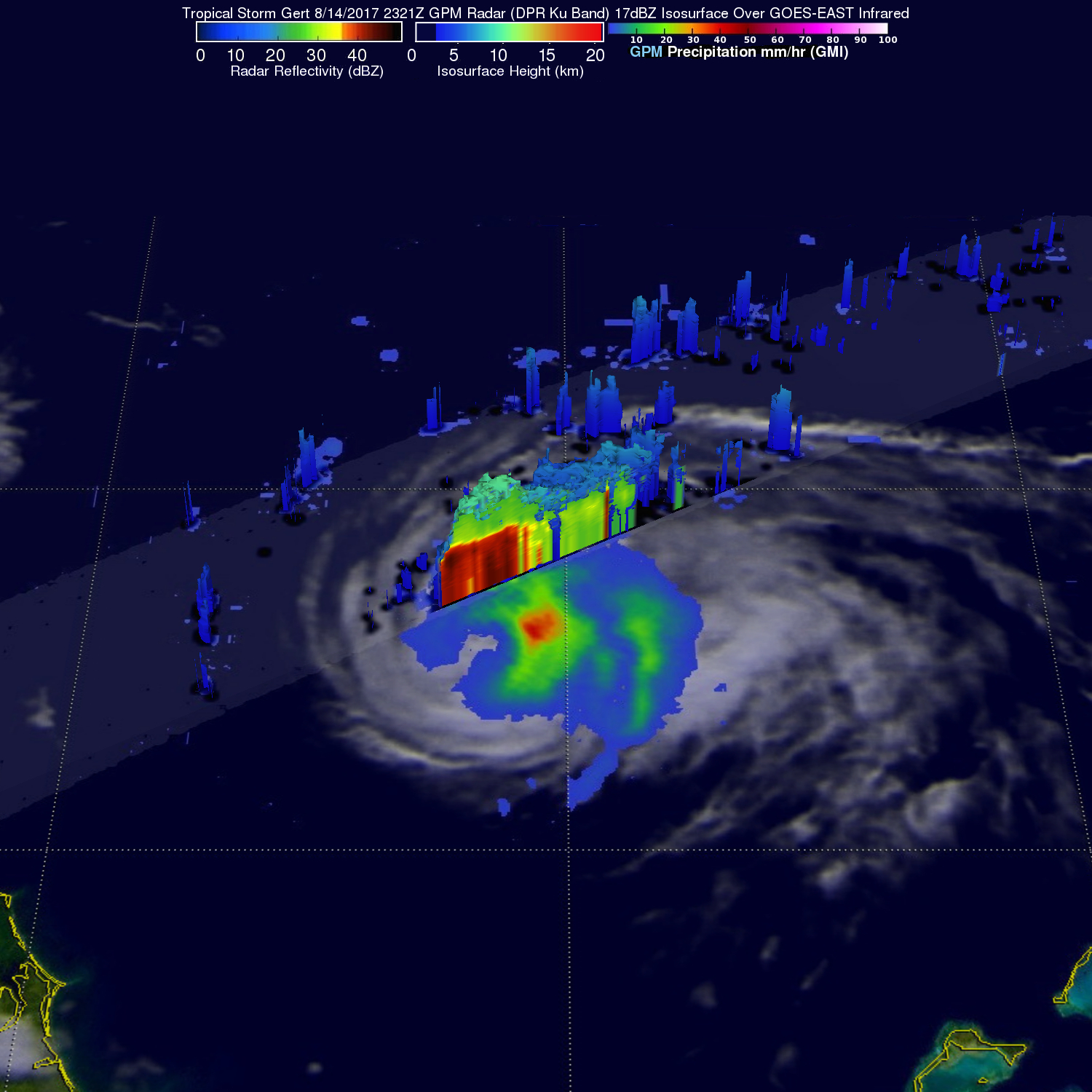
This 3-D radar (DPR Ku Band) slice through tropical storm Gert's eastern side reveals that intense downpours in that area were returning very strong echoes to the GPM satellite. Some storm tops in that area were shown to reach heights of almost 8 miles (13 km).