
GPM Observes Intensifying Hurricane Harvey's Rainfall
UPDATE: View the latest GPM overpass from 8/25/17 1141 UTC using the STORM Event Viewer: https://storm.pps.eosdis.nasa.gov/storm/cesium/EventViewer.html?position=-95.78,18.26,1199999&view=6.28,-1.00,6.28&fname=2A.GPM.DPR.V620160118.20170825-S114128-E121127.V04A.RT-H5
Hurricane Harvey has continued to intensify after regenerating in the southwestern Gulf of Mexico on Wednesday. Harvey's intensification has been aided by moving through an environment that includes low vertical wind shear and the warm waters in the Gulf Of Mexico.
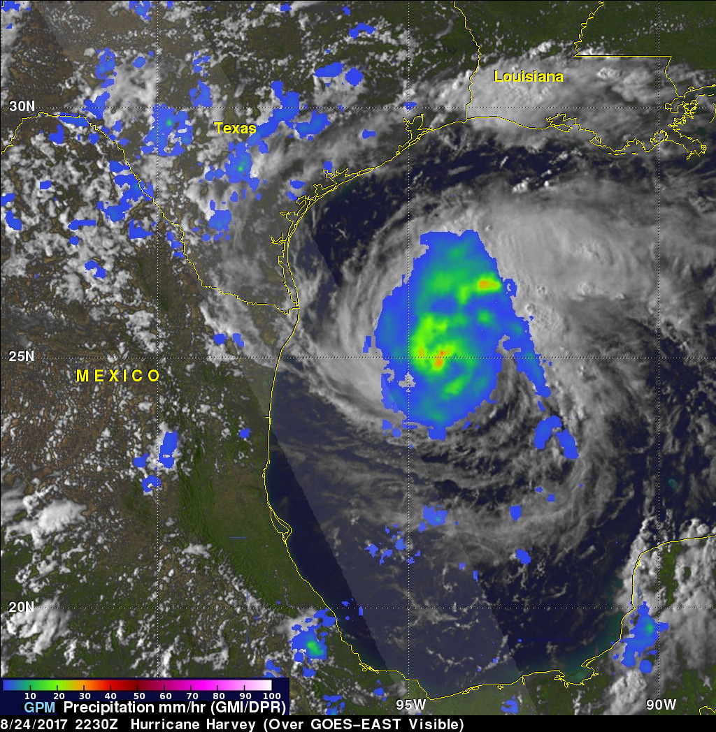
The Global Precipitation Mission (GPM) core observatory satellite flew almost directly above intensifying hurricane Harvey on August 24, 2017 at 5:30 PM CDT (2230 UTC) when maximum sustained winds had increased to about 86 mph (75 kts). GPM's Microwave Imager (GMI) provided informative data about the precipitation near Harvey's eye. GMI peered through dense storm clouds to reveal the location of intense rainfall bands near the center of the hurricane. The Goddard Profiling Algorithm (GPROF) using GMI data indicated that powerful storms in the hurricane were dropping rain at a rate of over 2.1 inches (54 mm) per hour.
The National Hurricane Center (NHC) predicts that Harvey will continue to intensify as it moves toward landfall in Texas. Harvey is predicted to be a dangerous category three hurricane with winds of about 121 mph (105 kts) when it hits the Texas coast. Harvey is predicted to produce life threatening flooding from storm surge and very heavy rainfall (15 to 25 inches).