
GPM Monitors Tropical Cyclone Donna
The above window displays an interactive visualization of GPM data collected from Tropical Cyclone Donna on 5/7/17.
Over the weekend tropical cyclone Donna dropped very heavy rain over Vanuatu as it moved toward the west of the islands. Donna had intensified and had maximum sustained winds of 115 kts (132 mph) on Monday morning. This made it the equivalent of a category four on the Saffir-Simpson hurricane wind scale.
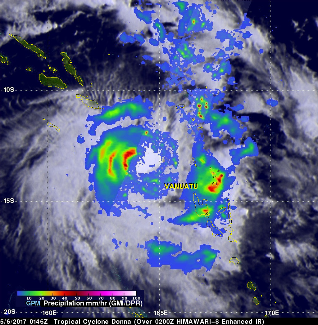

The GPM core observatory satellite had two excellent views of the intensifying tropical cyclone Donna on succeeding days. When GPM flew over Donna on May 6, 2017 at 0146 UTC the tropical cyclone was getting organized. The following day on May 7, 2017 at 1411 UTC GPM showed that Donna was very well organized and had a well defined eye. GPM's Microwave Imager (GMI) and Dual-Frequency Precipitation Radar (DPR) data showed that Vanuatu was being drenched with bands of very intense rain to the east of Donna's center. DPR showed that precipitation was falling at a rate of over 189 mm (7.4 inche) per hour in the eastern side of Donna's eye wall.
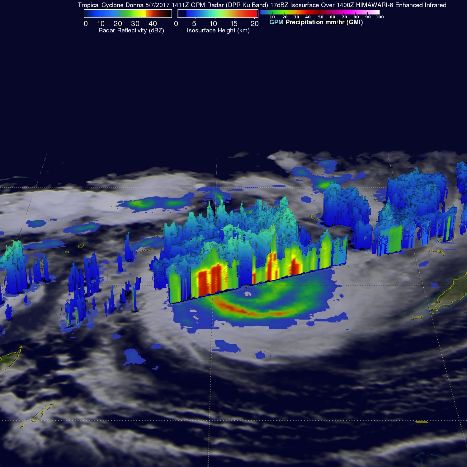
Tropical Cyclone Donna's rainfall structure was examined by GPM's radar (DPR Ku Band). GPM's DPR showed a 3-D view of the tropical cyclone's radar reflectivity. GPM's data swath revealed a cross section of rainfall through the eastern side of the tropical cyclone. GPM showed that some storm top heights were reaching altitudes above 14.3 km (8.9 mile) in tall storms in the eastern eye wall. GPM's DPR also found that a few powerful storms within Donna were returning radar reflectivity values exceeding 79 dBZ to the satellite.
The Joint Typhoon Warning Center (JTWC) predicts that tropical cyclone Donna has reached it's peak intensity and will weaken as it heads toward the south-southeast over the next few days. Donna is expected to still be a powerful tropical cyclone as it passes close to the east of New Caledonia.