Reunion Island

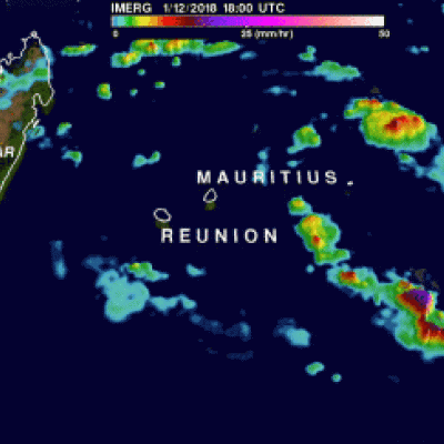
IMERG Reveals Rainfall Rates With Tropical Cyclone Berguitta

Tropical cyclone BERGUITTA formed in the southwestern Indian Ocean northeast of the islands of La Reunion and Mauritius on January 12, 2018. BERGUITTA is now moving toward the southwest and threatening the islands. Early on January 16,2018 BERGUITTA had maximum sustained winds estimated at 100 kts (115 mph). This means that BERGUITTA was the equivalent of a category three hurricane on the Saffir-Simpson hurricane wind scale. Later in the day BERGUITTA's maximum sustained wind speeds were estimated at 85 kts (98 mph) with gust to 105 kts (121 mph). On January 16, 2018 at 1200Z tropical cyclone

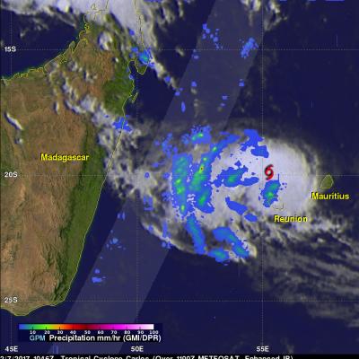
GPM Sees Carlos Moving Past Reunion Island

The GPM core observatory satellite flew above tropical cyclone Carlos on February 7, 2017 at 1056 UTC. Carlos was moving past Reunion Island with maximum sustained winds estimated at 45 kts (51.8 mph). GPM's Microwave Imager (GMI) and Dual-Frequency Precipitation Radar (DPR) data show that rain bands west of Carlos' center were producing heavy rainfall. GPM's DPR swath is shown in a lighter shade. DPR measured a few downpours in the bands west of the Carlos' center of circulation dropping rain at a rate of over 120 mm (4.7 inches) per hour. GPM's radar (DPR Ku Band) found that a few storm tops

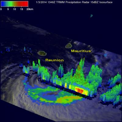
Reunion Island Hit Hard By Tropical Cyclone Bejisa

Bejisa's eye passed very close to the West of the French island of Reunion yesterday when maximum sustained winds were estimated to be 105 kts (~121 mph). Bejisa spawned wave heights of 8 meters (~26 feet), caused several serious injuries and extensive power outages. The TRMM satellite had a daytime view of Bejisa today at 1348 UTC after the tropical cyclone's sustained wind speeds had decreased to less than 60kts (~69 mph). Bejisa's past positions are shown overlaid in red on a rainfall analysis made from TRMM Microwave Imager (TMI) and Precipitation Radar (PR) data collected with this pass