Reunion Island Hit Hard By Tropical Cyclone Bejisa
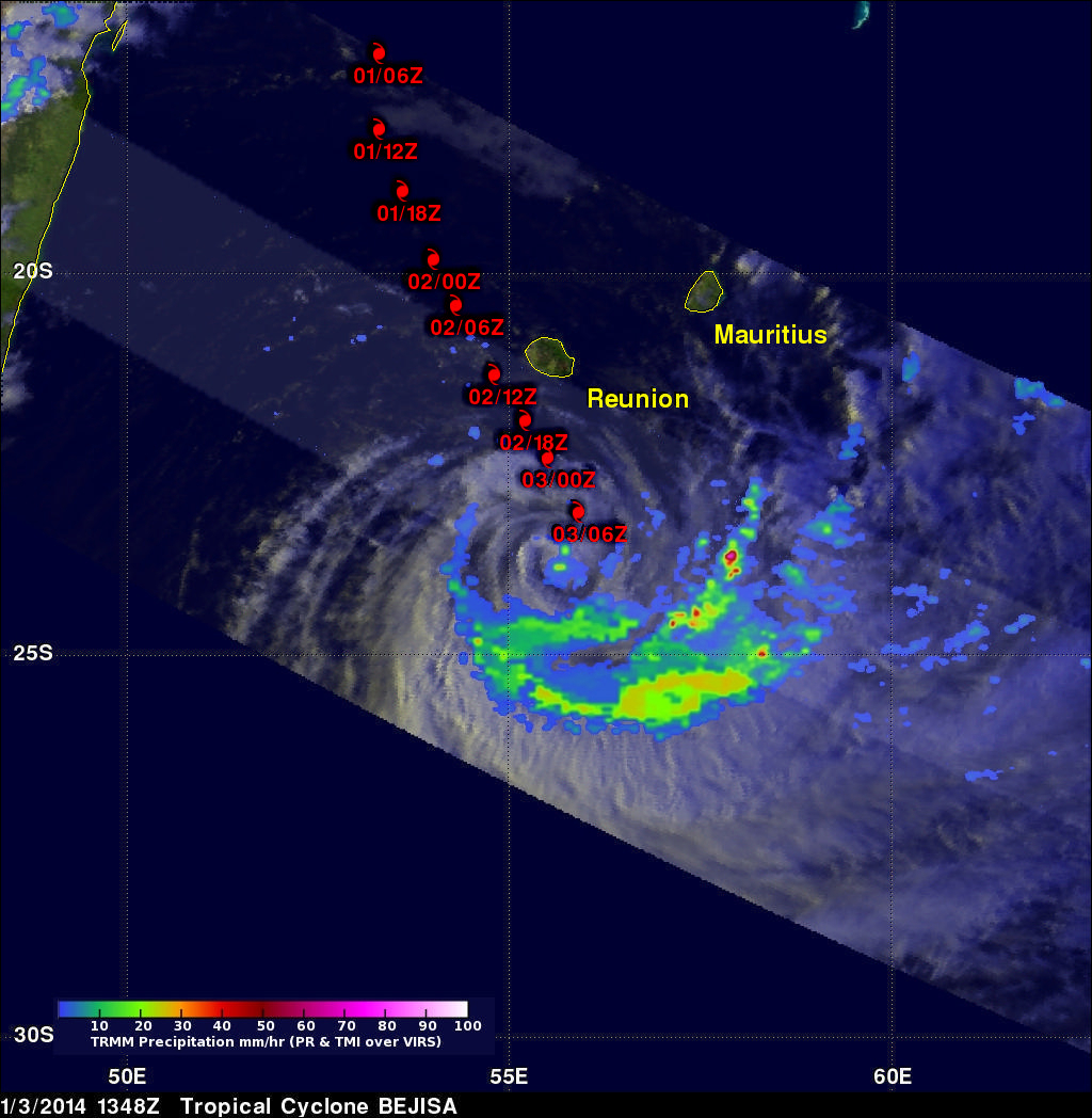
Bejisa's eye passed very close to the West of the French island of Reunion yesterday when maximum sustained winds were estimated to be 105 kts (~121 mph). Bejisa spawned wave heights of 8 meters (~26 feet), caused several serious injuries and extensive power outages. The TRMM satellite had a daytime view of Bejisa today at 1348 UTC after the tropical cyclone's sustained wind speeds had decreased to less than 60kts (~69 mph). Bejisa's past positions are shown overlaid in red on a rainfall analysis made from TRMM Microwave Imager (TMI) and Precipitation Radar (PR) data collected with this pass. TRMM found that Bejisa's no longer had an eye, a slot of dry air was shown wrapping around the center and heavy rainfall near the center of circulation had almost ended
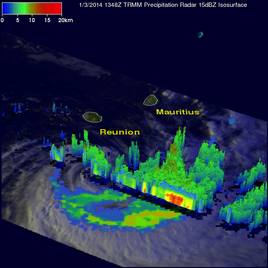
The 3-D view of Bejisa above reveals that the most powerful thunderstorms near Bejisa's center of circulation were then only reaching about 10km (~6.2 miles). Bejisa is predicted to continue gradually weakening while moving more rapidly toward the southwest over the open waters of the South Indian Ocean.