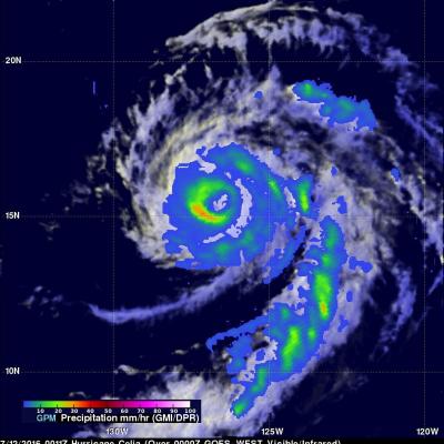
Rainfall Measured By GPM In Weakening Tropical Storm Celia
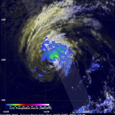
Celia was a powerful hurricane with winds of 85 kts (98 mph) a couple days ago but has recently been moving over cooler ocean waters that are contributing to a weakening trend. Hurricane Celia had weakened to a tropical storm with winds of about 45 kts (52 mph) when the GPM core observatory satellite flew over on July 14, 2016 at 0001 UTC. GPM found that convective storms were mainly located to the north and northeast of Celia's center of circulation. GPM's Microwave Imager (GMI) and Dual-Frequency Precipitation Radar (DPR) found that rain was falling at over 164 mm (6.4 inches) per hour