Europe

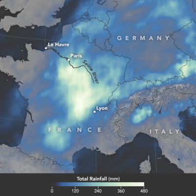
GPM IMERG Sees Flooding in France

In June 2016, a slow-moving weather system unleashed several days of heavy downpours on western Europe, pushing the Seine River to heights not seen in 34 years. With the Seine’s water levels 6.1 meters (20 feet) above normal in Paris, flood waters knocked out electricity for thousands of people, interrupted road and rail traffic, shut down schools, and caused an estimated 1 billion euros of damage. During the worst of the flooding, the world’s most visited museum, the Louvre, closed as employees scrambled to move artwork out of basement areas that were at risk of flooding. The map above

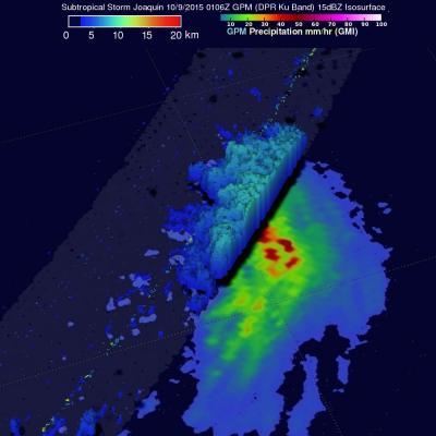
Subtropical Storm Joaquin Heads For Europe

Hurricane Joaquin became subtropical while traveling over the cool waters of the North Atlantic. The low pressure center that was once powerful hurricane Joaquin was viewed by the GPM core observatory satellite on October 9, 2015 at 0106 UTC. The low pressure center was moving past the Azores toward landfall in Portugal. GPM's Microwave Imager (GMI) and Dual-Frequency Precipitation Radar (DPR) instruments measured precipitation within the low pressure center. The most intense rainfall was located northeast of the center of the low and was falling at a rate of over 54 mm (1.1 inches) per hour