
Bill
Weakening Tropical Storm Bill Seen By GPM
 JacobAdmin
Thu, 06/18/2015
JacobAdmin
Thu, 06/18/2015
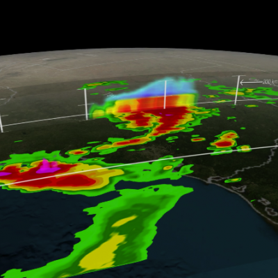
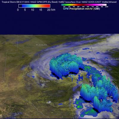
The GPM core observatory satellite had a good daytime look at tropical storm Bill on Wednesday June 17, 1015 at 1552 UTC ( 10:52 AM CDT). GPM saw that an area of heavy rain on Bills northern side was then moving into southern Oklahoma. The Dual-Frequency Precipitation Radar (DPR) on board the satellite measured rain dropping at a rate of over 50 mm (almost 2 inches) per hour in some intense storms. GPM radar data (Ku band) were also used to look at the 3-D structure and storm top heights within storms associated with tropical storm Bill. This image shows that in some areas the dissipating
IMERG Sees Gulf Rainfall With Tropical Storm Bill
 JacobAdmin
Wed, 06/17/2015
JacobAdmin
Wed, 06/17/2015
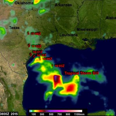
Tropical storm Bill became the second named tropical cyclone in the Atlantic Ocean Basin when it formed in the western Gulf Of Mexico on June 16, 2015. Data from the NASA's Integrated Multi-satellitE Retrievals for GPM (IMERG) was used in this analysis to estimate rainfall from Tropical Storm Bill. Precipitation was analyzed from the time when tropical storm Bill was forming in the Gulf Of Mexico on Monday June 15, 2015 until early this morning at 0800 UTC (4 AM CDT). The storm was dropping heavy rainfall over Texas this morning but this analysis indicates that the heaviest rainfall totals, up