

Direct Statistical Validation
A GPM Ground Validation prototype is currently underway to compare TRMM satellite data to similar measurements from the national network of operational weather radars. The goal of the Validation Network is to identify and resolve significant discrepancies between the US national network of ground radar observations and satellite observations.
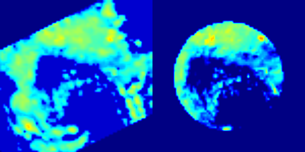
The validation network prototype matches-up TRMM Precipitation Radar (PR, see below image) and quality-controlled NEXRAD reflectivity data (right) for 21 ground radar sites in the Southeastern United States. Conceptually, the Validation Network also extends to include targeted hydrometeorological assets external to continental US (e.g., Kwajalein and other national networks). The ultimate goal of such comparisons is to understand and resolve the first order variability and bias of precipitation retrievals in different meteorological/hydrological regimes at large scales. Match-up data sets in the form of netCDF files are available starting from August 2006.
Links on this page provide access to the data sets and supporting software and documentation. Please contact the Ground Validation team if you want additional information.
Quick Links
- VN data archive
- VN Data Product User's Guides: Volume 1 (TRMM), Volume 2 (GPM)
- VN open source software
- VN publications
- VN points-of-contact
Other Direct Validation Frameworks
The Coordination Group for Meteorological Satellites (CGMS) supports the International Precipitation Working Group (IPWG) as forum for operational and research users of satellite precipitation measurements. The goal of the IPWG is to exchange information on methods for measuring precipitation and the impact of space borne precipitation measurements in numerical weather and hydrometeorological prediction and climate studies. The IPWG web site has links to data, products and tools of interest to precipitation ground validation.
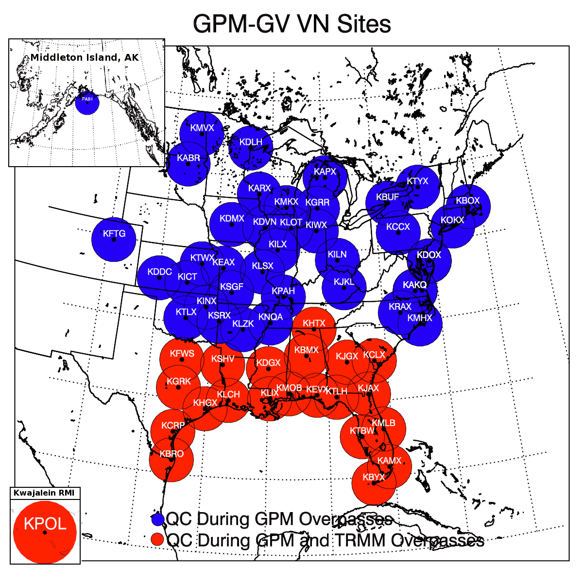
Location of radars in the Validation Network. Red circles indicate the original set used with TRMM, and blue circles indicate new radars to be used with GPM.
The National Mosaic and Multi-Sensor QPE (NWQ) serves as an international testbed for research, development, evaluation, science and operations. The NWQ uses high resolution 3D Mosiac of multiple radars and radar networks for model assimilation and aviation applications, Quantitative Precipitation Information (QPI) including Multiple Sensor Quantitative Precipitation Estimation (MSQPE) and Very Short Term Quantitative Precipitation Forecasts (VSTQPF) for the monitoring and warnings of floods and flash floods, and in support of comprehensive hydrology and ecosystem modeling.