
Weakening Tropical Storm Flossie Hits Hawaiian Islands
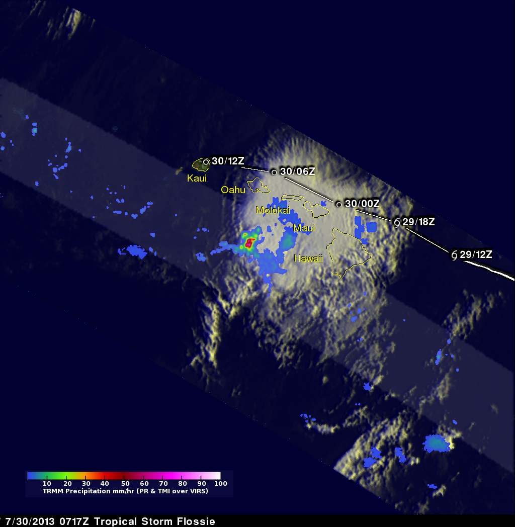
Weakening tropical storm Flossie had lightning with heavy rain and winds as it drove through the Hawaiian islands. The TRMM satellite flew above tropical depression Flossie on July 30, 2013 at 0717 UTC (July 29, 2013 at 9:17 PM HAST). TRMM's Microwave Imager (TMI) and Precipitation Radar (PR) instruments showed that the heaviest rain at that time was located to the southwest of the Islands and was falling at a rate of over 88mm/hr (3.5 inches). Flossie's approximate locations with appropriate tropical cyclone symbols are shown overlaid in white.
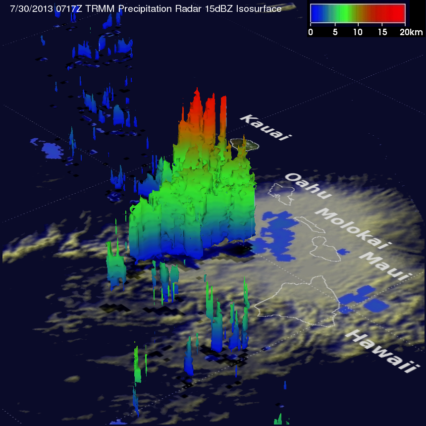
TRMM's Precipitation Radar is able to separate out rain echoes for vertical sample sizes of about 250 meters (820 feet) from the surface up to a height of about 20 kilometers (12 miles) . The powerful thunderstorms southwest of the Hawaiian Islands are shown in 3-D using the TRMM PR instrument. This view shows that these strong storms were reaching to heights of about 15km (~9.3 miles).
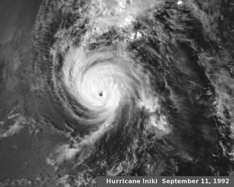
Weakening tropical storm Flossie has little in common with Hawaii's most damaging hurricane shown here. Hurricane Iniki hit the Hawaiian Islands in September 1992 as a category four hurricane with winds of 125kts (~145mph) causing $1.8 billion of damage and six deaths. This was a little over five years before the TRMM satellite was launched on November 27, 1997.