
Tropical Storm Don Forms In The Gulf Of Mexico
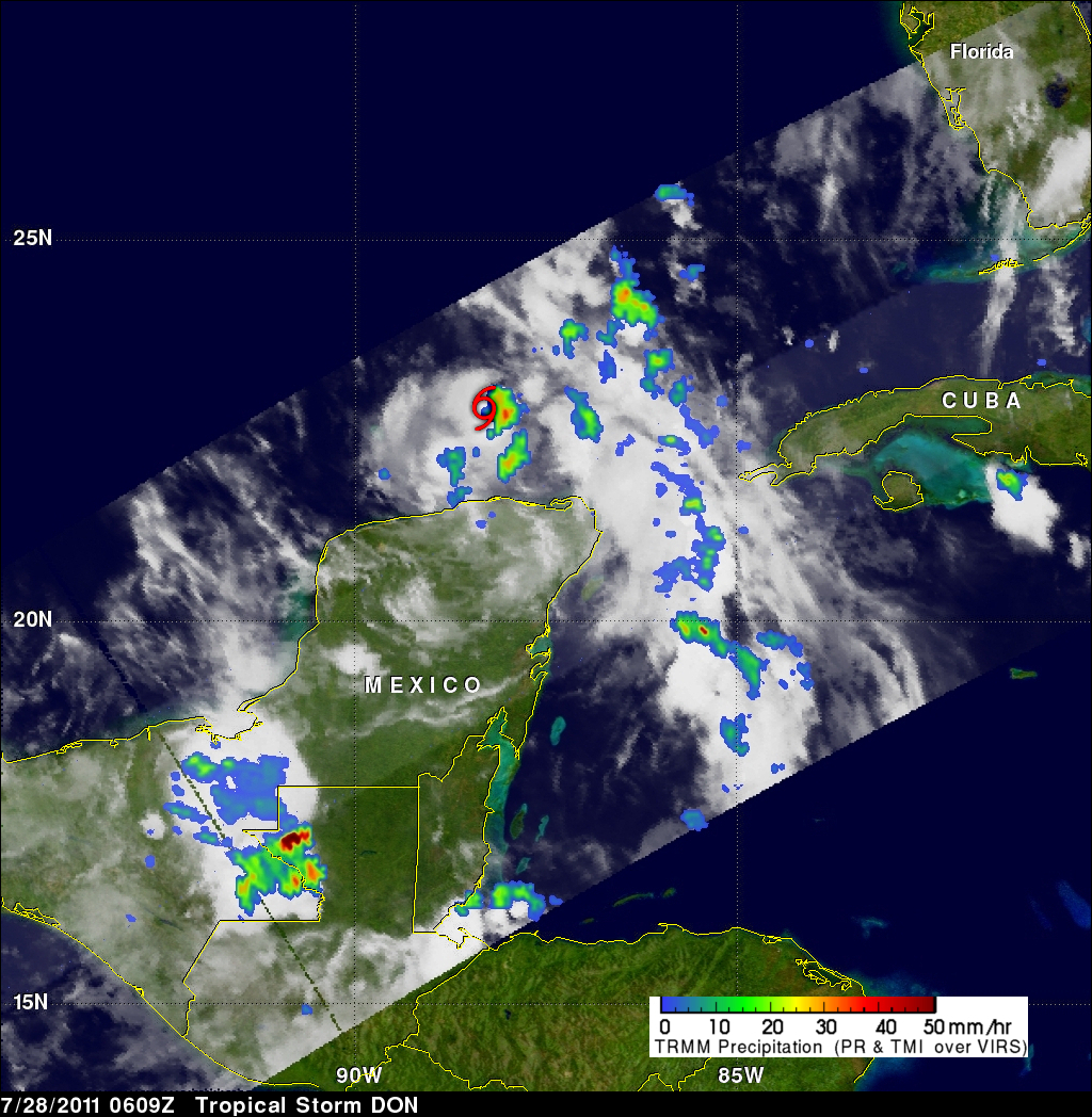
An area of disturbed weather in the southern Gulf Of Mexico was upgraded by the National Hurricane Center (NHC) to tropical storm DON on 27 July 2011 at 2100 UTC (4 PM CDT). The TRMM satellite had a fairly good view of tropical Storm DON when it passed over on 28 July 2011 at 0609 UTC (2:09 AM EDT). A red tropical storm symbol shows the position, north of Mexico's Yucatan peninsula, where DON was located at that time. A rainfall analysis from TRMM's Microwave Imager (TMI) data shows that DON was dropping moderate to heavy rainfall in the eastern side of the small storm. The NHC predicts that DON may strengthen slightly as it moves toward the west-northwest over the southern Gulf Of Mexico and approaches the Texas coast on Friday (29 July 2011).