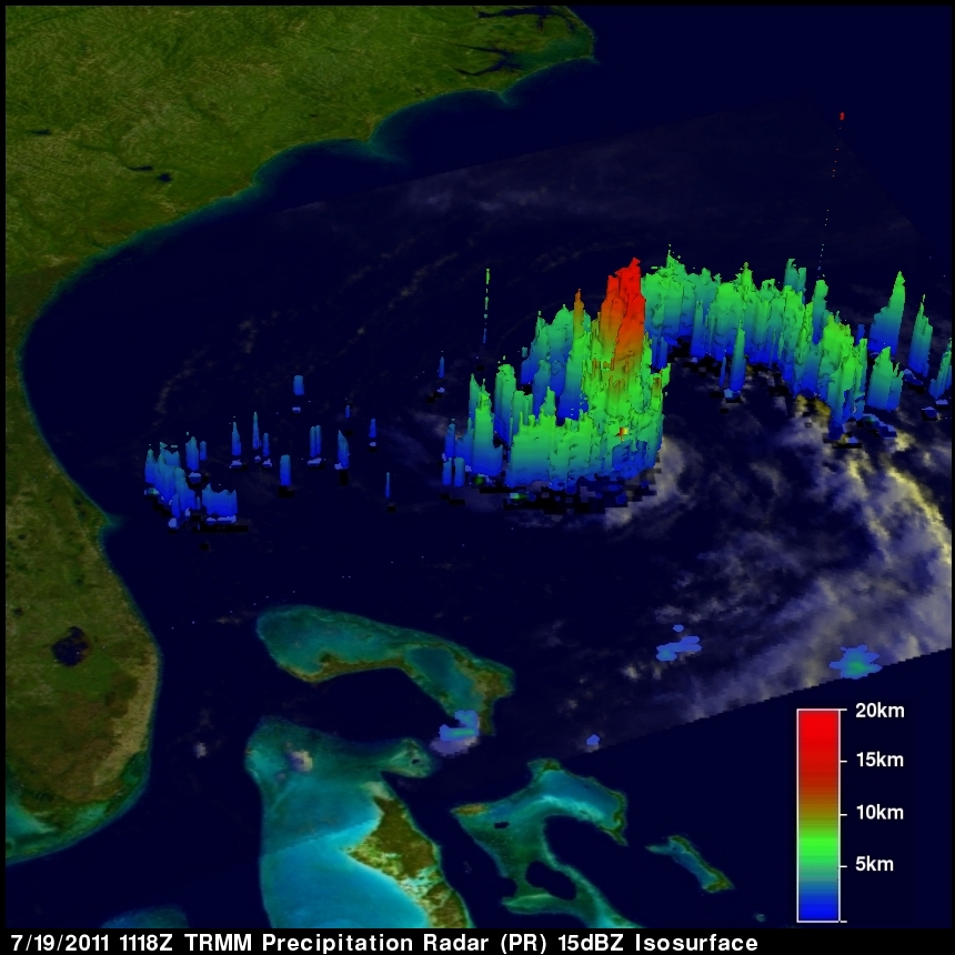
Tropical Storm BRET
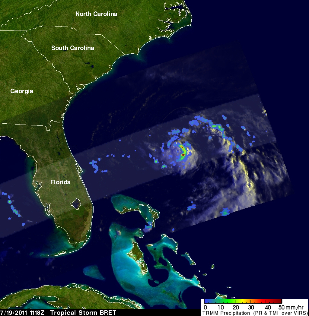
The TRMM satellite flew over tropical storm Bret in the Atlantic Ocean north of the Bahamas on 19 July 2011 at 1118 UTC ( 7:18 AM EDT). This early morning pass showed that BRET was very small, but TRMM's Precipitation Radar (see below) showed that the storm had some powerful thunderstorms reaching to heights of 15km (9.3 miles).