
TRMM Views Of Tropical Storm Andrea
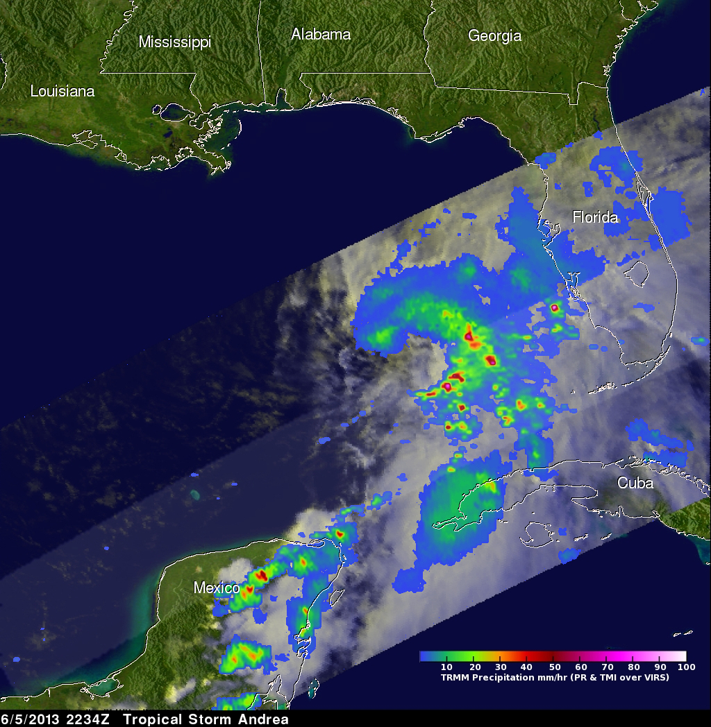
The TRMM satellite satellite flew directly above tropical storm Andrea on Wednesday June 5, 2013 at 2234 UTC (6:34 PM EDT) and received data used in the image on the left. These data were captured just over an hour after the National Hurricane Center (NHC) named tropical storm Andrea. A rainfall analysis from TRMM's Microwave Imager (TMI) and Precipitation Radar (PR) instruments shows that moderate to heavy rain was wrapping around the eastern side of the storm. The heaviest rainfall of 124.5 mm/hr (~4.9 inches) from TRMM PR data was found on Andrea's southeast side.
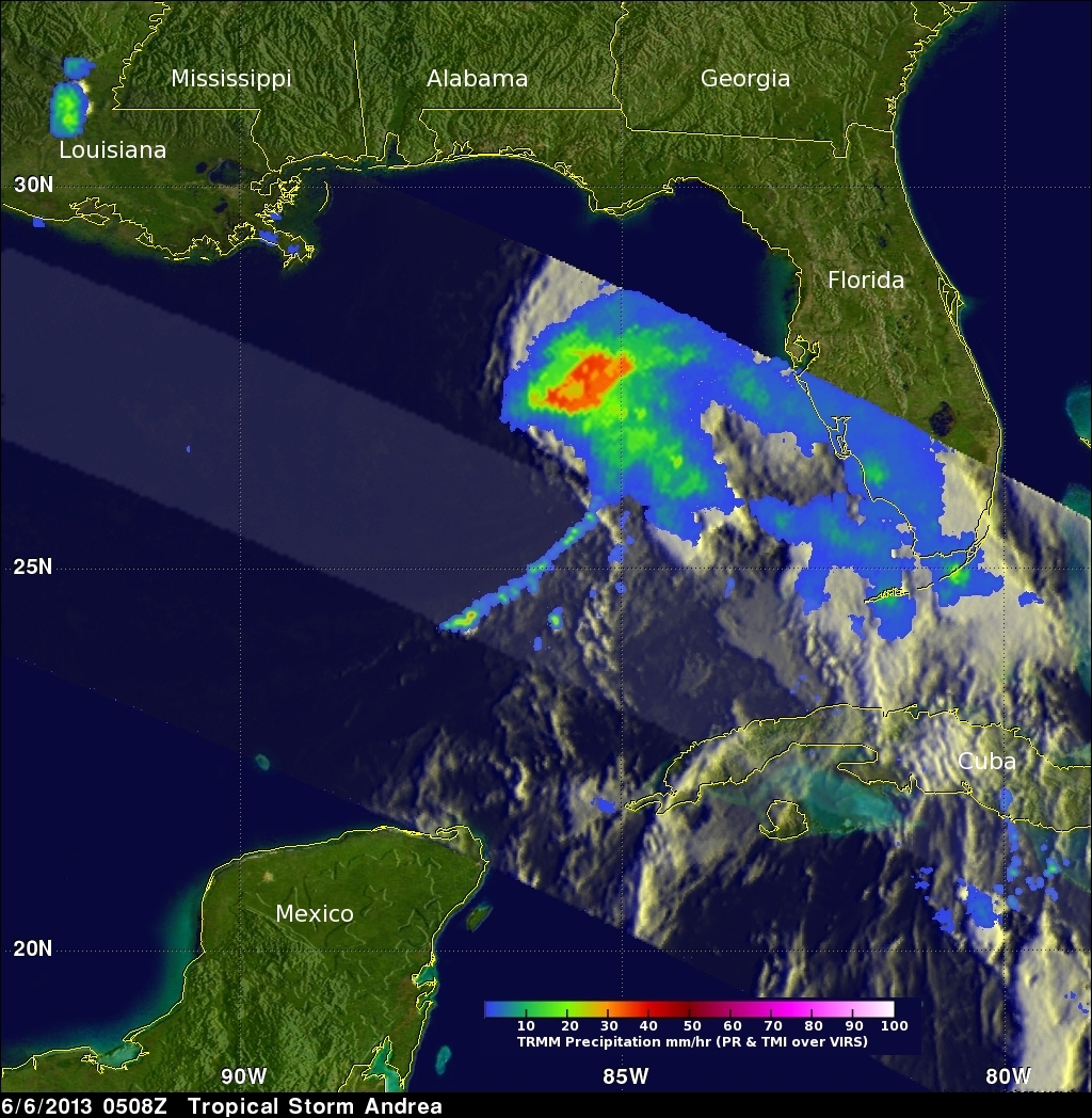
TRMM had another fairly good view of Andrea when it traveled above the storm again on June 6, 2013 at 0508 UTC (1:08 AM EDT). This orbit showed that Andrea had a large area of moderate to heavy rainfall in the northeast quadrant of the storm and precipitation was spreading over the state of Florida.
The National Hurricane Center (NHC) predicts that Andrea will produce more heavy rain in the next few days as it passes to the northeast over Florida and the Atlantic Coast states.
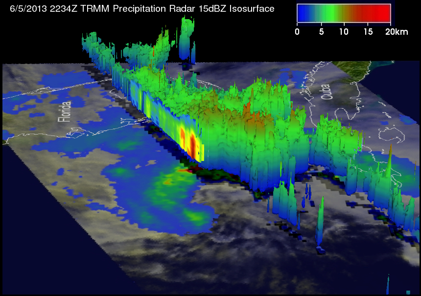
This 3-D view from the west was derived from TRMM Precipitation Radar (PR) data captured when Andrea was examined by the TRMM satellite with the June 5, 2234 UTC orbit. It clearly shows that the majority of the heavy convective rainfall was located on Andrea's eastern side. TRMM PR also showed that the tallest convective thunderstorms reached heights of about 14km (~8.7 miles).
Click here to see a Quicktime simulated Flyby animation courtesy of TRMM PR.
Click here to see a Mpeg simulated Flyby animation courtesy of TRMM PR.