
TRMM Sees Stormy Bay Of Bengal

On May 19, 2014 at 1056 UTC TRMM flew over a tropical low (92B) in the Bay Of Bengal east of India. TRMM's Precipitation Radar (PR) instrument found that rain was falling at a rate of over 138 mm/hr (about 5.4 inches) in some strong convective storms. A rainfall analysis from TRMM's Microwave Imager (TMI) and Precipitation Radar (PR) data is shown overlaid on a METEOSAT-7 visible/infrared image captured at 1100 UTC .
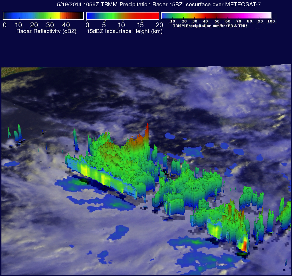
TRMM PR data were also used in this 3-D image that shows a simulated view of the tropical disturbance's rainfall structure. Tall storms were shown reaching heights of over 14km (about 8.7 miles) and returning reflectivity values of over 52dBZ to the satellite.
Click here to see a Low Resolution 640x360 simulated 3-D (Quicktime) flyby.
Click here to see a Low Resolution 640x360 simulated 3-D (MPEG) flyby.
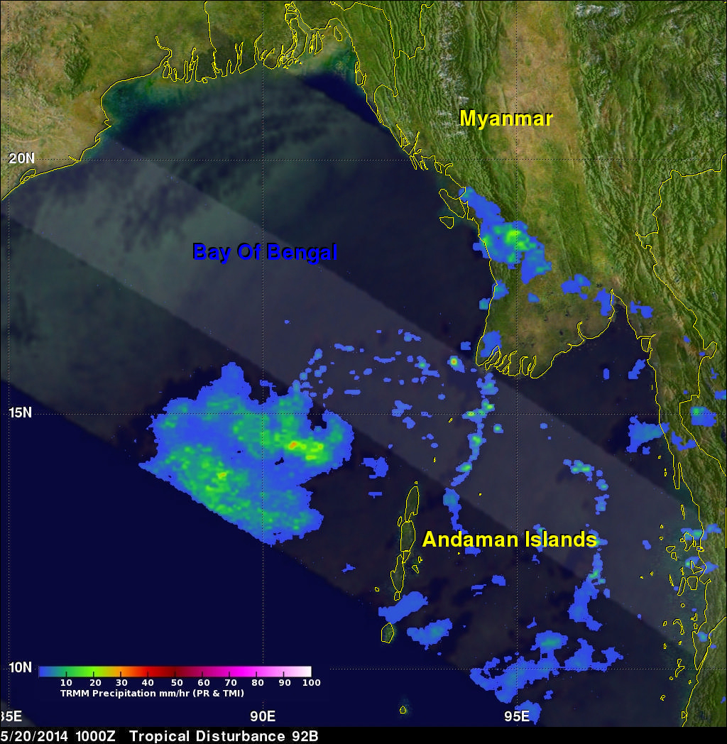
TRMM had another fairly good look at 92B on May 20, 2014 at 1000 UTC. TRMM's Microwave Imager (TMI) had a better view than the Precipitation Radar (PR) instrument that viewed only the northern edge of 92B. TMI showed that 92B was better organized than previously and estimated that rain was falling at a rate of over 33.8 mm/hr (1.3 inches) in some areas.