
TRMM Sees Developing Western Pacific Tropical Cyclone
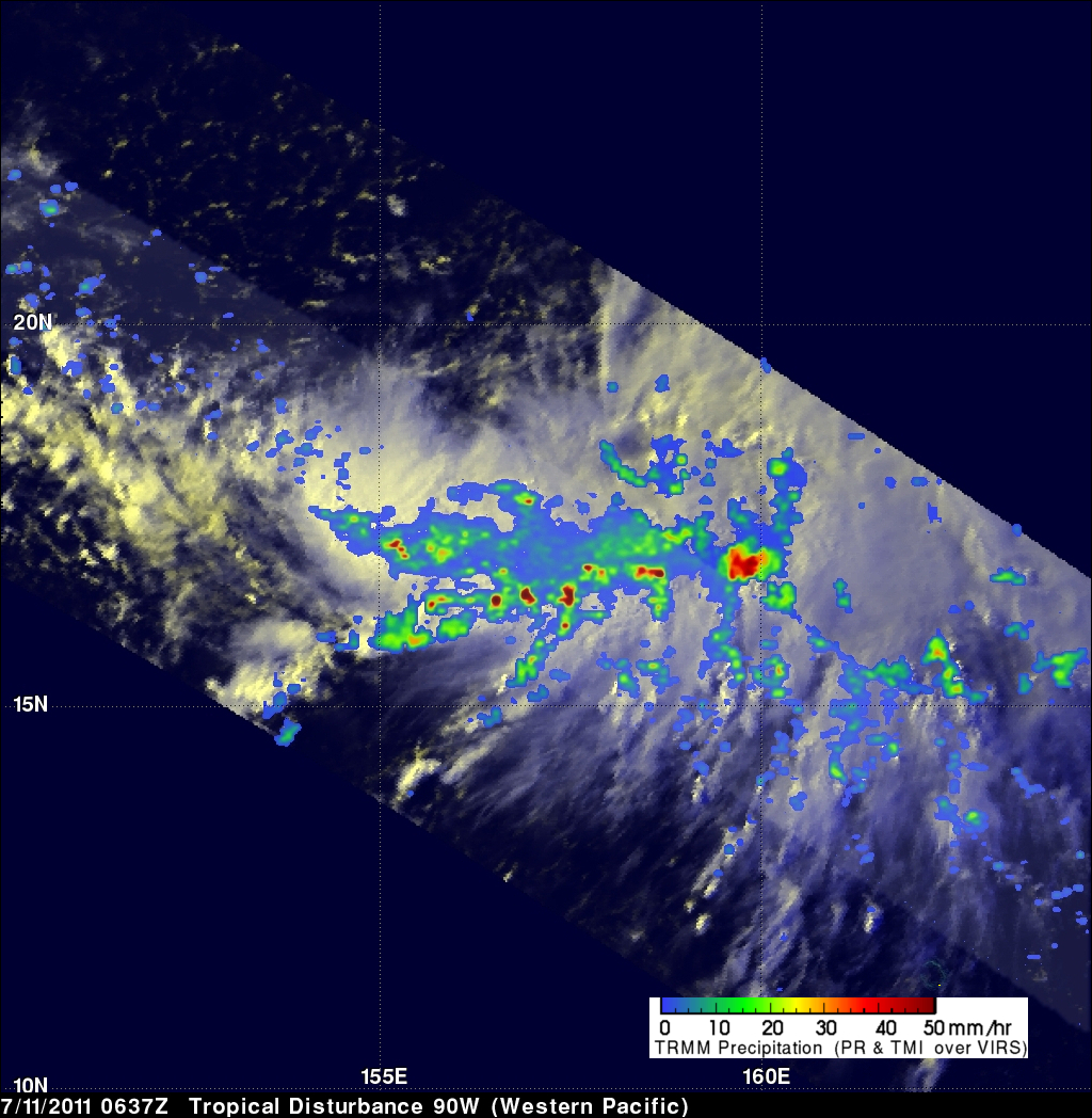
The TRMM satellite flew over newly designated tropical depression 08W in the western Pacific Ocean on 11 July 2011 at 0637 UTC. The rainfall analysis on the left above, derived from TRMM Microwave Imager (TMI) and Precipitation Radar (PR) data, shows that numerous convective thunderstorms were dropping moderate to heavy rainfall over a large area of the Pacific Ocean near 18.1N 157.3E. The Naval Maritime Forecast Center Pearl Harbor, HI (NMFC-PH) predicts that 08W will become a typhoon over the open waters of the Pacific with 65kt (~75 mph) winds by 13 July 2011.
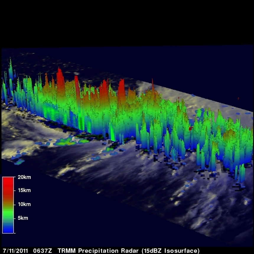
The 3-D display above uses PR data to show the structure of tropical depression 08W. Several thunderstorm towers within 08W reached heights of at least 15km (~9.3 miles).
Click here to see an animation that shows TMI and PR rainfall being drawn over an image from TRMM's Visible and InfraRed Scanner (VIRS).