
Storminess Increases North Of Dissipating Rina
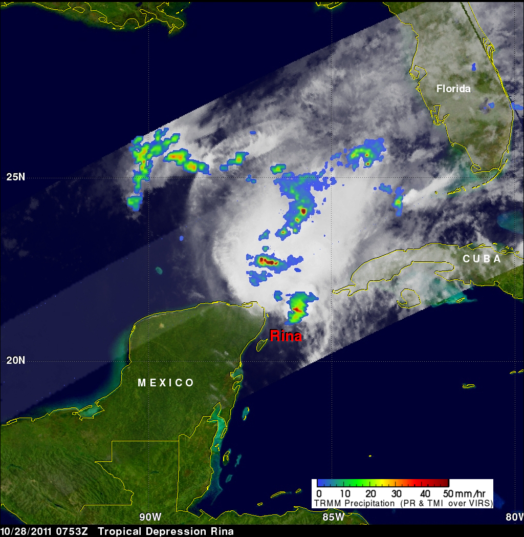
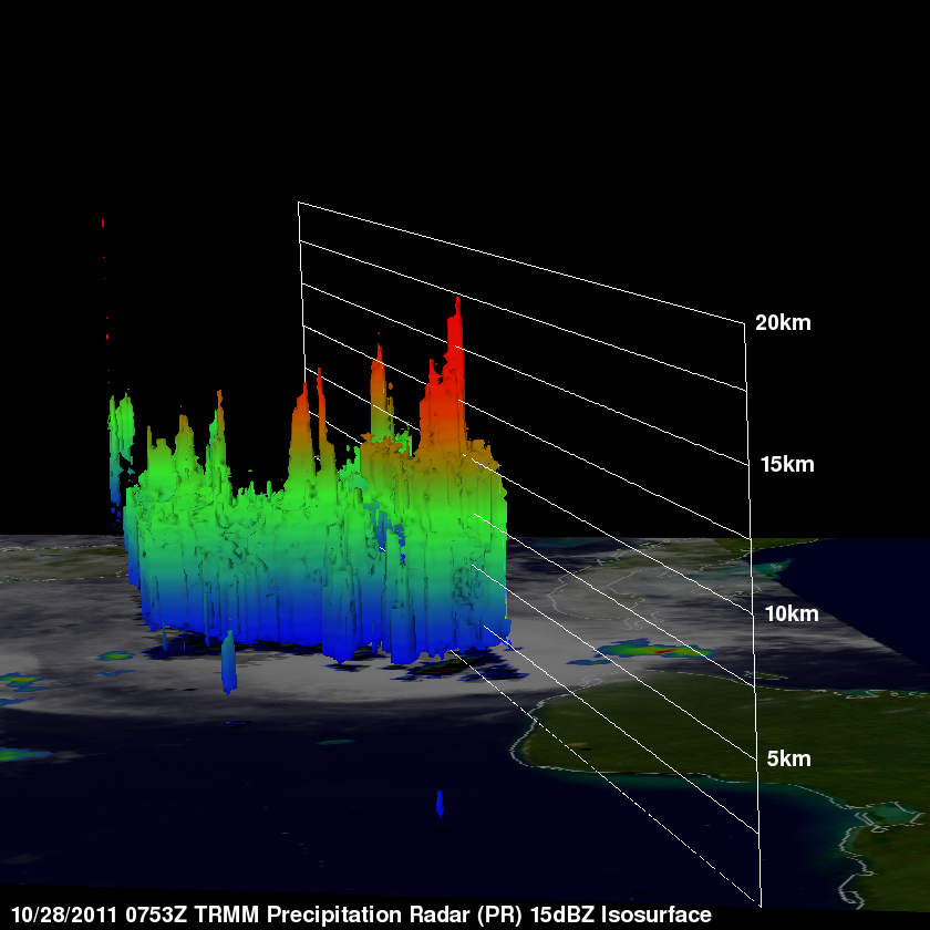
The TRMM satellite passed over rapidly dissipating tropical storm Rina twice on 28 October 2011. The images shown above were made using TRMM's Microwave Imager (TMI) and Precipitation Radar (PR) data collected by the first orbit before daylight at 0753 UTC (3:53 AM EDT). Tropical storm Rita was still dropping heavy rainfall in a small area off the northeastern tip of the Yucatan Peninsula but an even larger area of convective rainfall had formed to the north-northwest of Rina. The image on the upper right , looking toward the east, was made from TRMM's Precipitation Radar (PR) data. It reveals that powerful convective storms within this stormy area were reaching to heights of almost 17km (~10.6 miles).
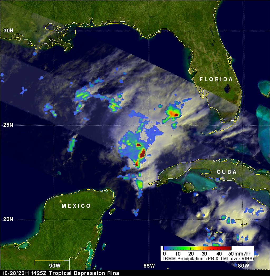
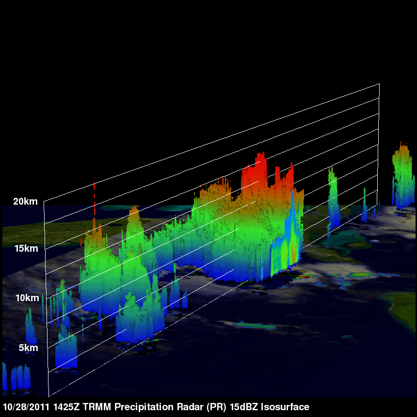
The second TRMM orbit occurred during the daylight on 28 October 2011 at 1425 UTC (10:25 AM EDT). Those data collected with this pass show that Rina had weakened even further. The area of heavy convection north of Rina was still producing heavy rainfall and it was spreading toward southwestern Florida. Another 3-D image from TRMM's Precipitation Radar (PR), on the upper right, shows that this persistent area of extremely heavy convective rainfall had storm tops reaching to heights of over 16km (~9.9 miles).