
Weakening Tropical Storm Olaf Examined By GPM
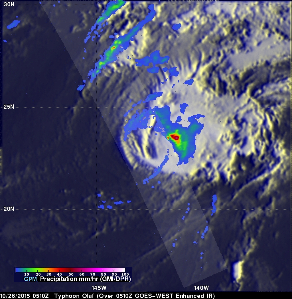
After maintaining hurricane intensity for over a week former category four hurricane Olaf is now a weakening tropical storm. The GPM core observatory satellite flew above Olaf on October 26, 2015 at 0510Z. Rainfall derived from data collected by GPM's Microwave Imager (GMI) and Dual-Frequency Precipitation Radar (DPR) instruments is shown here. Olaf had moved over cooler waters that were sapping the tropical cyclone's energy. GPM's GMI found that storms located in a small area within Olaf were still dropping rain at a rate of over 65 mm (2.6 inches) per hour.
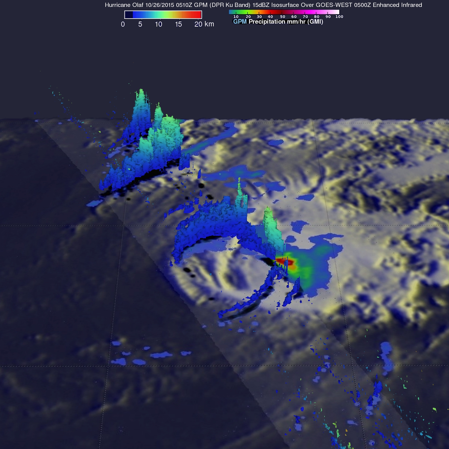
GPM's radar (DPR Ku band) sliced through Olaf's western side showing that rainfall was sparse in that area. GPM's 3-D examination of precipitation structure on that side of Olaf showed that the highest storm tops were reaching heights of 12 km (7.4 miles). Rain in these storms was measured by DPR falling at a rate of up to 62 mm (2.4 inches) per hour.
Olaf is predicted to continue weakening and is expected to be a only tropical depression within a couple days.