
Intensifying Hurricane Irma Checked By GPM Satellite
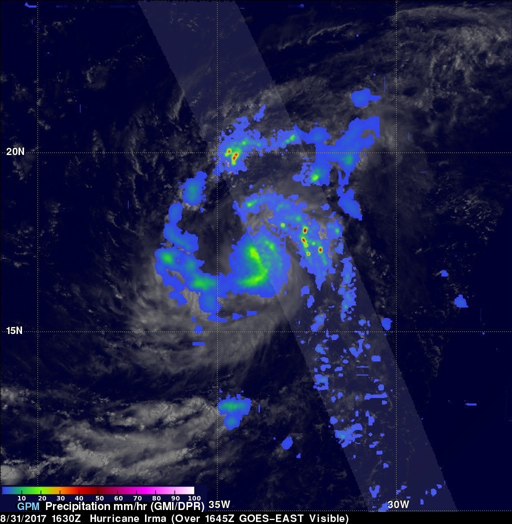
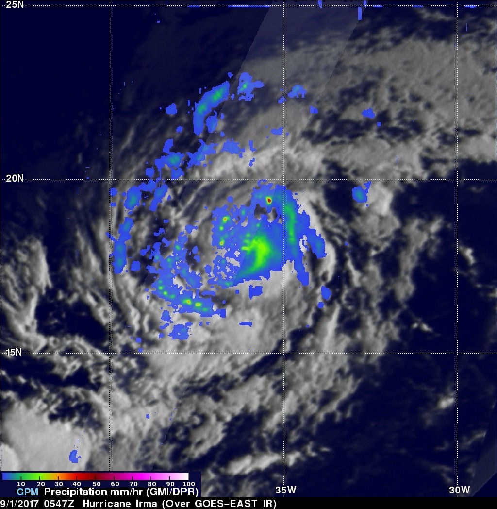
After forming in the eastern Atlantic Ocean on Wednesday tropical storm Irma strengthened and became a powerful category three hurricane on Thursday August 31, 2017. Hurricane Irma was moving west-northwestward with winds of about 115 mph (100 kts) when the GPM core Observatory satellite saw it on September 1, 2017 at 1:47 AM AST (0547 UTC). Data collected by GPM's Microwave Imager (GMI) and Dual-Frequency Precipitation Radar (DPR) instruments showed the locations and intensity of heavy precipitation within the hurricane. GPM's Radar (DPR Ku band) found that a powerful convective storm in a band of rain on Irma's northern side was dropping rain at a rate of almost 6.3 inches (159 mm) per hour.
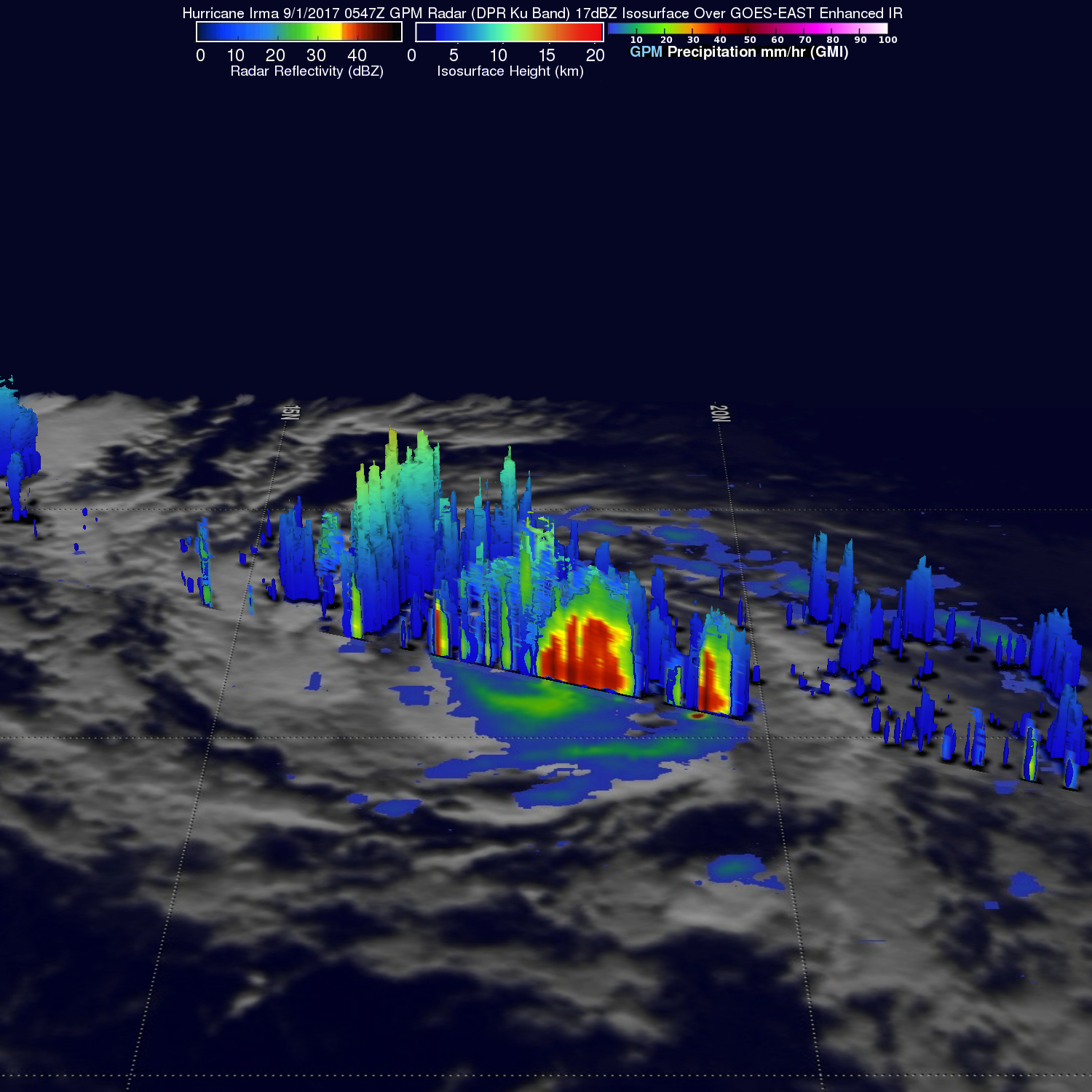
GPM's radar (DPR Ku Band) showed the height and the 3-D rainfall structure of powerful storms spiraling around hurricane Irma. DPR showed that storm tops were reaching heights of over 9.6 miles (15.5 km) in the band of powerful convective storms north of the hurricane's center.
The National Hurricane Center (NHC) predicts that hurricane Irma will slowly intensify while heading toward the west-northwest. Irma is predicted to have winds of over 123 mph (110 kts) within the next five days. There is some uncertainty about the long term direction of Irma's movement. The strength of the Atlantic sub-tropical high is one factor that can influence whether the hurricane moves on a low latitude track toward the Bahamas or heads toward the east coast of the United States.