
GPM Sees Potential Tropical Depression Developing In The Gulf Of Mexico
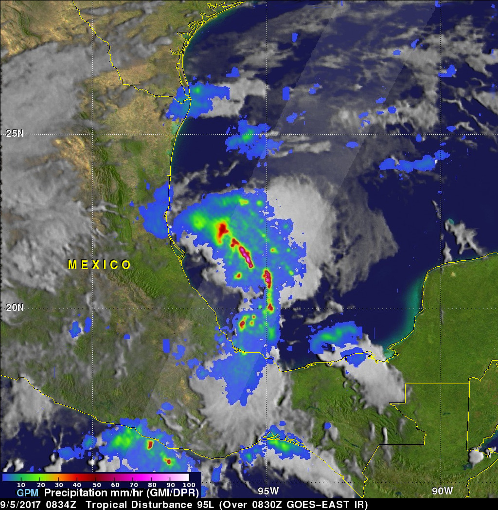
The GPM Core Observatory satellite had an excellent view of a potential tropical depression developing in the Gulf Of Mexico on September 5, 2017 at 3:34 AM CDT (0834 UTC). GPM found that powerful convective storms were dropping heavy rainfall in the Gulf of Mexico east Mexico's coast. GPM's Dual-Frequency Precipitation Radar (DPR) instrument measured rain falling at a rate of over 9.2 inches (233 mm) per hour in an intense band of storms.
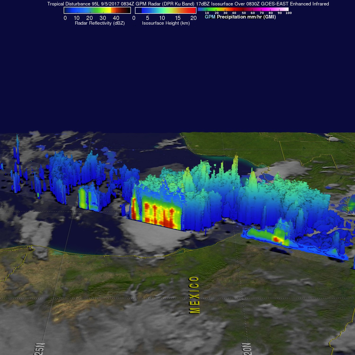
GPM's Radar (DPR Ku Band) data was used to examine the 3-D structure of precipitation in this area of strong convective storms. GPM's DPR showed that storm tops in the tallest storms in this area of potential development were reaching heights of almost 9.9 miles (16 km). Heavy downpours in the area were returning radar reflectivity values greater than 60 dBZ to the satellite.
The National Hurricane Center (NHC) expects a tropical depression to form in this area within the next couple days. Heavy rain is predicted over the Mexican coast in this area.