
GPM Measures Tropical Storm Champi's Heavy Rainfall
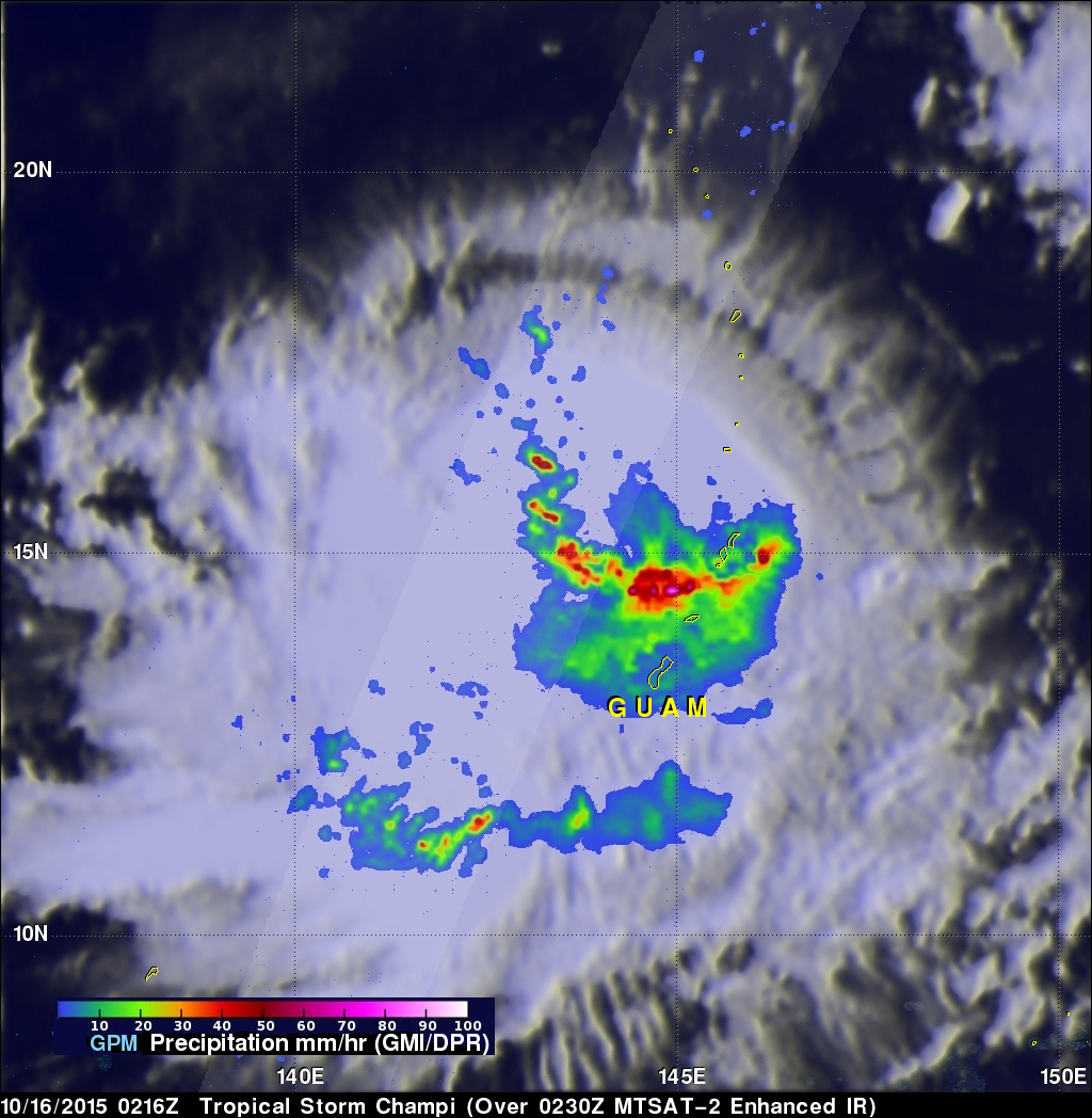
On October 16, 2015 at 0216 UTC the GPM core observatory satellite passed above tropical storm Champi as it was drenching the northern Mariana Islands. GPM's Dual-Frequency Precipitation Radar (DPR) measured rain within Champi falling at a rate of over 114.8 mm (4.5 inches) per hour in a band of intense showers.
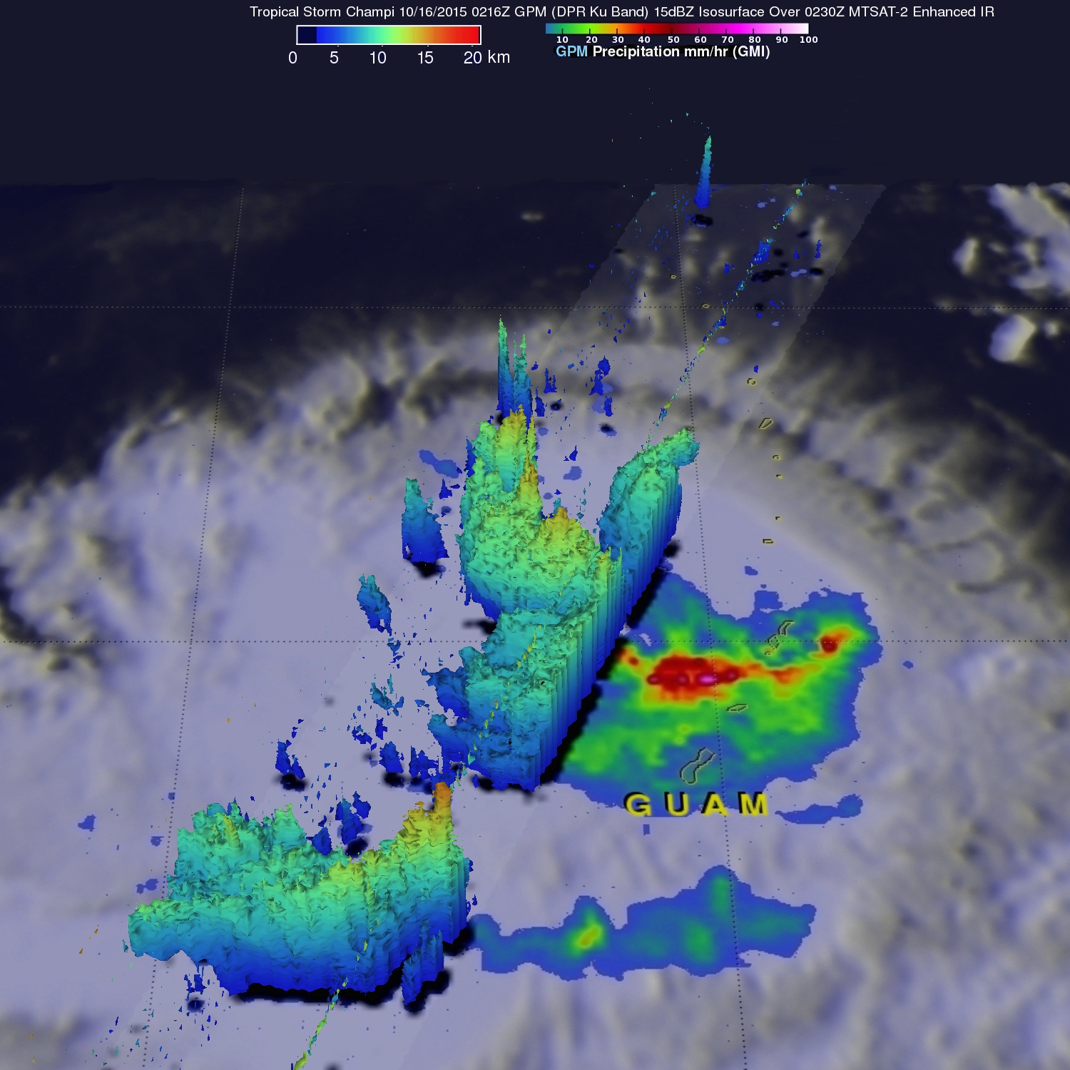
GPM's radar sliced through Champi's western side and made 3-D measurements of storm top heights. Radar reflectivity values found to be greater than 15 dBZ are shown in a simulated perspective 3-D view. The lowest Heights are shaded blue and the tallest 3-D 15dBZ surfaces are colored red. GPM measured storm tops (orange) that were reaching altitudes above 16.5 km (10.2 miles) within a strong feeder band southwest of Guam.
The Joint Typhoon Warning Center (JTWC) determined that Tropical storm Champi had reached typhoon status with winds of 65 kts (74.8 mph) about ten hours after GPM collected data with this pass. JTWC predicts that typhoon Champi will move toward the northwest of the Marianas and intensify with peak winds of 105 kts (120.8 mph) tomorrow. Champi is then predicted to gradually weaken as it re-curves toward the northeast.