
GPM Checks on Cat 4 Hurricane Olaf
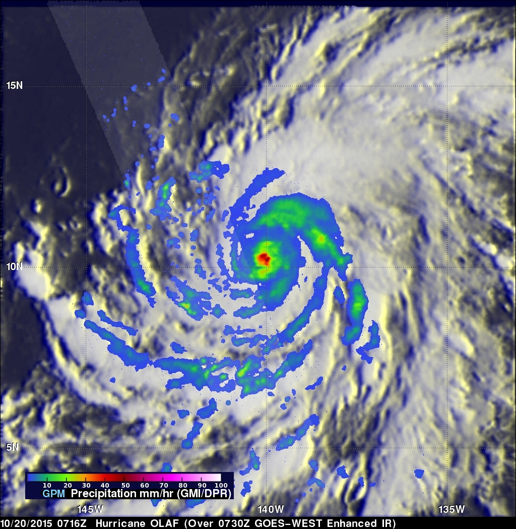
On October 19, 2015 Hurricane Olaf became the eighth category four hurricane in the busy 2015 Eastern Pacific hurricane season. The GPM core observatory satellite had a good look at the distribution of rainfall around powerful hurricane Olaf on October 20, 2015 at 0716 UTC. At that time Olaf had sustained winds estimated at over 130 kts (150 mph). GPM's Microwave Imager (GMI) and Dual-Frequency Precipitation Radar (DPR) measured the intensity of rainfall within the hurricane. GPM's GMI found rain falling at a rate of over 71.5 mm (2.8 inches) per hour in Olaf's eye wall. The DPR instrument swath covered scattered rain bands on the western side of the hurricane where it found precipitation dropping at a rate of 56.8 mm (2.23 inches).
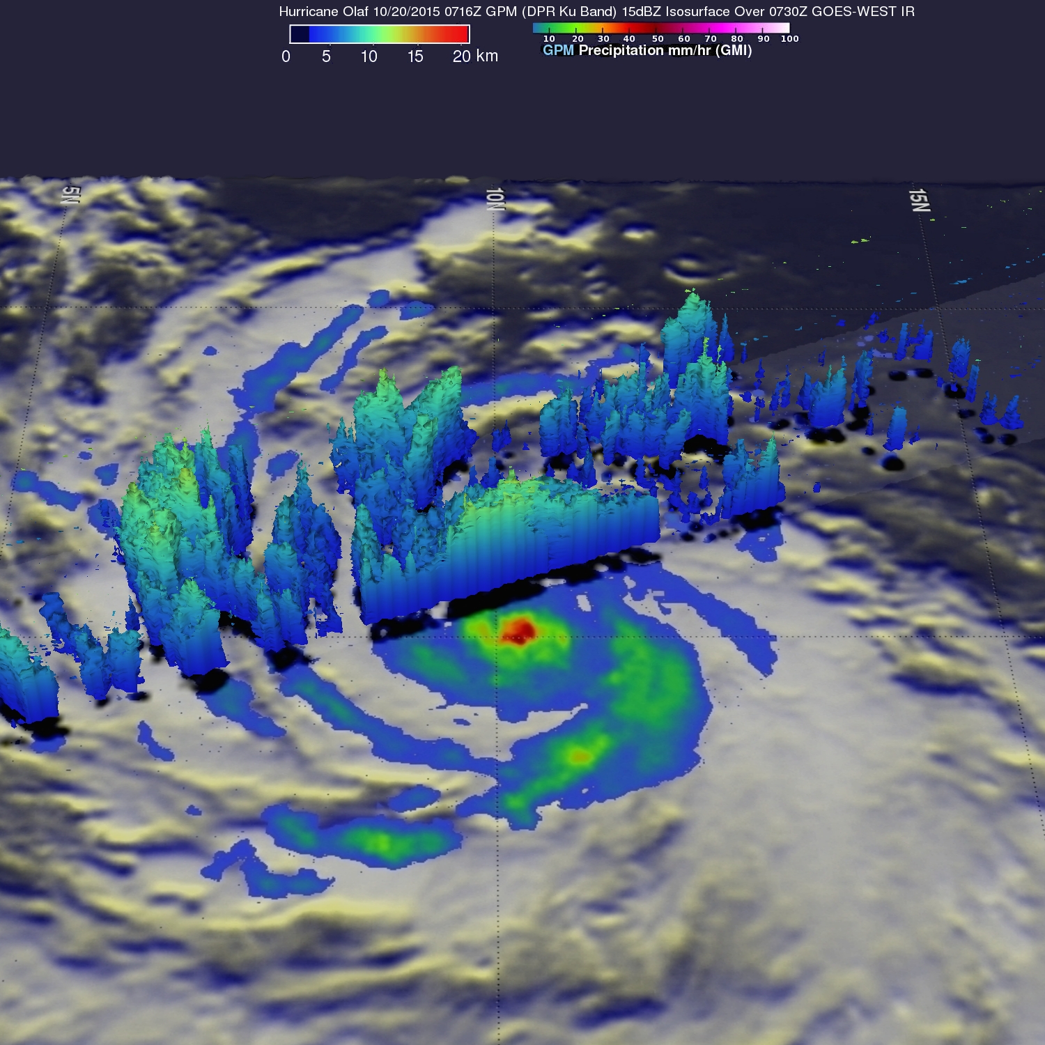
This simulated 3-D view was derived from GPM's radar (DPR Ku band) when it measured the heights of scattered rain bands in the western side of Olaf's circulation.
Olaf is predicted by the Central Pacific Hurricane Center (CPHC) to remain a powerful hurricane for the next four days. Fortunately for the Hawaiian Islands, Hurricane Olaf which was about 1090 mi southeast of Hilo, Hawaii is predicted to stay far away. Olaf is expected re-curve to the north well before it approaches the Hawaiian island.