
Flooding Midwest Downpours Observed By GPM Satellite
Today NOAA's National Weather Service has issued flood advisories and flood warnings for large areas of Arkansas and Tennessee. Large parts of the Ohio Valley and Mississippi valley have received flooding rainfall during the past week. Arkansas has seen more rain than any other state. Life threatening flood conditions have resulted from over 10 inches of rain falling in extensive areas of central Arkansas.
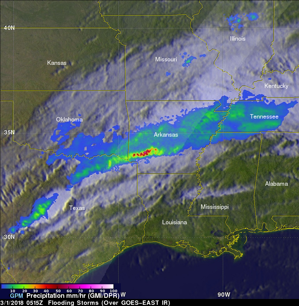
The GPM core observatory satellite had an excellent view of the storms that were producing flooding rainfall in Arkansas when it flew above the state on Wednesday February 28, 2018 at 11:15 PM CST (Thursday March 1, 2018 at 0515 UTC ). This image shows a rainfall analysis that was derived from data received by the satellite with GPM's microwave Imager (GMI) and Dual Frequency Precipitation Radar (DPR) instruments. GPM's radar passed directly above storms that were dropping heavy rain over southwestern Arkansas. The area covered by GPM's radar is shown in lighter shades. GPM's radar (DPR) indicated that some of these storms were dropping rain at greater than 5.1 inches (30.7 mm) per hour.
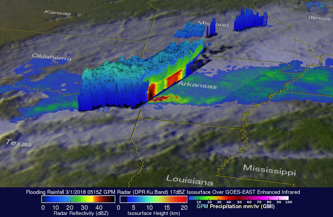
The GPM satellite's 3-D radar data (DPR Ku Band) were used to show the vertical structure of precipitation falling over Arkansas. These 3-D views use GPM's radar data to reveal simulated cross-sections of intense storms that were extending from Oklahoma into southwestern Arkansas. Storm tops in the area were shown by GPM to reach heights above 5.6 miles (9 km).
