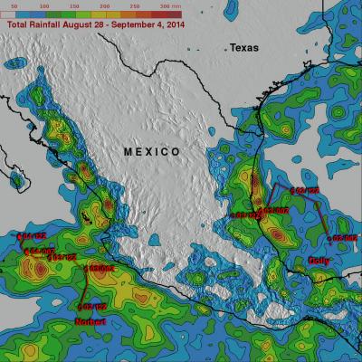
Moisture From Norbert Spreads Heavy Rain Over Southwest
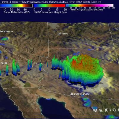
The TRMM satellite flew above the post-tropical cyclone remnants of former hurricane Norbert on September 8, 2014 at 0849 UTC (1:49 AM PDT). This image shows TRMM rainfall derived from the Microwave Imager (TMI) and Precipitation Radar (PR) instruments overlaid on a 0900 UTC GOES-EAST enhanced Infrared image. These data show that only a small amount of light to moderate rainfall was located around Norbert's center of circulation. This view shows that heavy rainfall was being produced over the southwestern United States. This 3-D image was made from TRMM Precipitation Radar (PR) data. It shows