Landslides

Deadly Philippine Flooding And Landslides

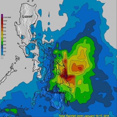
People in the southern Philippines are used to heavy rainfall this time of the year but rainfall totals have recently been exceptionally high. A tropical low northeast of Mindanao has been an almost permanent feature on weather maps for the past week. It has caused nearly continuous rain in the area of northeastern Mindanao triggering floods and landslides that have caused the reported deaths of 34 people. The TRMM Multi-Satellite Precipitation Analysis (TMPA), produced at Goddard Space Flight Center, combines the rainfall estimates generated by TRMM and other satellites (3B42) . The analysis

Faces of GPM: Dr. Dalia Kirschbaum, GPM Applications Scientist

Submitted by JacobAdmin on Fri, 12/27/2013
Video Embed

Dr. Kirschbaum discusses her role with GPM, how she became a scientist, and how remotely sensed satellite data can be used to study and evaluate natural hazards such as landslides.

This video is the first in a series called "Faces of GPM", which will interview several GPM team members to learn what it is like to be a NASA scientist or engineer.


Video Text:

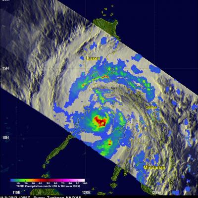
Super Typhoon Haiyan Hits the Philippines
Super typhoon Haiyan, equivalent to a Category 5 hurricane on the US Saffir-Simpson scale, struck the central Philippines municipality of Guiuan at the southern tip of the province of Eastern Samar early Friday morning at 20:45 UTC (4:45 am local time) as an extremely powerful super typhoon, perhaps the strongest ever recorded at landfall, with sustained winds estimated at 195 mph (315 kph) by the Joint Typhoon Warning Center. Previously, Hurricane Camille, which struck the northern Gulf Coast in 1969, held the record with 190 mph sustained winds at landfall. After striking Samar, Haiyan...

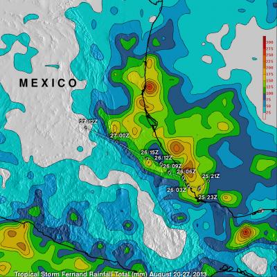
Tropical Storm Fernand Causes Deadly Mudslides

Heavy rain with tropical storm Fernand generated mudslides that caused the reported deaths of 13 people in the Mexican state of Veracruz. TRMM precipitation data are used to calibrate rainfall estimates from other satellites. The resulting TRMM- based, near-real time Multi-satellite Precipitation Analysis (TMPA) at the NASA Goddard Space Flight Center is used to estimate rainfall over a wide portion of the globe. The analysis above shows estimated TMPA rainfall totals for the period from August 20-27, 2013 when Fernand was developing and moving through the area. Total Rainfall greater than

GPM: Too Much, Too Little

Submitted by JacobAdmin on Fri, 06/07/2013
Video Embed

Researchers need accurate and timely rainfall information to better understand and model where and when severe floods, frequent landslides and devastating droughts may occur. GPM’s global rainfall data will help to better prepare and respond to a wide range of natural disasters.

Video Text: 

Dalia: GPM will help us to understand precipitation extremes. And this is everything from too much rainfall, such as flooding in India or Southeast Asia, to too little rainfall such as drought in the U.S. Southwest.

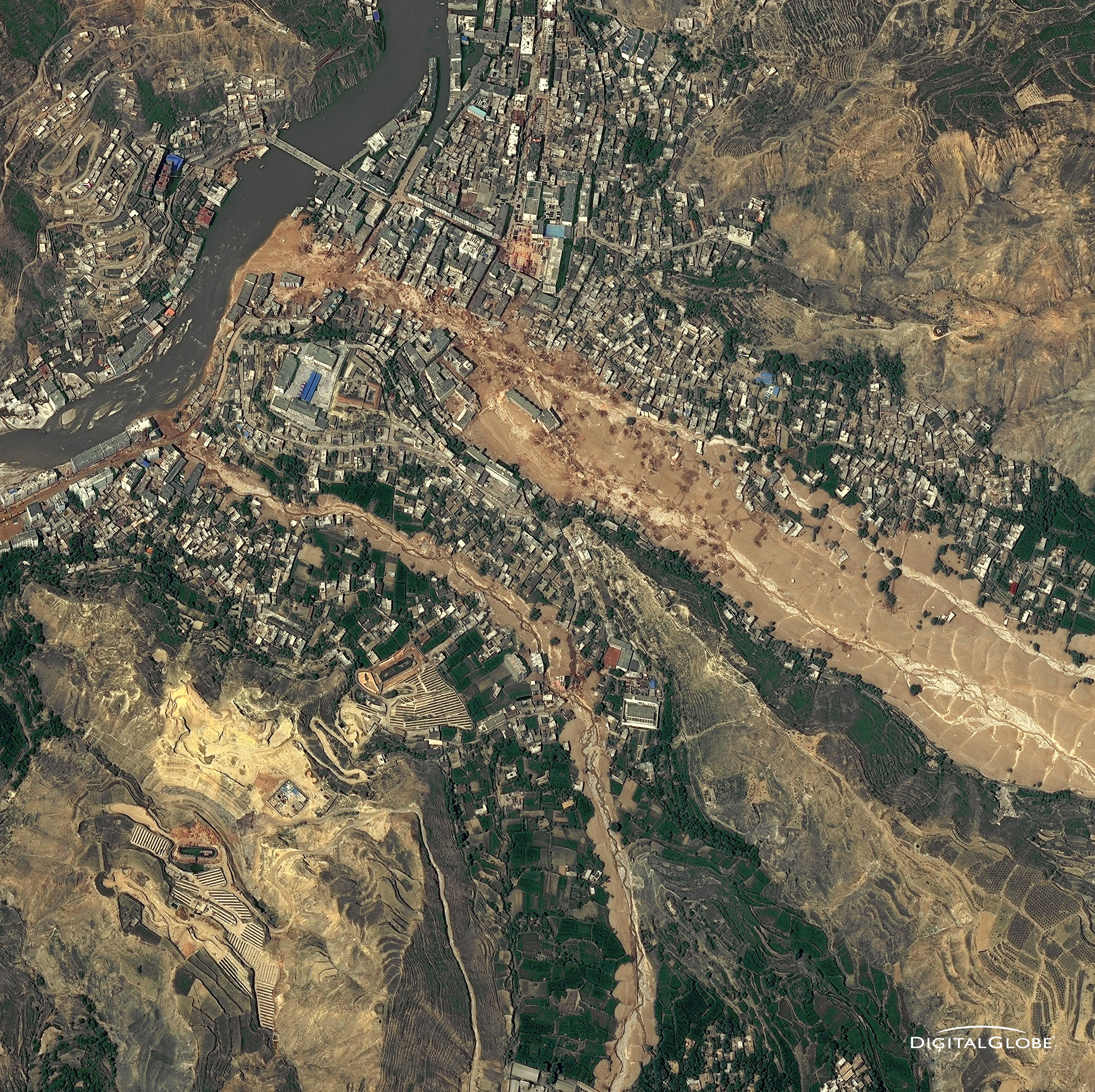
Aerial photo of 2010 landslide in Gansu, China
By Lisa-Natalie Anjozian , NASA Goddard Space Flight Center Original www.nasa.gov Press Release (published 11/27/12) A NASA study using TRMM satellite data revealed that the year 2010 was a particularly bad year for landslides around the world. Around midnight on August 8, 2010, a violent surge of loosened earth roared down mountain slopes and slammed into quietly sleeping neighborhoods in Zhouqu County in Gansu, China. The catastrophic mudslides—the deadliest in decades according to state media—buried some areas under as much as 23 feet (7 meters) of suffocating sludge. 1,765 people died...

2010 Landslide in Gansu, China

Aerial photo of 2010 landslide in Gansu, China
Image Caption
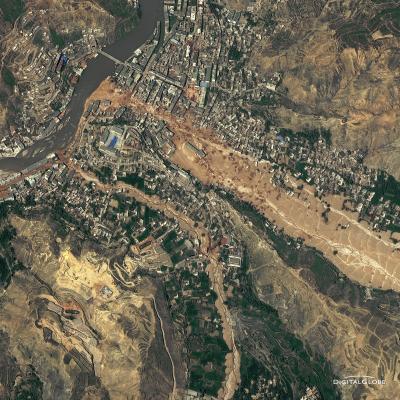
Around midnight on August 8, 2010, a violent surge of loosened earth roared down mountain slopes and slammed into quietly sleeping neighborhoods in Zhouqu County in Gansu, China.

The catastrophic mudslides—the deadliest in decades according to state media—buried some areas under as much as 23 feet (7 meters) of suffocating sludge. 1,765 people died. Property damages totaled an estimated $759 million. Cutting from right to left, this detailed image, from DigitalGlobe’s WorldView-2 satellite, shows the largest slide in the lower part of the city on August 10, 2010.

Image Credit: Digital Globe, DigitalGlobe usage policy

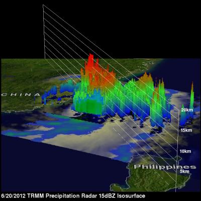
Tropical Storm Talim's Heavy Rainfall Over Taiwan

Tropical storm Talim has produced torrential rainfall over southern Taiwan as it pumped warm moist air from the South China Sea over mountainous terrain. The TRMM satellite flew over tropical storm Talim in the Taiwan Strait on 20 June 2012 at 0140 UTC. TRMM Precipitation Radar (PR) data from this orbit shows that tropical storm Talim was dropping rainfall at a rate of almost 50mm/hr over Taiwan. TRMM data captured with that orbit shows that the most intense rainfall of over 50mm/hr (~2 inches) was located over the Strait Of Taiwan. Flash flooding and landslides are probable in southern Taiwan