Iggy

Iggy Rainfall Hits Australia

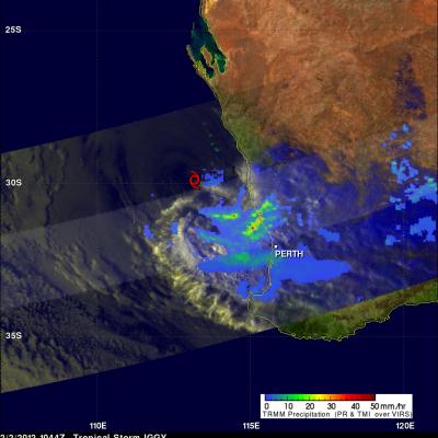
On 2 February 2012 at 1044 UTC the TRMM satellite again saw weakening tropical storm IGGY as it was approaching the coast of southwestern Australia. Data from TRMM's Microwave Imager (TMI) and Precipitation Radar (PR) instruments showed that bands of heavy rainfall measuring over 50mm/hr (~2 inches) were hitting coastal areas northwest of Perth, Australia. A red tropical storm symbol shows where Iggy's center was located.

Tropical Cyclone Iggy

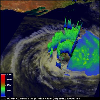
The TRMM satellite passed above tropical storm Iggy on 1 February 2012 at 0647 UTC as the storm was heading toward the coast of southwestern Australia. Iggy was briefly categorized as a category 1 tropical cyclone on the Saffir-Simpson scale but is predicted to be a weak tropical storm with winds of about 35kts (~40 mph) when it moves over the Australian coast. Iggy's past and forecast locations are shown with appropriate white tropical cyclone symbols on the image above. TRMM data revealed that Iggy had a large area of moderate to heavy rainfall south of the center of circulation. TRMM's