Adrian

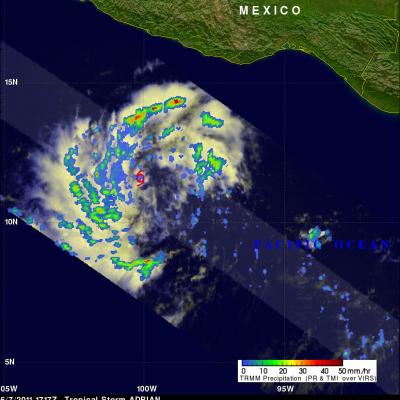
TRMM Sees Adrian's Eye

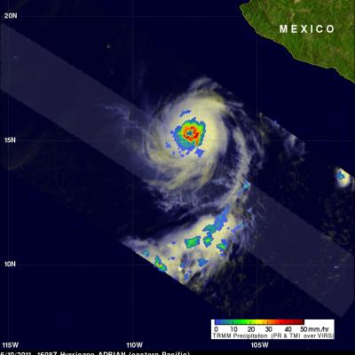
Hurricane Adrian's eye was clearly seen by the TRMM satellite when it passed over on 10 June 2011 at 1608 UTC. The heavy rainfall completely surrounding Adrian's well defined eye was revealed with TRMM Microwave Imager (TMI) data obtained at the same time. Hurricane Adrain, located southwest Mexico , was classified as a dangerous category 4 on the Saffir-Simpson scale with sustained wind speeds estimated at 115 kts (~132 mph).

Tropical Storm Adrian Seen Forming

Tropical Depression ONE-E was well on it's way to becoming tropical storm ADRIAN when the TRMM satellite flew over again on 7 June 2011 at 1717 UTC. Rainfall data from TRMM's Microwave Imager (TMI) and Precipitation Radar (PR) show that bands of rainfall were starting to get organized. A red tropical storm symbol shows the location of the future storm's center of circulation. TRMM's PR showed thunderstorm towers as high as 15 km (~9.3 miles) in rain bands west of ADRIAN's center.