

World Health
Malaria outbreaks after the 2010 floods in Pakistan, E. coli and colliform from raw sewage in Mississippi flood waters, and cholera spread by heavy rains in Cameroon, West Africa are among the many health hazards associated with flood disasters and torrential rains. In developing regions with limited clean water infrastructure and health resources that are stretched thin, any advanced warning can make a huge difference in the health community’s response to help people in need.
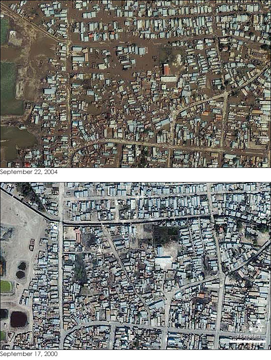
Flooding in Gonaives Haiti before and after the 2004 tropical storm Jeanne
Using satellite data to forecast disease outbreaks is an emerging field. NASA’s Malaria Modeling and Surveillance (MMS) Project’s Global Situational Awareness Tool (GSAT) combines data sets from a number of satellites, including rainfall data from TRMM, to evaluate the risk of malaria worldwide. TRMM and GPM’s global coverage and high frequency observations also help locate areas at risk over short time-scale events like hurricane-induced flooding, which can cause sewage and waste-related health issues. Characterizing the patterns of extreme precipitation and the flooding or landslides that may happen as a result is also vital for understanding where, when and how populations may be impacted.