
GPM Observes Hot Tower in Florida Squall Line
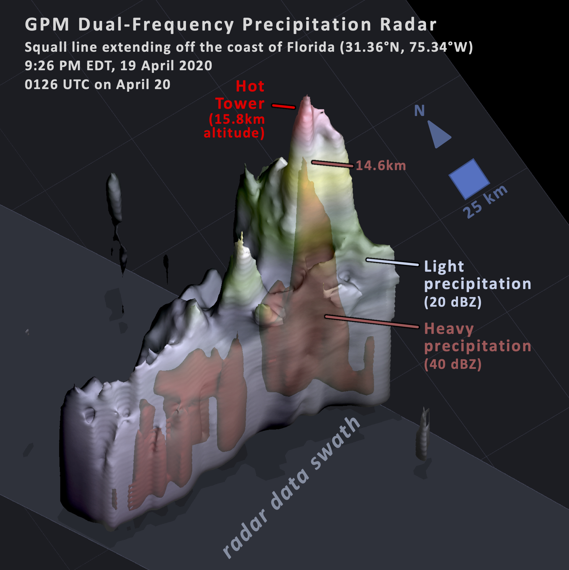
At 9:26pm on Sunday April 19, 2020, NASA's GPM satellite observed an extremely vigorous convective storm cell embedded within a squall line that had produced tornadoes earlier that evening along the US Gulf Coast. NASA's GPM satellite flew over the portion of this squall line that extended over the Atlantic Ocean, 350 miles (500 kilometers) east of Florida's Coast.
The Dual-Frequency Precipitation Radar (DPR) observed a storm cell whose updrafts were strong enough to lift small ice particles into the stratosphere 15.8 km above the ocean surface. Equally remarkable is that the updrafts were able to lift large ice particles, perhaps including hail, to a 14.5 km altitude. In round numbers, the precipitation radar detects small and large precipitating ice particles by means of a radar reflectivity of 20 or 40 dBZ, respectively.
As documented in NASA research*, it is unusual, but not unheard of, for a precipitation cell over the ocean to reach such a high altitude. ;The vast majority of storm cells over the ocean fail to reach such high altitudes because the ocean's surface temperature does not heat up as much as mid-latitude land surfaces can, denying storm cells an extremely unstable, warm, near-surface layer of air.
Image and Text by Owen Kelley (NASA GSFC)
*Kelley, O. A., J. Stout, M. Summers, and E. J. Zipser, 2010: Do
the tallest convective cells over the tropical ocean have slow
updrafts? Monthly Weather Review, 138, doi:10.1175/2009MWR3030.1.