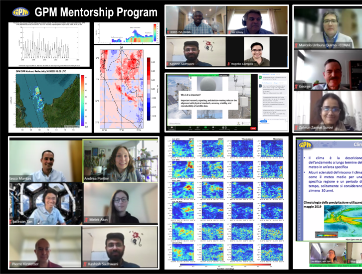
2023 Mentors
Aaron Funk
Affiliation: Texas A&M University, Texas, USA
Project Mentees: Clara Avila Dea Permata; Kaman Ghimire
Why are you participating in this program as a mentor?
I enjoy sharing any knowledge I've gained throughout my career with others, so the GPM Mentorship Program is appealing to me.
What is your area of expertise and how does GPM fit into your research?
My areas of expertise include radar meteorology and computer science. One of my primary interests is using GPM DPR radar data to analyze the impact of various rain types on a nearly global scale.
What is a challenge you often notice by users with using remote sensing data? Any advice to overcome this challenge?
The depth of information included in remote sensing data sets can cause them to be challenging to understand. For DPR, it's important to understand the operation of the radar and the algorithms that correct the data. Luckily NASA GPM provides good documentation for DPR and DPR data products (see https://gpm.nasa.gov/data/directory) and there are good publications in the literature outlining the DPR algorithms and scientific findings.
Ali Tokay
Affiliation: NASA Goddard Space Flight Center and University of Maryland Baltimore County (UMBC) Goddard Earth Sciences Technology and Research (GESTAR-II), Maryland, USA
Project Mentee: Marcos Benso
Why are you participating in this program as a mentor?
Mentoring is one of the main activities as a university professor. It is crucial to pass the knowledge to the young scientists.
What is your area of expertise and how does GPM fit into your research?
GPM ground validation program. Our research is to provide the ground reference for the validation of satellite precipitation retrieval algorithms (e.g., GPM’s IMERG product).
What is a challenge you often notice by users with using remote sensing data? Any advice to overcome this challenge?
The data volume versus computing capability is a thin line. The remote sensing data comes with a big volume and the user should know what exactly to look for.
Andrea Portier
Affiliation: NASA Goddard Space Flight Center, Science Systems and Applications, Inc (SSAI)., Maryland, USA
Project Mentees: Precipitation Extremes Mentee Cohort (Amy Molina; Ana Ligia Arancibia; Carlo Montes; Daniel Aderotoye; Edson Baptista; Gustavo de la Cruz; Idris Baba; Zahrun Zannat)
Why are you coordinating this program and participating in this program as a mentor?
Over the years, satellite precipitation data have enabled a wealth of applications that address societal needs. However, users often experience difficulty accessing, processing, and applying the data to enable these applications. I believe that providing opportunities to decrease barriers to engagement and learning and connecting experts to end users can greatly facilitate precipitation data usage for applications. Additionally, by working directly with end users, one gains an understanding of their needs and what’s important to them. This program created a space for this dialogue and an opportunity to learn from others.
What is your area of expertise and how does GPM fit into your research?
I am the NASA GPM Mission Applications Lead. For this role, my goal is to engage with different stakeholder communities to understand and quantify how GPM satellite data products are applied for decision-making and provide opportunities to educate potential users about how this data can benefit their work and lives. By being part of this program, it allowed me to understand participants’ needs and requirements for satellite precipitation data and deliver efficient and effective resources to support and enable their decision making.
What is a challenge you often notice by users with using remote sensing data? Any advice to overcome this challenge?
Understanding which products to use and where to access data products for applications can often be overwhelming. My advice is to take a step back and ask yourself - what are my data needs? What spatial and temporal resolutions can I work with? What time period do I need data for? And in what formats? I would then suggest studying the literature thoroughly, reaching out to data developers, and looking into similar case studies related to your work. Additionally, make use of any data tutorials available. I would encourage end users to review these resources too. Getting a thorough understanding of data products available and examples of how others are using the data can be helpful and guide you in a direction that fits your needs. And again, don’t hesitate to reach out to a mission and its data developers. For example, the GPM mission has a contact form and we (the GPM Team) strive to answer your questions through this form!
Amita Mehta
Affiliation: NASA Goddard Space Flight Center and University of Maryland Baltimore County (UMBC) Goddard Earth Sciences Technology and Research (GESTAR-II), Maryland, USA
Project Mentee: Kenneth Ekpetere
Why are you participating in this program as a mentor?
This program is a great way to introduce GPM data to students, who can not only benefit from the use of this data in their research, but they are the future work force and can take this experience with them - potentially increasing the use of GPM data in research and applications.
What is your area of expertise and how does GPM fit into your research?
I use GPM’s Integrated Multi-satellitE Retrievals for GPM (IMERG) precipitation product for understanding weather, climate, and hydrology research and applications. I also use IMERG precipitation for capacity building for decision makers through the Applied Remote Sensing Training Program (ARSET) for monitoring extreme weather conditions and water resources.
What is a challenge you often notice by users with using remote sensing data? Any advice to overcome this challenge?
Having multiple sites and formats for data often confuse users! Perhaps having clearer instruction of choosing a particular product from a specific source might help.
Andrey Savtchenko
Affiliation: NASA Goddard Space Flight Center, NASA Goddard Earth Sciences (GES) Data and Information Services Center (DISC), Maryland, USA
Project Mentee: Rogelio Campos
Why are you participating in this program as a mentor?
I felt compelled to share my expertise with younger people. I also wanted to be exposed to challenges people with less experience may encounter while working on their applications and research projects. What appealed to me is the broad outreach to applications users from the entire world, and the opportunity to work on one particular and practical issue.
What is your area of expertise and how does GPM fit into your research?
My main areas of interest include climate variability, multi-year to multi-decadal oscillations, such as El Niño-Southern Oscillation (ENSO) and Pacific Decadal Oscillation (PDO), changes in patterns of temperature, humidity and precipitation, principal modes of variability in decadal satellite and reanalysis records as well as changes in patterns of extreme events. Additionally, I am involved in providing science data analysis supporting numerous missions, including GPM.
What is a challenge you often notice by users with using remote sensing data? Any advice to overcome this challenge?
I gave it a long thought on what for me the main challenge is working with satellite data, and GPM’s Integrated Multi-satellitE Retrievals for GPM (IMERG) precipitation product in particular. I came to conclusion that hydrologists and climatologists likely have very different expectations, and IMERG tends to be more suitable to hydrologists. As a climatologist, I don’t need the fine spatial resolution. But I do need long and stable time series. So for me one challenge is to find a compromise between NASA’s TRMM Multi-satellite Precipitation Analysis (TMPA) and IMERG products. While the former is more stable and easier to work with because of the smaller size, it ends in 2019. But then again, it does include 1998-2000 and IMERG doesn’t. However, the IMERG product highest quality currently covers up to 2021. But it is harder to work with because of its large size that tends to suit hydrologists better.
Ankita Pradhan
Affiliation: University of Wisconsin-Madison, Madison, Wisconsin, USA
Project Mentee: Rojan Lamichhane
Why are you participating in this program as a mentor?
The utilization of satellite-derived precipitation estimates has facilitated a diverse range of applications aimed at addressing societal demands. Nevertheless, challenges persist in terms of data accessibility, processing, and application, hindering the effective use of such data for societal purposes. In my perspective, mitigating these challenges can be achieved by offering opportunities that alleviate barriers to engagement and knowledge acquisition, while also establishing connections between domain experts and end users. This approach holds the potential to enhance the ease of employing precipitation data for various applications. I strongly believe that as a mentor in this program, I actively fostered an environment that cultivated meaningful dialogues, creating an exceptional experience and valuable opportunity to contribute to this significant undertaking.
What is your area of expertise and how does GPM fit into your research?
My research interest focuses on hydrometeorology, primarily concentrating on the intricate dynamics of the atmospheric water cycle including precipitation processes and its implications on floods. In my PhD thesis I studied the implications of remote sensing-based precipitation uncertainty within the framework of the Global Precipitation Measurement (GPM) mission. During my PhD, I had the privilege of being a part of the NASA Precipitation Measurement Missions (PMM) science team in 2019. This involvement provided me with an invaluable opportunity to collaborate with esteemed researchers and scientists within the field, further broadening my expertise and perspective.
In alignment with my dedication to research with real-world implications, I am particularly interested in the utilization of satellite-derived precipitation data for flood forecasting and enhancing decision-making processes related to flood risk management. By leveraging the wealth of information provided by satellite-based precipitation estimates, I aim to contribute to the development of robust methodologies and tools that can support effective flood forecasting systems and aid in making informed decisions to mitigate flood-related risks.
What is a challenge you often notice by users with using remote sensing data? Any advice to overcome this challenge?
One common challenge with remote sensing data, including satellite precipitation data, is dealing with uncertainties specifically sampling uncertainty. To overcome this, incorporate uncertainty quantification and validation techniques, understand the limitations of the data, and collaborate with experts in the field.
Ardeshir Ebtehaj
Affiliation: University of Minnesota, Minnesota, USA
GPM Mentorship Lecturer
Why are you participating in this program as a lecturer?
I am passionate to inform the students and researchers around the world about GPM and in the involved science.
What is your area of expertise and how does GPM fit into your research?
My research interest focuses on precipitation passive microwave retrievals and machine learning.
What is a challenge you often notice by users with using remote sensing data? Any advice to overcome this challenge?
Remote sensing data are large and require advanced computational and statistical skills to extract and inform from them.
Becky Adams-Selin
Affiliation: Atmospheric and Environmental Research, Nebraska, USA
Project Mentee: Prosper Ayabagabo
Why are you participating in this program as a lecturer?
I am new to the GPM community myself, so I am very familiar with the challenges of finding your way among all the data! I was particularly excited to work with scientists seeking to understand hail fall.
What is your area of expertise and how does GPM fit into your research?
I research many aspects of mid-latitude and sub-tropical convection, but one of my big interests is understanding how hail is produced by a thunderstorm. GPM satellite data can be used to detect large amounts of ice aloft in thunderstorm clouds, which often translates to hail at the ground. I am working to understand how hail can be produced in regions and environments that often don’t look like those environments that we more typically see producing hail in the U.S. or Europe. Furthermore, understanding where and when hail can happen has a big societal impact! The use of satellite data can be key for understanding where hail might be happening in regions without a large radar network or a public spotter network.
What is a challenge you often notice by users with using remote sensing data? Any advice to overcome this challenge?
The sheer breadth of the data can be overwhelming when first accessing it – I encourage potential users to reach out to the GPM mentors to get advice for best access points and resources. Once you know the ins and outs, it isn’t as hard as it seems.
Chuntao Liu
Affiliation: Texas A&M University – Corpus Christi, Texas, USA
Project Mentee: Gianella Botetano Bastidas
Why are you participating in this program as a mentor?
It is very important for the community to understand the usefulness and limitations of GPM observations and applications. I hope that my background on the remote sensing and experiences of precipitation retrievals could help clarify some common misunderstandings in the GPM observations and retrievals.
What is your area of expertise and how does GPM fit into your research?
My area of expertise focuses on convection, lightning, precipitation, radar and passive microwave remote sensing. I work to understand more about severe weather, global atmospheric electric circuit, and global deep convection transport into the lower stratosphere.
What is a challenge you often notice by users with using remote sensing data? Any advice to overcome this challenge?
One of the challenges in utilizing remote sensing data is related to the temporal and spatial resolution and geometry of sampling and sensitivity of each instrument. Without a good understanding of these backgrounds, it is difficult to know the pros and cons, and give a reasonable interpretation of the data product.
Courtney Schumacher
Affiliation: Texas A&M University, Texas, USA
Project Mentees: Clara Avila Dea Permata; Kaman Ghimire
Why are you participating in this program as a mentor?
I often work with scientists across the tropics and wanted to expand upon that network. I really liked that this program had a major goal to make GPM data more accessible and useful to a larger community.
What is your area of expertise and how does GPM fit into your research?
I study convection with radars. The GPM DPR allows unprecedented views of convective storms around the globe, so it and the TRMM PR are favorite tools of mine.
What is a challenge you often notice by users with using remote sensing data? Any advice to overcome this challenge?
Remote sensing data can often be large and unwieldy, so I think starting with small datasets (e.g., a small region or short time frame) makes things more manageable. After that analysis can be expanded in space and/or time with more confidence.
Ibrahim N. Mohammed
Affiliation: NASA Goddard Space Flight Center and Science Applications International Corporation (SAIC), Maryland, USA
Project Mentee: Giorgio Dalmasso
Why are you participating in this program as a lecturer?
I am interested in developing tools to facilitate satellite Earth observation data access. Moreover, my dedication to education extends to my involvement in undergraduate, graduate, and post-graduate research, where I encourage student-led initiatives and guide them in publishing their work. The GPM mentorship program fits well with my research interests and dedication to education.
What is your area of expertise and how does GPM fit into your research?
My research interests span physical and statistical hydrological modeling and their relationship with climate and land cover, as well as integrating and synthesizing water related science and engineering research activities to meet the growing demands for integrated professional data analyses. In addition, my research is engaged with the development of web-based decision support system tools to facilitate satellite earth observation data access. GPM plays a central role on my work because precipitation is a key component of the water balance.
Furthermore, I develop decision support systems that help in managing transboundary river basins and address complex challenges related to transboundary water governance, strategic planning, financial capacity, and information sharing.
What is a challenge you often notice by users with using remote sensing data? Any advice to overcome this challenge?
One of the challenges in ingesting remote sensing data into hydrological models is related to technology and format information. Good knowledge of remote sensing data formats and hydrological model data needs help in saving time for scientists tasked with analyzing weather and climate data as well as developing hydrological models.
Jackson Tan
Affiliation: NASA Goddard Space Flight Center and University of Maryland Baltimore County, Maryland, USA
Project Mentee: Kashish Sadhwani
Why are you participating in this program as a mentor?
As an algorithm developer, it is important to communicate the product to the users and gather feedback on possible improvements. The program is also great in fostering the next generation of talent to advance precipitation science and the proper use of satellite precipitation data for society.
What is your area of expertise and how does GPM fit into your research?
I am part of the Integrated Multi-satellitE Retrievals for GPM (IMERG) algorithm development team, which produces NASA’s gridded GPM precipitation product.
What is a challenge you often notice by users with using remote sensing data? Any advice to overcome this challenge?
From the perspective of an algorithm developer, one challenge is making sure that users know how the product is made and its limitations. An associated difficulty is that different users may need different levels of understanding of the product, so different levels of documentation may be required. One advice is for users to reach out to us if they have any questions. We are happy to respond and provide details as needed!
Joe Turk
Affiliation: NASA Jet Propulsion Laboratory and California Institute of Technology, California, USA
Project Mentee: Alan Vaz Lopes
What is your area of expertise and how does GPM fit into your research?
My area with GPM is involved with improvement to passive MW algorithm over complex land surfaces, and the influence of the environmental conditions (properties such as the nearby temperature and moisture structure) on the evolution of precipitation. I’m not directly involved with an application that supports decision making, but I hope that the results of my GPM research eventually feeds back into better GPM data products for the wide variety of users who use GPM datasets for decision making.
What is a challenge you often notice by users with using remote sensing data? Any advice to overcome this challenge?
NASA supports some very powerful and extensive data portals for precipitation data products, easy to access and well-known formats. Since many of the precipitation products are produced by complex algorithms, it’s important for users to know how the data being used was created, so that they can best understand their strengths, weaknesses and any limitations. I would encourage users to have a sense of how a product such as IMERG is created, even at a basic level. There are many resources available on the PMM site, including training materials, and users can reach out to product developers directly.
Linda Bogerd
Affiliation: Wageningen University and Research, Wageningen, and Royal Meteorological Institute of the Netherlands (KNMI), de Bilt, The Netherlands
Project Mentee: Prosper Ayabagabo
Why are you participating in this program as a mentor?
I am participating in the GPM mentor program because I think the GPM mission is a great initiative and deserves to be known amongst and used by a broad audience. When you are new to the mission and its products, it might feel overwhelming and you might not know where to start. Hence, I decided to become a mentor and help people finding their way in GPM.
What is your area of expertise and how does GPM fit into your research?
My research is focused on space-borne precipitation retrieval, especially retrieved from radiometers. Often I am focused on shallow precipitation, which refers to precipitation formed close to the Earth’s surface. Shallow precipitation is difficult to detect from space due to the weak signal associated with this precipitation type. I try to improve the retrieval algorithms by enhancing our understanding of the physics associated with shallow precipitation.
What is a challenge you often notice by users with using remote sensing data? Any advice to overcome this challenge?
It can be difficult to understand the algorithms behind GPM’s precipitation products, or to understand the difference amongst the available products. Information is available on the GPM website, but reading through published papers mentioned on the GPM website might help as authors often elaborate on the products they use in their study.
Lisa Milani
Affiliation: NASA Goddard Space Flight Center and Earth System Science Interdisciplinary Center – University of Maryland, Maryland, USA
GPM Education Mentorship Program: Italian Cohort Lead
Can you describe what you did for the Educator track and engaging other educators?
I involved middle- and high-school teachers with a series of lectures on water cycle, climate change and precipitation through the eyes of the GPM mission. Then I encouraged them to pass the knowledge down to their students. I assisted the teachers in their projects providing GPM data, educational material and brainstorming sessions. I’ve also visited some of the schools involved in the program and got to meet the students. It was a very nice experience, I got to see all the instruments they used to measure precipitation and environmental variables (temperature, pressure, humidity etc.) and I attended some presentations they gave about their projects.
Why did you participate in this program as a mentor for the Educator track?
I’ve worked as a high school teacher in the past and I know how curious and involved teenagers can be when stimulated with the right topics and the right methodologies. Precipitation as a proxy for climate change is a great topic to involve young generations in the broader climate change matter.
What is your area of expertise and how does GPM fit into your research?
I mainly work basic algorithm improvement and snowfall retrievals from active and passive satellite microwave sensors. I use GPM radiometer data to detect and quantify snowfall and determine the snowfall regime (shallow convective or deep stratiform) that characterizes the precipitating scene.
What is a challenge you often notice by users with using remote sensing data? Any advice to overcome this challenge?
Satellite data are not an ‘out-of-the-box’ feature. Final users often forget that different sensors look at different features in a different way. Knowing what a sensor is capable of, its characteristics and how the algorithms have been developed is a key information to choose the right dataset for the specific feature we are looking at. So my advice is always to be aware of what we are using.
Marcelo Uriburu Quirno
Affiliation: National Commission of Space Activities (CONAE), Buenos Aires, Argentina
Project Mentees: Santiago Villar; Ana María Pinilla
Why are you participating in this program as a mentor?
I've been kindly invited to participate in this program, which I accepted with much delight. The mentorship program offers both to mentees and mentors from around the world the opportunity to exchange knowledge and experience, in a very interactive and synergistic way.
What is your area of expertise and how does GPM fit into your research?
My area of expertise is the use of satellite-based remote sensing data in hydrological applications. I have a 30-year experience as a hydrological engineer, involved both in operational hydrology (as a forecaster and modeler) and in design hydrology for infrastructure projects including hydroelectricity, storm sewer systems, and rail systems at the project stages of design, development, and environmental assessment.
Additionally, I have been using Integrated Multi-satellitE Retrievals for GPM (IMERG) data for many years, as input to hydrologic models, for different purposes. I developed a simple application that uses GPM to evaluate the hydrological status of a number of basins across Argentina and neighboring countries. It proved useful for different sectors, notably the agronomical sector to support their decision-making process.
What is a challenge you often notice by users with using remote sensing data? Any advice to overcome this challenge?
When it comes to the use of satellite precipitation data for operational hydrology, one of the challenges is to ensure the continuity of data, which entails the continuity in time of satellite missions. It is important that space agencies ensure the continuity of successful missions, for the sustainability of the derived applications.
Mei Han
Affiliation: NASA Goddard Space Flight Center and Morgan State University Goddard Earth Sciences Technology and Research (GESTAR-II), Maryland, USA
Project Mentee: Chetan Gurung
Why are you participating in this program as a mentor?
I participated in this program as a mentor because I want to share my knowledge about the GPM satellite and project with people who want to use it. GPM satellite is one of a kind of observational tools that monitor the precipitation nearly globally. It offers a wide application in society and research. The program appealed to me because there are many motivated mentors and mentees which make the work interesting and fulfilling.
What is your area of expertise and how does GPM fit into your research?
My area of expertise includes clouds and precipitation physics and atmospheric dynamics. I extensively use satellite and radar data and numerical models to study clouds and precipitation properties and processes in a wide range of scales, from cloud and local to global scales. I use GPM retrieval products to study precipitation physics. One of my focus areas was to understand the global three-dimensional distribution of precipitation mean particle size as retrieved from the GPM dual-frequency radar (DPR) and multi-channel microwave imager (GMI).
What is a challenge you often notice by users with using remote sensing data? Any advice to overcome this challenge?
A challenge I noticed is that new users are often confused about many types of product and variables in the remote sensing and/or satellite precipitation data. It is normal to take a nontrivial amount of time to find the data that is most suitable for a specific application or research. I think to make data accessible through cloud and providing such mentorship program helps. Another way may be considered is to provide a public data forum.
Mircea Grecu
Affiliation: NASA Goddard Space Flight Center and University of Morgan State University Goddard Earth Sciences Technology and Research (GESTAR-II), Maryland, USA
Project Mentees: Precipitation Extremes Mentee Cohort (Amy Molina; Ana Ligia Arancibia; Carlo Montes; Daniel Aderotoye; Edson Baptista; Gustavo de la Cruz; Idris Baba; Zahrun Zannat)
Why are you participating in this program as a mentor?
I am participating in this program because I believe it enables a better utilization of GPM data and resources for the benefit of society at large. The most appealing aspect of the program is that it brings together experts and users with diverse knowledge, perspectives, and professional interests.
What is your area of expertise and how does GPM fit into your research?
My area of expertise is the estimation of precipitation from satellite combined radar and radiometer observations. This type of scientific and technical activities is motivated by the launch of TRMM and GPM and the need to derive accurate global precipitation estimates.
What is a challenge you often notice by users with using remote sensing data? Any advice to overcome this challenge?
The volume of the data and the computational methods to analyze them may be a challenge. The use of cloud computing and readily available services such as NASA GES DISC, Google Drive, Google Colab in conjunction with innovative sampling and analysis methodology are always helpful.
Pierre Kirstetter
Affiliation: University of Oklahoma, Oklahoma, USA
Project Mentee: Melek Akin
Why are you participating in this program as a mentor?
Along the years I learned that precipitation estimates, while invaluable to science and society, require knowledge to optimize their applications. The need for such knowledge is huge in many parts of the world, especially where ground networks for precipitation monitoring are sparse. At the same time, remote mentoring is growing so this program provided a good opportunity.
What is your area of expertise and how does GPM fit into your research?
I have expertise in hydrometeorology, radar meteorology and hydrology with a focus on the atmospheric water cycle, precipitation processes, variability, and microphysics. I am interested in extreme precipitation and flood events. I use radar and satellite remote sensing, and GPM is a primary framework for my research.
As for research supporting societal applications, I am interested in heavy precipitation and flood forecasting and risk decision making. I have developed approaches for remotely sensed precipitation that convey information about uncertainty and extremes that are becoming more frequent as the climate changes so the nation can better prepare for them. This research is demonstrated for transition to operations for hazard applications with ground-radar networks at the NOAA/National Severe Storms Laboratory (https://mailchi.mp/ou/ouvprp-research-insider-9-4-20?e=[UNIQID]). I led several mobile weather radar deployments to enhance underserved communities’ preparedness and resilience to post-wildfire disasters such as debris flows and landslides.
What is a challenge you often notice by users with using remote sensing data? Any advice to overcome this challenge?
A recurrent challenge is one needs to be familiar with the sensor to make an optimal use of remote sensing data.
Sarah Ringerud
Affiliation: NASA Goddard Space Flight Center, Maryland, USA
GPM Mentorship Lecturer
Why are you participating in this program as a lecturer?
Communication is extremely valuable from each perspective. On my end, getting feedback from users helps to validate the retrievals and motivate future improvements and additions. I am also happy to help users understand how the retrievals are done – knowing where estimates come from leads to better/smarter use of the data.
What is your area of expertise and how does GPM fit into your research?
My work primarily focuses on improving precipitation retrievals from microwave instruments on satellites, especially passive microwave radiometers. I am heavily involved in algorithm development for GPM and I am always extremely interested to speak with science and applications users of the data. This communication is hugely valuable from both sides.
What is a challenge you often notice by users with using remote sensing data? Any advice to overcome this challenge?
I have reviewed many papers where it is clear that satellite retrieved data was misunderstood or misused. Programs like this can help keep the community educated on data best uses and practices.
Vasco Mantas
Affilation: University of Coimbra, Earth and Space Science Center (CITEUC) - Coimbra, Portugal
Project Mentees: Precipitation Extremes Mentee Cohort (Amy Molina; Ana Ligia Arancibia; Carlo Montes; Daniel Aderotoye; Edson Baptista; Gustavo de la Cruz; Idris Baba; Zahrun Zannat)
Why are you coordinating this program and participating in this program as a mentor?
The amazing wealth of remote sensing data now available is only valuable if users around the world can understand it, access it, and integrate it into research and applications. This is a complex endeavor, and it means that the path to go from novice to experienced user is often arduous and lengthy. Programs such as these can make the learning curve less steep, or at least less daunting, by connecting experienced researchers with new users. The dialogue the program enabled with the users and within the community was very enjoyable.
What is your area of expertise and how does GPM fit into your research?
My interest in GPM is primarily focused on the application and validation of gridded products, like IMERG. I use the products to study the impact of precipitation over land cover dynamics, and enjoy working with users designing applications catered to their needs.
What is a challenge you often notice by users with using remote sensing data? Any advice to overcome this challenge?
Understanding uncertainties and errors, especially when going from a global to a regional or local level. End-users often voice this concern. My advice is to study the literature thoroughly, reach out to algorithm developers, analyze similar cases where the data was applied (if available) and, if still needed, design and implement an independent validation study. Throughout the process, document everything and be transparent when communicating the advantages and disadvantages of the products you or the end-users you are working with.
Yagmur Derin
Affiliation: University of Oklahoma, Oklahoma, USA
Project Mentee: Melek Akın
Why are you participating in this program as a mentor?
During my MSc, PhD, and with my current position as a postdoc I have done extensive ground validation analysis of TRMM and GPM products. To be able to share these knowledge and experience appealed me to the program.
What is your area of expertise and how does GPM fit into your research?
My research interests lie at the intersection of hydrometeorology and remote sensing. I am particularly interested in data-driven analysis of the combination of remote sensing and numerical weather modeling for the accurate quantification of orographic precipitation and hydrological applications. I conduct ground validation of GPM products (Level-2 and Level-3) against ground radar data, mainly orographic precipitation over mountainous regions.
What is a challenge you often notice by users with using remote sensing data? Any advice to overcome this challenge?
Satellite-based precipitation products over complex terrain has multiple uncertainties. This challenge while it is very exciting to tackle has many difficulties. We are working on improving the data quality of satellite-based precipitation products over mountainous terrain by incorporating environmental variables from numerical weather models.
Zhong Liu
Affiliation: NASA Goddard Earth Sciences (GES) Data and Information Services Center (DISC) and George Mason University, Maryland, USA.
Project Mentees: Precipitation Extremes Mentee Cohort (Amy Molina; Ana Ligia Arancibia; Carlo Montes; Daniel Aderotoye; Edson Baptista; Gustavo de la Cruz; Idris Baba; Zahrun Zannat)
Why are you participating in this program as a mentor?
The GPM mentoring program provides a unique opportunity for one-to-one contact with non-professional users. Such experience can be very helpful to enhance NASA GES DISC data services. According to the ACSI (American Customer Satisfaction Index) surveys for NASA data services, significant improvements in data services are still needed for non-professional user groups (e.g., students).
What is your area of expertise and how does GPM fit into your research?
My area of focus is satellite-based global precipitation products, interdisciplinary data services and research, and data quality. NASA GPM data and other precipitation data (e.g., GPCP) are archived and distributed at the NASA GES DISC. As a member of the GES DISC GPM data support team, I interact with GPM users on a daily basis.
Additionally, I have been involved in several applications to support decision making activities in the past, such as the UN World Food Programme operations in Africa using TRMM precipitation data. Also, I have been involved in the development of data services to support the USDA Crop Explorer with precipitation data.
What is a challenge you often notice by users with using remote sensing data? Any advice to overcome this challenge?
Data discovery is one of the top challenges. New users often do not know which dataset to choose for their research or applications. Current data services do not provide sufficient information for self-guided data discovery. Often there are many similar datasets found in the search result. Data services continue to improve. If you have questions, feel free to ask supporting staff at the data repository for advice.


