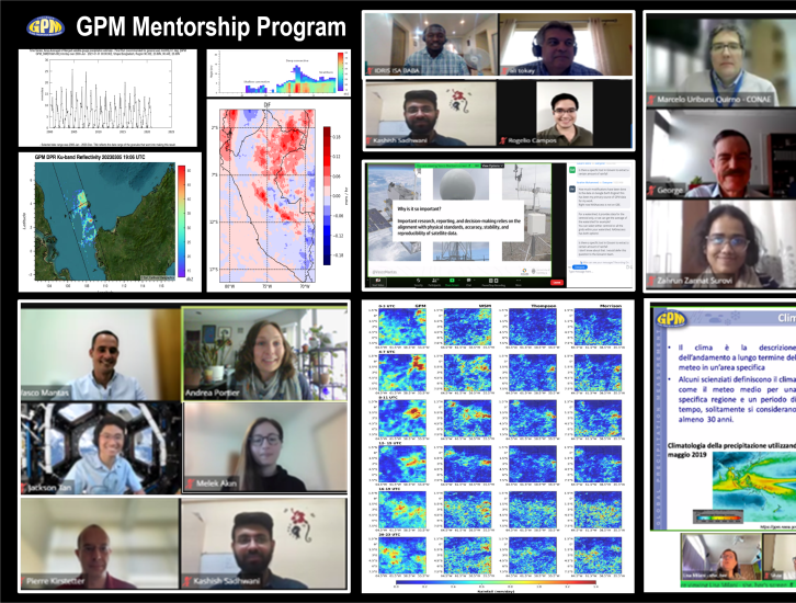
2023 Mentees and Projects
Alan Vaz Lopez - Characterizing Tropical Droughts Using GPM Data
Amy Molina Estrada - Improving Water Resource Management Practices using GPM
Ana Maria Pinilla - Hydrological Modeling with GPM IMERG
Chetan Gurung - Investigating Diurnal Cycle of Precipitation in the Amazon Rainforest
Carlo Montes - Using IMERG in Monitoring Rainfall and the Midsummer Drought in Honduras
Clara Avila Dea Permata - Evaluation of Rainfall During the Borneo Vortex Event using IMERG and DPR
Daniel Aduragbemi Aderotoye - Investigation of the Performance of IMERG over Nigeria
Edson Baptista - Impact of Climate Change in SW Angola: Discovering Solutions with GPM
Gianella Botetano Bastidas - Spatial Downscaling of IMERG Final Over the North Coast of Peru
Giorgio Dalmasso - Exploring GPM Data via the NASAaccess Tool
Gustavo De la Cruz - Evaluation of IMERG Products for Daily Precipitation Analysis Over Peru
Idris Isa Baba - Assessing Impact of Climate Change in Northern Nigeria
Kaman Ghimire - Evaluation of IMERG Over Nepal’s High Himalayan Region
Kashish Sadhwani - Comparing the Performance of IMERG: Implications for Streamflow Simulation
Kenneth Ekpetere - IMERG Precipitation Extractor Tool
Marcos Roberto Benso - Ground Validation of Hourly IMERG in Brazil
Melek Akin - Analysis of a Flash Flood Event using GPM Data
Prosper Ayabagabo - Hail Detection Using GPM Data Over Rwanda
Rogelio Campos - El Niño and La Niña Events: Comparison of Monthly Precipitation in Peru
Rojan Lamichhane - Investigating the Application of IMERG in Ungauged Regions in Nepal
Santiago Villar - Evaluation of IMERG for Drought Classification
Zahrun Zannut - Understanding Data Access Tools to Assess Urban Flooding Events
Alan Vaz Lopez - Characterizing Tropical Droughts Using GPM Data
Affiliation: National Water Agency (ANA) - Governo Federal, Brasília, Brazil
Current role: Deputy Superintendent of Operations and Extreme Events
Mentor: Joe Turk
Why are you participating in this program?
The unique opportunity to learn and apply GPM satellite data products to current water resources problems, under the supervision of NASA experts.
Tell us about your project
Droughts can cause significant economic impacts. In tropical regions, even with abundant annual rainfall totals, droughts can manifest as reduced wet season rainfall and longer dry season periods, patterns that might be modified by future climate change. Yet, characterization of drought spatial and timing patterns has been hampered by scarcity of rainfall data. The focus is to use GPM data in the analysis of hydrological droughts, relationships with other datasets, physical processes, their spatial and temporal patterns, and inform water resources management decisions related to water scarcity. Specifically for this project, we are using GPM’s Integrated Multi-satellitE Retrievals for GPM (IMERG) Final daily precipitation product to detect changes in tropical drought patterns manifested in seasonal rainfall characteristics in a central region Brazilian river basin.
What communities or organizations may benefit from your case study project?
Water agencies, river basin committees, water users, water use communities, water utilities and water infrastructure operators.
What is something surprising that you have learned about the GPM mission, the data, or applying GPM data for applications?
The IMERG data product’s temporal hourly scale and near real-time data availability, which makes it extremely useful for practical real-world applications.
What is a challenge you faced with using remote sensing data? Any lessons learned that helped overcome this barrier?
One challenge is the access and analysis of large datasets at fine temporal and spatial scales, which are important for hydrological studies at local scales. Also, cloud cover is an issue when performing hydrological analysis during flood events. That can be overcome by new features and capabilities in computational languages such as Python and Google Earth Engine, although there is a learning curve to go through.
How do you plan to use GPM in the future?
I plan to use GPM in the analysis of past extreme hydrological events, such as droughts and floods, in tropical regions, in order to assess the risk and vulnerability of communities.
Amy Molina Estrada - Improving Water Resource Management Practices using GPM
Affiliation: Private Institute of Climate Change Research (ICC), Guatemala City, Guatemala
Current role: Researcher in Hydrology
Mentors: Andrea Portier; Mircea Grecu; Vasco Mantas; Zhong Liu
Why are you participating in this program?
We have scarce information in Guatemala and limited access to some regions. Knowing other sources of information, such as data retrieved from satellites, represents better coverage and complements field information.
Tell us about your project
Guatemala is a country exposed to natural hazards, such as hurricanes. During these events, the ICC provides information and coordinates with government institutions and the agro-industrial sector to support disaster risk reduction efforts by understanding potential risks and monitoring them over time. To help support this effort, this project focused on assessing biases between the GPM estimates and the data collected from 48 local weather stations, and evaluate how GPM can be used to increase coverage and enhance precipitation extreme analysis for ICC.
What communities or organizations may benefit from your case study project?
Public sector institutions, university students, agro-industrial sector, farmers of all sizes, and other relevant stakeholders in the lowlands of the Pacific coast of Guatemala.
What is something surprising that you have learned about the GPM mission, the data, or applying GPM data for applications?
The NASA Giovanni tool has much potential and presents a friendly platform to new users and to access GPM’s Integrated Multi-satellitE Retrievals for GPM (IMERG) precipitation product. Specifically, it has information in near real-time and allows you to visualize it in an accessible way. Although IMERG is a product that should be calibrated with on-the-ground information, it presents a complete picture, mainly for extreme events.
What is a challenge you faced with using remote sensing data? Any lessons learned that helped overcome this barrier?
Barriers in the use of satellite information, mainly for countries like ours, is free and quality access. Depending on the focus of the study or scale, the resolution of the information is key, especially if it is for decision-making at the local level. Data from GPM presents a practical and functional way to fill information gaps.
How do you plan to use GPM in the future?
GPM will be a complementary dataset for different objectives. It will currently be used to complement a hydrological analysis to establish the base flows of a basin from precipitation data, both from stations and GPM. The coverage of stations is somewhat limited by the variation of topography and the different microclimates in the area, and having more coverage using satellite data will allow a better understanding of the planning and management of water for users.
Ana Maria Pinilla - Hydrological Modeling with GPM IMERG
Affiliation: National Commission of Space Activities (CONAE), Buenos Aires, Argentina
Current role: Hydrogeologist
Mentor: Marcelo Uriburu Quirno
Why are you participating in this program?
Participation in programs such as the GPM Mentorship Program provides a platform for collaboration, knowledge sharing and networking with subject matter experts that can lead to innovative research projects and the exchange of valuable ideas. Also, I also participated to further my understanding on global precipitation patterns and their impact on various ecosystems.
Tell us about your project
In situ precipitation measurement networks are sparse in Argentina as in many regions of the world. Remote sensing precipitation estimates with global coverage and good spatiotemporal resolution are very useful in this regard. The focus of my GPM mentorship project was to explore the use of GPM’s Integrated Multi-satellitE Retrievals for GPM (IMERG) product as input to hydrological models in lowland basins and compare the results with those obtained with in situ measurements.
What communities or organizations may benefit from your case study project?
My results can be used for improving water resources management, ecological management and generating more accurate warning systems, mainly in the lowland catchment areas.
What is something surprising that you have learned about the GPM mission, the data, or applying GPM data for applications?
I was surprised that the data provided by the GPM mission is easily accessible and the latency is short enough for many hydrological uses.
What is a challenge you faced with using remote sensing data? Any lessons learned that helped overcome this barrier?
Remotely sensed data have shown significant overestimation with respect to in situ observations. In any case, the resolutions are adequate for a wide range of watershed areas, with the exception of very small rapid response watersheds.
How do you plan to use GPM in the future?
I will probably use GPM data such as IMERG as an input to mathematical models to solve one of the most common problems in the simulation of hydrological processes, the scarcity of in situ data.
Chetan Gurung - Investigating Diurnal Cycle of Precipitation in the Amazon Rainforest
Affiliation: University of Maryland Baltimore County (UMBC), Maryland, USA
Current role: Graduate Student
Mentor: Mei Han
Tell us about your project
The Amazon Rainforest is one of the world’s hot spots of convective activity. However, models do not produce a realistic representation of precipitation. To explore this topic, we compared three microphysical schemes (WSM6, Thompson, Morrison) of the WRF model against GPM precipitation data near Manaus, Brazil to see how well the model represents the diurnal cycle of precipitation.
Results indicate that the coarser resolution WRF model inadequately captures GPM precipitation and the WSM schemes exhibit superior performance in comparison to other schemes. For future analysis, we plan to conduct model simulation at a finer spatiotemporal resolution to enhance accuracy and detail as well as incorporate higher resolution precipitation data and, if needed, utilize the GPM as a supplementary resource.
Carlo Montes - Using IMERG in Monitoring Rainfall and the Midsummer Drought in Honduras
Affiliation: International Maize and Wheat Improvement Center (CIMMYT), Texcoco, Mexico
Current role: Agricultural Climatologist
Mentors: Andrea Portier; Mircea Grecu; Vasco Mantas; Zhong Liu
Why are you participating in this program?
In my work I try to promote the use of cutting-edge scientific tools. GPM’s Integrated Multi-satellitE Retrievals for GPM (IMERG) data product represents a significant advance in satellite precipitation, and as an IMERG user, the program was immediately appealing to me.
Tell us about your project
I've used IMERG for multiple applications, such as the study of extreme rainfall events in South Asia or the statistical forecasting of droughts in Southern Africa. My GPM project is based on the use of IMERG for near real-time monitoring of rainfall and the study of the mid-summer drought in Honduras, a country with scarce ground truth observations.
What communities or organizations may benefit from your case study project?
The results of this project will help the Honduran Weather Service to implement an online platform for the monitoring of rainfall and the progression of the mid-summer drought. Users from the agricultural sector both at the national and regional level will use the data generated for agrometeorological bulletins, among other applications.
What is something surprising that you have learned about the GPM mission, the data, or applying GPM data for applications?
The GPM mission represents a milestone and an upgrade in the field of satellite precipitation. The use of a satellite constellation along with the algorithms to retrieved precipitation make IMERG a very reliable product.
What is a challenge you faced with using remote sensing data? Any lessons learned that helped overcome this barrier?
In the case of rainfall, it's always a challenge to understand what is being measured, and what is the scope of the data provided by the final products. This means that, for example, the direct comparison between a satellite product and rain gauges is not always an appropriate approach, although it may seem so. The latter implies that the validation/comparison methodologies must be analyzed at multiple spatial and temporal scales, which represents a research challenge.
How do you plan to use GPM in the future?
IMERG represents an opportunity. I’m currently planning its use for multiple applications in agriculture. I can mention its evaluation regarding the representation of the Central American dry corridor, as an observational reference for the calibration of seasonal forecasts from a set of Global Climate Models, and the spatial evaluation of the performance of the Weather Research & Forecasting Model (WRF) in the forecast of rainfall in Honduras. For sure very soon I will use IMERG for new projects.
Clara Avila Dea Permata - Evaluation of Rainfall During the Borneo Vortex Event using IMERG and DPR
Affiliation: Meteorology Climatology and Geophysics Agency of Indonesia (BMKG), Jakarta, Indonesia
Current role: Weather Forecaster
Mentors: Aaron Funk and Courtney Schumacher
Why are you participating in this program?
I am participating in this program because I want to learn about remote sensing and its applications in understanding the distribution of rainfall in Indonesia. Particularly, I am interested in exploring the use of satellites and space-based weather radar for this purpose.
Tell us about your project
The focus of my GPM mentorship project is to evaluate rainfall patterns during Borneo Vortex events using GPM’s Integrated Multi-satellitE Retrievals for GPM (IMERG) and Dual Frequency Precipitation Radar (DPR) data products. Through the analysis of this data, my aim is to contribute valuable insights for disaster risk reduction and the development of early warning systems.
What communities or organizations may benefit from your case study project?
My work benefits the organization I work for, BMKG, weather forecasters, and stakeholders in disaster early warning and the vulnerable communities.
What is something surprising that you have learned about the GPM mission, the data, or applying GPM data for applications?
Through this project, I was amazed by the wide variety of products available through the GPM mission. Furthermore, I discovered that the DPR data allows us to examine cross-sections of clouds, enabling the identification of cloud structures and various types of precipitation.
What is a challenge you faced with using remote sensing data? Any lessons learned that helped overcome this barrier?
One of the challenges I faced was in data processing, which required advanced programming skills, but having a highly supportive mentor was incredibly beneficial in navigating and overcoming this challenge.
How do you plan to use GPM in the future?
In the future, I intend to analyze additional cases of extreme rainfall in Indonesia to establish correlations between GPM data and observed rainfall, with the aim of utilizing GPM data as a reliable reference for rainfall analysis.
Daniel Aduragbemi Aderotoye - Investigation of the Performance of IMERG over Nigeria
Affiliation: Centre for Space Research and Applications, Federal University of Technology Akure, Akure, Nigeria
Current role: Graduate Trainee
Mentors: Andrea Portier; Mircea Grecu; Vasco Mantas; Zhong Liu
Why are you participating in this program?
I participated in the program to gain more knowledge about satellite Earth observation data for application and programming.
Tell us about your project
Bias correction and the investigation of the performance of GPM IMERG and GPCC Global Precipitation Climatology Centre data over Nigeria.
What communities or organizations may benefit from your case study project?
Research community and decision makers.
What is something surprising that you have learned about the GPM mission, the data, or applying GPM data for applications?
GPM data is popular and well-appreciated in research globally.
What is a challenge you faced with using remote sensing data? Any lessons learned that helped overcome this barrier?
Computation and analysis is a challenge.
How do you plan to use GPM in the future?
I intend to use GPM data for my future research on precipitation trends across West Africa.
Edson Baptista - Impact of Climate Change in SW Angola: Discovering Solutions with GPM
Affiliation: Huila Provincial Water and Sanitation Company, Lubango, Angola
Current role: Executive Administrator for the Technical Area of a Public Company and Provider of Water Supply and Sanitation Services
Mentors: Andrea Portier; Mircea Grecu; Vasco Mantas; Zhong Liu
Why are you participating in this program?
I seek to support the leaders of my country and not only with technical and practical ideas, in the search for a solution to mitigate the impact of climate change. The tools made available by the training program seemed to suit the idea, and also the possibility of learning from colleagues and lecturers.
Tell us about your project
Creating measures in support of water and food security in Angola is highly needed. For this project, a precipitation climatology was developed using GPM’s Integrated Multi-satellitE Retrievals for GPM (IMERG) product to evaluate impacts of climate change within the southern region of Angola and help advance the analysis for systematic monitoring and enable disaster preparedness in real time. This will help integrate and produce an efficient vision of water resources in the Okavango and Cunene watersheds of Angola.
What communities or organizations may benefit from your case study project?
People and decision-makers in the water and environment sector and sector managers of my region.
What is something surprising that you have learned about the GPM mission, the data, or applying GPM data for applications?
The applications and information available for accessing, downloading, and using GPM data that I had no idea of their existence.
What is a challenge you faced with using remote sensing data? Any lessons learned that helped overcome this barrier?
It is not easy to use the platforms and the exclusive time for new users in terms of learning is very limited.
How do you plan to use GPM in the future?
Applying available information to further develop my project.
Gianella Botetano Bastidas - Spatial Downscaling of IMERG Final Over the North Coast of Peru
Affiliation: National Agrarian University – La Molina (UNALM), La Molina, Peru
Current role: Undergraduate Student
Mentor: Chuntao Liu
Why are you participating in this program?
This program encompassed everything related to global rainfall observations surrounding the Global Precipitation Measurement (GPM) mission. However, my main interest was on its most recent high-resolution spatiotemporal satellite precipitation product: Integrated Multi-satellitE Retrievals for GPM (IMERG) data product, Version 06B. My particular interest was in spatial downscaling of satellite precipitation products, bias correction, and database building. Moreover, it provided the opportunity to collaborate with leading scientists in this field. For this reason, I considered that this opportunity was ideal to deepen these issues and carry out research in this area.
Tell us about your project
In the hydrological and climatic context, precipitation plays a fundamental role, providing valuable information for the assessment of climatic variability, the efficient management of water resources, and the mitigation of natural disasters. The quality of precipitation data significantly influences decision making in these fields. One of the most important challenges is the spatial resolution of these products, especially in regions with complex topography and climatic conditions.
Conventional rain measurement stations often have limited coverage, restrictive temporal sampling resolutions, and data access issues. As a result, there are challenges in the accuracy of precipitation estimates. Faced with this, a model based on the predictive relationship between precipitation patterns and multiple geospatial factors has been proposed. This model uses Geographic Weighted Regression (GWR) method to downscale the IMERG Final V06B daily precipitation satellite product from 0.1° to a finer gridded resolution of 0.01°. In addition, a caliber correction is applied that takes advantage of the principles of Geographic Difference Analysis (GDA) and Geographic Relationship Analysis (GRA), using in situ precipitation data for its refinement.
What communities or organizations may benefit from your case study project?
This approach was tested along the northern coast of Peru during the summer season, which is particularly susceptible to climate phenomena like El Niño-Southern Oscillation (ENSO). By improving spatial resolution in precipitation estimation, it is expected to improve monitoring of extreme weather events, optimize water resource management, and support informed decision-making regarding food security, hydrological and meteorological forecasting, and early disaster prevention alerts in the region.
What is something surprising that you have learned about the GPM mission, the data, or applying GPM data for applications?
The complexity in handling satellite data related to precipitation. This involves the statistics inherent in the eigenvariable and the multiple user applications.
What is a challenge you faced with using remote sensing data? Any lessons learned that helped overcome this barrier?
Several challenges were faced in the process of this project. These include the proper selection of a downscaling model, the representativeness and availability of high-resolution data related to precipitation predictor variables, bias correction techniques, and the low density of rainfall stations in Peru.
How do you plan to use GPM in the future?
The project is currently in progress, and there are improvements and adjustments yet to be made. Firstly, the bias correction model has not been implemented yet. Furthermore, there is a plan to enhance the selection of predictor co-variables with a stronger correlation to precipitation in the study area.
In addition, there is an intention to expand the scope of the project. This involves encompassing a larger extension of the Peruvian territory, including geographically complex areas such as the Andes region. The ultimate goal is to create a database that provides high resolution and quality estimates of daily precipitation in regions of Peru where the availability of rain gauge data is limited.
Giorgio Dalmasso - Exploring GPM Data via the NASAaccess Tool
Affiliation: University of Pavia, Pavia, Italy
Current role: PhD Student
Mentor: Ibrahim N. Mohammed
Why are you participating in this program?
I participated because it seemed to me a good way to explore topics related to my field of research that could be useful to me. My PhD is in sustainable development and climate change, and I am studying precipitation over oceans. I am analyzing regimes of precipitation with different analysis and in particular, I am focusing on extreme events. So I also use satellite data and this program I thought could be useful for going deep in instrumentation involved and problems related to it.
Tell us about your project
To help expand on my PhD research, for my GPM Mentorship project I did a preliminary analysis in precipitation over oceans with the NASAaccess Tool. NASAaccess is an open-source platform for accessing, and presenting quantitative remote sensing earth observation, and climate data products in an interactive format. You can access GPM data from this tool and we thought it would complement my research well.
What communities or organizations may benefit from your case study project?
Research.
What is something surprising that you have learned about the GPM mission, the data, or applying GPM data for applications?
Before this program, I never had lessons on satellite data, instruments, and data barriers and limitations with respect to using satellite data. So I found it very useful that someone explained to me all the work that is behind the data I use daily including the technical and construction characteristics of the tools and data products.
What is a challenge you faced with using remote sensing data? Any lessons learned that helped overcome this barrier?
I think the most difficult challenge is to verify the reliability of the remote sensing data.
How do you plan to use GPM in the future?
For my research- If I continue in academic life, and if I will work in the future with satellite data, I'm sure that GPM could be useful and a future "friend" to work with!
Gustavo De la Cruz - Evaluation of IMERG Products for Daily Precipitation Analysis Over Peru
Affiliation: National Service of Meteorology and Hydrology of Peru (SENAMHI), Lima, Peru
Current role: Climate Specialist
Mentors: Andrea Portier; Mircea Grecu; Vasco Mantas; Zhong Liu
Why are you participating in this program?
My objective is to enhance my knowledge about GPM’s Integrated Multi-satellitE Retrievals for GPM (IMERG) Early, Late, and Final products and their contribution in monitoring and analyzing extreme precipitation events. Peru, being highly vulnerable to severe hydrometeorological occurrences like heavy rainfall, floods, and landslides, could benefit greatly from utilizing GPM products. Knowing and applying GPM data would contribute to better monitoring of these events and better decision-making for risk reduction.
Tell us about your project
The spatial coverage of rain gauge stations in Peru is not yet sufficient for adequate monitoring and forecasting of extreme rain events. The focus of my project is to validate and analyze the daily precipitation data obtained from the GPM IMERG product, specifically for Peru, with a particular emphasis on the coastal regions. The project's outcomes will prove beneficial for monitoring regions that lack rain gauge stations and also for predicting and preparing for extreme events.
What communities or organizations may benefit from your case study project?
Weather forecasters and those responsible for issuing alerts regarding extreme events can derive significant benefits from this. Consequently, decision-makers will find it valuable in effectively managing the risks associated with extreme events. Moreover, researchers in institutions and universities can utilize this information for their studies and projects.
What is something surprising that you have learned about the GPM mission, the data, or applying GPM data for applications?
I was surprised about the data availability of GPM products, which offers an optimal spatial and temporal resolution and can be utilized across diverse project types. Furthermore, it is remarkable the progress and anticipated techniques to enhance the quality of these products.
What is a challenge you faced with using remote sensing data? Any lessons learned that helped overcome this barrier?
All products have their benefits and limitations. That is why it is necessary to analyze the products of GPM and compare with observed data to have a better knowledge of the limitations and also make decisions with more information.
How do you plan to use GPM in the future?
In the subsequent phases, my plan is to develop a system that automates the download and correction process of daily and hourly rainfall data obtained from the GPM IMERG. The primary objective of this system would be to contribute to the monitoring and forecasting of extreme events. To achieve accurate corrections, I intend to apply machine learning techniques that can effectively reduce the bias of these products.
Idris Isa Baba - Assessing Impact of Climate Change in Northern Nigeria
Affiliation: Economic Community of West African States (ECOWAS), Abuja, Nigeria
Current role: Environmental Advocate/Researcher
Mentors: Andrea Portier; Mircea Grecu; Vasco Mantas; Zhong Liu
Why are you participating in this program?
I participated in the GPM Capstone Mentorship Program to mitigate the challenges of flooding. The mentors provided outstanding support and attention, and I learned a great deal about NASA's data accessibility and applications.
Tell us about your project
The focus of my GPM mentorship project is on the climate issues such as flooding where I used GPM’s Integrated Multi-satellitE Retrievals for GPM (IMERG) data product to improve flood forecasting and early warning systems in my community. I am specifically using IMERG data to develop a new algorithm for estimating rainfall intensity. This algorithm will be used to improve the accuracy of flood forecasts, which will help to save lives and property.
What communities or organizations may benefit from your case study project?
Local communities affected by flooding will benefit greatly from the adoption of the GPM application. I have already reached out to key stakeholders to discuss this opportunity.
What is something surprising that you have learned about the GPM mission, the data, or applying GPM data for applications?
I was surprised to learn how easy it was to get timeseries maps using the NASA Giovanni tool. I was able to create a map showing the rainfall intensity in my community over the past year in just a few minutes. This was really fascinating to me, as I had previously thought that it would be much more difficult to access and analyze GPM data.
What is a challenge you faced with using remote sensing data? Any lessons learned that helped overcome this barrier?
One of the major challenges with using remote sensing data is data latency. This means that there is a delay between the time the data is collected and the time it is available to users. This can be a problem for applications that require real-time data, such as flood forecasting.
How do you plan to use GPM in the future?
I intend to continue using GPM data for drought and flood applications. GPM data is a valuable resource for monitoring and forecasting these hazards, and I believe that it has the potential to save lives and property.
Kaman Ghimire - Evaluation of IMERG Over Nepal’s High Himalayan Region
Affiliation: Nepal Department of Hydrology and Meteorology, Tribhuvan University, Kathmandu, Nepal
Current role: Research Assistant
Mentors: Aaron Funk and Courtney Schumacher
Why are you participating in this program?
To comprehend the significance of remote sensing data in the high Himalayan region, where real-time ground observation is nearly impossible.
Tell us about your project
Observing rainfall over remote regions of steep topography and at high altitude remains a challenge. To help improve rainfall estimates and information over Nepal, we assess GPM’s Integrated Multi-satellitE Retrievals for GPM (IMERG) precipitation product’s ability to measure rainfall in the Solukhumbu region of Nepal by comparing IMERG daily rain rates to the rain gauge observations.
What communities or organizations may benefit from your case study project?
These types of studies can benefit local communities like Sherpas as well as tourists and mountain climbers.
What is something surprising that you have learned about the GPM mission, the data, or applying GPM data for applications?
The IMERG datasets slightly overestimate the high precipitation and underestimate the low rainfall over the mountain.
What is a challenge you faced with using remote sensing data? Any lessons learned that helped overcome this barrier?
One of the challenges of remote sensing data over high Himalayan region is the presence of atmospheric interference such as cloud and aerosols, which reduces its accuracy and data quality. And during this Mentorship, I learned about data accuracy and how to conduct meaningful analysis of these datasets.
How do you plan to use GPM in the future?
I would like to calculate precipitation phase change over high mountains using GPM’s Dual Frequency Precipitation Radar (DPR) data and validate it with ground-observed data.
Kashish Sadhwani - Comparing the Performance of IMERG: Implications for Streamflow Simulation
Affiliation: Indian Institute of Technology Bombay, Mumbai, India
Current role: Ph.D. Research Scholar
Mentor: Jackson Tan
Why are you participating in this program?
This program will help me learn more about satellite data products and their applications. The opportunity to learn from experts of this field appealed me to join this program.
Tell us about your project
My main focus on this project is the application of GPM data in the hydrological field. Since GPM provides high resolution datasets for data scarce regions, it will be very beneficial for hydrological analysis in such regions and identifying the existing problems. Which will then be beneficial for stakeholders to propose suitable solutions.
However, GPM’s Integrated Multi-satellitE Retrievals for GPM (IMERG) data display inconsistent accuracy in certain diverse geographical regions, posing challenges in its reliability for water resource management and climate analysis. To explore this issue, my project compares the variation in satellite derived rainfall estimates (IMERG) in the Western Ghats of India to further investigate its adequacy for streamflow simulation and quantify the effect of the bias correction.
What communities or organizations may benefit from your case study project?
The results of my work will be useful for government agencies, policy makers, environmental enthusiasts, and other stakeholders.
What is something surprising that you have learned about the GPM mission, the data, or applying GPM data for applications?
The information that surprised me was the availability of different platforms like NASA Giovanni, OPeNDAP, and GrADS Data Server (GDS, formerly known as the GrADS-DODS Server) that add ease to data download and access. This will be very beneficial for researchers.
What is a challenge you faced with using remote sensing data? Any lessons learned that helped overcome this barrier?
Remote sensing data are a boon in this data scarce research field. Two major problems that I felt that need to be dealt carefully is checking the accuracy of data with respect to ground truth points. This will improve the reliability of data. The other thing is discontinuity in download process of these bunch of files. Little assistance is needed when dealing with downloading such large number of files from the server.
How do you plan to use GPM in the future?
I am planning to use the IMERG precipitation data as an input in a hydrological model for my research that focuses on climate change impact assessment on hydrology.
Kenneth Ekpetere - IMERG Precipitation Extractor Tool
Affiliation: University of Kansas, Kansas, USA
Current role: PhD Candidate
Mentor: Amita Mehta
Why are you participating in this program?
To explore a variety of ways to extract GPM’s Integrated Multi-satellitE Retrievals for GPM (IMERG) precipitation product data.
Tell us about your project
Often users face issues with accessing and processing IMERG precipitation data to evaluate rainfall for local scale and storm path analysis as well as to calculate monthly anomalies from a particular year, long durations, and extract the results as either CSV or GEOTIFF or both. To help address this issue, my project focused on developing an application to ease data access and analysis using IMERG data. Called the IMERG Precipitation Extractor (IPE), the tool allows for rapid extraction of IMERG data for points and polygons using the IPE to enhance applications and research. It also allows the user the ability to track storm intensities, movements, and paths and the ability to calculate and extract precipitation anomaly over a location. This can be especially useful for stakeholders that would like to enhance their data extraction capabilities and model impacts of extreme events.
What communities or organizations may benefit from your case study project?
Researchers, students, universities, and individuals.
What is something surprising that you have learned about the GPM mission, the data, or applying GPM data for applications?
The ever-evolving data retrieval algorithms is impressive.
What is a challenge you faced with using remote sensing data? Any lessons learned that helped overcome this barrier?
The different product versions can become challenging if not properly described.
How do you plan to use GPM in the future?
For research and model development and testing.
Marcos Roberto Benso - Ground Validation of Hourly IMERG in Brazil
Affiliation: University of São Paulo, São Paulo, Brazil
Current role: PhD Student
Mentor: Ali Tokay
Why are you participating in this program?
I participated in the GPM Mentorship Program because I was interested in learning more about the different applications of GPM and gaining hands-on experience by working on a project. What appealed to me the most was the opportunity to work with a real work project in collaboration with an expert in the field. Also, the opportunity for networking was unique and could lead to future collaboration for research.
Tell us about your project
The focus of my project was to improve ground validation of the sub-daily GPM Integrated Multi-satellitE Retrievals for GPM (IMERG) product dataset in flood prone areas. There is a significant number of people living in poorly gauged flood prone areas in Brazil. The integration of GPM IMERG data with newly installed sub-daily rain gauges in Brazil can lead to a better understanding of small-scale precipitation patterns and identify vulnerable areas. The focus of the project is to estimate GPM reliability to provide accurate information, ultimately contributing to improved disaster resilience and response strategies in Brazil.
What communities or organizations may benefit from your case study project?
The work I am conducting with this program has the potential to benefit several key stakeholders, including municipalities, civil defense agencies, and CEMADEN (Centro Nacional de Monitoramento e Alertas de Desastres Naturais - National Center for Monitoring and Natural Disaster Alerts) in Brazil.
What is something surprising that you have learned about the GPM mission, the data, or applying GPM data for applications?
I learned that precipitation estimated from GPM IMERG product is a product of many different types of sensors, and we can retrieve the information of which type of sensor was used to estimate precipitation at a given point in time and space. This can be used to understand the limitations of each instrument and help improve the accuracy of precipitation estimates in the future.
What is a challenge you faced with using remote sensing data? Any lessons learned that helped overcome this barrier?
The biggest challenge is the lack of sub-daily gauge data to validate remote sensing data in Brazil. Even though a significant effort has been done in the past years in order to improve rain gauges coverage in Brazil, there is still a considerable large amount of people living in ungauged or poorly gauged flood prone areas in Brazil. The use of alternative sources of data such as GPM can significantly help us gradually overcome this challenge and improve flood risk analysis, however, this also means that the efforts in investing in more sub-daily rain gauges is needed in the next few years.
How do you plan to use GPM in the future?
I plan to focus on writing research proposals to apply the same method I used on a small scale to the whole Brazilian territory and utilize as much data as available to provide ground-based validation at different spatio-temporal scales. The primary emphasis will be on developing tools for disaster risk monitoring and early warning systems.
Melek Akin - Analysis of a Flash Flood Event using GPM Data
Affiliation: Istanbul Technical University, Istanbul, Türkiye
Current role: PhD Student
Mentors: Pierre Kirstetter and Yagmur Derin
Why are you participating in this program?
I participated in a program to learn about GPM data products and the GPM Ground Validation Multi-Radar/Multi-Sensor (MRMS) Precipitation Reanalysis for Satellite Validation Product dataset. Through this, I gained a better understanding of flash flood analysis using remote sensing data. Our goal was to evaluate and select GPM’s Integrated Multi-satellitE Retrievals for GPM (IMERG) data product that would be useful for flash flood prediction.
Tell us about your project
Analyzing flash floods is a challenging task due to topography, a lack of gauges, and spatial resolution constraints. To address these challenges, we use satellite data. However, satellite data is not without errors, which necessitates its validation against ground observations. For this project, we analyzed one notable flood event that occurred in Death Valley National Park, California on October 18, 2015 where we evaluated the IMERG products against GV-MRMS ground data to select the IMERG product that could be useful for flash flood events. As a result of the research, IMERG Early outperforms both IMERG Late and Final products. This is because the Early version is released within a few hours after observation and contains near real-time data. That is why it has less smoothing in time. On the other hand, IMERG Late incorporates more satellite and ground-based data. That is why we observe smoothing in time and it corresponds to the wider peaks in the quantile plots. While IMERG Final undergoes bias adjustments using rain gauges, this adjustment proves insufficient for this specific region due to its complex terrain and the scarcity of nearby rain gauges.
What communities or organizations may benefit from your case study project?
This research will enhance studies on flash flood events in various regions. It holds significant value for the scientific community, national meteorological services, and flood early warning systems.
What is something surprising that you have learned about the GPM mission, the data, or applying GPM data for applications?
I have learned that, for flash flood analysis, IMERG Early yields better results than the Late and Final products.
What is a challenge you faced with using remote sensing data? Any lessons learned that helped overcome this barrier?
IMERG data can enhance our understanding of precipitation estimation and offers numerous societal benefits. Because remote sensing data involves indirect measurements, incorporating ground validation data into the study is essential to minimize errors.
How do you plan to use GPM in the future?
We will continue this study by expanding to a wider area and using a longer dataset. Furthermore, we are considering the inclusion of both IMERG passive microwave (PMW) and IMERG microwave-calibrated infrared (IR) datasets in our research.
Prosper Ayabagabo - Hail Detection Using GPM Data Over Rwanda
Affiliation: Rwanda Meteorology Agency, Kigali, Rwanda
Current role: Senior Radar Applications
Mentors: Becky Adams-Selin and Linda Bogerd
Why are you participating in this program?
To learn the application of satellite data products into various applications including monitoring and detection of hail, floods and drought. I have realized that there is an enormous amount of satellite datasets that can be used for several applications for societal benefit.
Tell us about your project
Hailstorms are devastating in terms of damages for hectares of crops, infrastructure and livelihoods. In case of Rwanda, between Sep 2013 and Sep 2021, 126 hail events took place and injured 2 people, killed 10 cattle, and damaged 1461 houses and 5,283 hectares of crops. This hail database is based on individual reports in the field. There is a need to validate these reports against data by observing systems such as radars and satellites. In addition, there is need for improved monitoring and forecasting to enhance community preparedness and recovery process. For this project, we compared reports on the ground for observed hail cases in Rwanda against hail detection using GPM’s Microwave Imager (GMI) dataset as described in Bang and Cecil 2019 paper to support agricultural applications.
What communities or organizations may benefit from your case study project?
Hail has devastating effects on crops and house roofing materials. The study would help to mitigate effects of hail in agriculture and disaster risk reduction sectors.
What is something surprising that you have learned about the GPM mission, the data, or applying GPM data for applications?
GPM data can be used to understand hail occurrences and studies are showing that soil moisture can be used to estimate rainfall.
What is a challenge you faced with using remote sensing data? Any lessons learned that helped overcome this barrier?
Remote sensing data is better to cover the area when there is no ground truth data available.
How do you plan to use GPM in the future?
I plan to use GPM data for different applications in hail and soil moisture monitoring.
Rogelio Campos - El Niño and La Niña Events: Comparison of Monthly Precipitation in Peru
Affiliation: Ministry of the Environment of Peru (MINAM), Magdalena del Mar, Peru
Current role: Technical Specialist in GHG Mitigation and Carbon Footprint
Mentor: Andrey Savtchenko
Tell us about your project
Coastal El Niño events in the 1980s and 1990s in Peru have generated records of extreme precipitation. However, in the last 20 years these magnitudes have not been observed again (except in 2017), even though El Niño periods have been reported during 2000-2021. Therefore, to identify this change in precipitation in periods of coastal El Niño, it is necessary to understand how its frequency and magnitude have varied.
The goal of my project was to understand the frequency or probability of occurrence, as well as its magnitude, of precipitation using GPM’s Integrated Multi-satellitE Retrievals for GPM (IMERG) monthly product in Peru in the periods of coastal El Niño (and La Niña) during the period 2000-2021. Peru was chosen as the study area, as it is a country directly affected by coastal El Niño and La Niña. Understanding more about these events can help support climate mitigation efforts.
Rojan Lamichhane - Investigating the Application of IMERG in Ungauged Regions in Nepal
Affiliation: Nepal Department of Hydrology and Meteorology, Kathmandu, Nepal
Project:
Current role: Meteorologist
Mentors: Ankita Pradhan and Sam Hartke
Why are you participating in this program?
I am participating in this program because I was doing research using satellite data. I found that precipitation data from the GPM Mission is widely used so I was interested in learning more about the data and its applications.
Tell us about your project
Gauge data is generally unavailable in mountainous regions of Nepal (and an intensive resource to collect), and terrain is too variable to interpolate between existing gauge stations. Without precipitation data, weather forecasting becomes very difficult. The focus of my project was to evaluate GPM’s Integrated Multi-satellitE Retrievals for GPM (IMERG) Early, Late, and Final products to understand which product is most suitable for precipitation estimates in high elevation, ungauged regions of Nepal. This will then be applied to help improve weather forecasts over the region.
What communities or organizations may benefit from your case study project?
It will mostly benefit meteorological agencies and stakeholders conducting research.
What is something surprising that you have learned about the GPM mission, the data, or applying GPM data for applications?
What I found is that GPM data has a wide range of applications and uses.
What is a challenge you faced with using remote sensing data? Any lessons learned that helped overcome this barrier?
I found that accessing and downloading large data sets can be difficult. The GPM Mentorship helped enable an understanding of how to access and download long-term data to enhance my research.
How do you plan to use GPM in the future?
I plan to use GPM data for extreme event analysis and validation.
Santiago Villar - Evaluation of IMERG for Drought Classification
Affiliation: University of Buenos Aires, Buenos Aires, Argentina
Current role: Undergraduate Student
Mentor: Marcelo Uriburu Quirno
Why are you participating in this program?
GPM’s Integrated Multi-satellitE Retrievals for GPM (IMERG) precipitation product seems to be a suitable solution to developing countries such as Argentina where there is a lack of in-situ precipitation data.
Tell us about your project
There is a lack of in-situ precipitation measurements across Argentina. This situation complicates both local and national governments as well as producers to classify the magnitude of the drought, as Argentina’s economy is mainly based on the export of raw materials such as meat, corn and soybeans. The focus of this project was to determine how suitable IMERG data is to classify drought conditions through the computation of the Standardized Precipitation Index (SPI).
What communities or organizations may benefit from your case study project?
Local and national government of Argentina.
What is something surprising that you have learned about the GPM mission, the data, or applying GPM data for applications?
The IMERG Early and Late products have a latency of approximately 4 and 12 hours, and these products can be valuable to use for almost real time applications.
What is a challenge you faced with using remote sensing data? Any lessons learned that helped overcome this barrier?
In the project, I realized that IMERG was overestimating precipitation in my area of study. I learned the importance of applying bias correction to improve my analysis.
How do you plan to use GPM in the future?
For work related issues in areas where precipitation data is not available.
Zahrun Zannut - Understanding Data Access Tools to Assess Urban Flooding Events
Affiliation: Institute of Water and Flood Management, Bangladesh University of Engineering and Technology, Dhaka, Bangladesh
Current role: Graduate Student and Full Time Private Job Holder
Mentor: Andrea Portier; Mircea Grecu; Vasco Mantas; Zhong Liu
Why are you participating in this program?
I participated mainly to get introduced to the new analytical system of Climate Data Analysis. I have an undergraduate degree in Urban and Regional Planning, and I am currently pursuing my Master's in Water Resource Development. I have already defended my Master's Thesis and am now waiting to submit the thesis paper. My thesis primarily focuses on techno-economic analysis. I have a plan to pursue a Ph.D. in climate data science, so this program came as a blessing. What was most appealing to me was the guidance from the mentors, group work, introduction to the database, and hands-on analysis. It also made me realize that I have a lot to learn and do in this field.
Tell us about your project
The city of Dhaka has experienced catastrophic flood events, causing major health impacts and economic losses. To examine scenarios of urban flooding caused by climate factors, I explored the use of GPM’s Integrated Multi-satellitE Retrievals for GPM (IMERG) precipitation product. This will help gain a deeper understanding of long-term precipitation patterns and potential impacts on the local ecosystem and human activities.
What communities or organizations may benefit from your case study project?
Currently, in both Dhaka, where I currently reside, and Chittagong, urban flooding is a recurring issue, leading to substantial disruptions in the lives of city dwellers. In light of this, my research on the analysis of climate-induced urban flooding scenarios may prompt the government to reassess its policies, while inspiring engineers and planners to explore inventive and sustainable approaches to tackle these challenges.
What is something surprising that you have learned about the GPM mission, the data, or applying GPM data for applications?
Prior to participating in this program, my knowledge was limited to gauge data, and I was unaware of the effectiveness of satellite-based precipitation data.
What is a challenge you faced with using remote sensing data? Any lessons learned that helped overcome this barrier?
Remote sensing data is currently unavailable for smaller, localized areas, and data before the year 2000 is also lacking. A valuable lesson from this situation is that it is advisable to employ a mixed-method approach, incorporating data from various sources for validation. Combining both gauge data and establishing a relationship between gauge data and GPM data can be instrumental in overcoming these limitations.
How do you plan to use GPM in the future?
Right now, I'm mainly trying to learn and understand how to use the GES DISC Giovanni platform for analyzing climate-related disasters. I still have a lot to learn.


