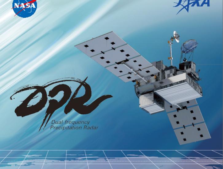
Dual-frequency Precipitation Radar (DPR)
DPR Overview
One of the prime instruments onboard the GPM Core Observatory is the Dual-frequency Precipitation Radar (DPR). The DPR consists of a Ku-band precipitation radar (KuPR) and a Ka-band precipitation radar (KaPR). The KuPR, which operates at 13.6 GHz, is an updated version of the highly successful unit flown on the Tropical Rainfall Measuring Mission (TRMM). The KuPR and the KaPR are co-aligned on the GPM spacecraft bus such that the 5-km footprint location on the earth is the same.
Data collected from the KuPR and KaPR units provide 3-dimensional observations of rain and also provide an accurate estimation of rainfall rate to the scientific community.
Measuring Precipitation in 3D
Two days before Hurricane Maria devastated Puerto Rico, the NASA-JAXA Global Precipitation Measurement Core Observatory satellite captured a 3-D view of the storm. At the time Maria was a Category 1 hurricane. The 3-D view reveals the processes inside the hurricane that would fuel the storm’s intensification to a category 5 within 24 hours.
For the first time in 360-degrees, this data visualization takes you inside the hurricane. The precipitation satellite has an advanced radar that measures both liquid and frozen water. The brightly colored dots show areas of rainfall, where green and yellow show low rates and red and purple show high rates. At the top of the hurricane, where temperatures are colder, blue and purple dots show light and heavy frozen precipitation. The colored areas below the dots show how much rain is falling at the surface.
For more information: https://www.nasa.gov/feature/goddard/...
Created by: NASA's Scientific Visualization Studio and NASA's Goddard Space...
DPR Instrument Details
The DPR is a spaceborne precipitation radar capable of making accurate rainfall measurements. The DPR is more sensitive than its TRMM predecessor especially in the measurement of light rainfall and snowfall in mid latitude regions. Rain/snow determination is accomplished by using the differential attenuation between the Ku-band and the Ka-band frequencies. The variable pulse repetition frequency (VPRF) technique increases the number of samples at each instantaneous field of view (IFOV) to realize a 0.2 mm/h sensitivity. The KuPR and KaPR instruments provide rain sensing over both land and ocean, day and night.
Top-level general design specifications are as follows:
| Item | KuPR | KaPR |
|---|---|---|
| Swath Width | 245 kilometers (km) | 245 kilometers (km) as of May 2018 (previously 120km) |
| Range Resolution | 250 meters (m) | 250/500 meters (m) |
| Spatial Resolution | 5 km (Nadir) | 5 km (Nadir) |
| Beam Width | 0.71 degrees | 0.71 degrees |
| Transmitter | 128 Solid State Amplifiers | 128 Solid State Amplifiers |
| Peak Transmit Power | 1013 Watts (W) | 146 Watts (W) |
| Pulse Repetition Freq. (In nominal operations mode) | 4100 to 4400 Hertz | 4100 to 4400 Hertz |
| Pulse Width | two 1.667 microseconds (µs) pulses | two 1.667 microseconds (µs) pulses in matched beams two 3.234 microseconds (µs) pulses in interlaced scans |
| Beam Number | 49 | 49 (25 in matched beams and 24 in interlaced scans) |
Related Resources
The Dual-frequency Precipitation Radar (DPR) built by the Japan Aerospace Exploration Agency (JAXA) for the Global Precipitation Measurement (GPM) mission's Core Observatory arrived on Friday, March 16 and was unloaded today at NASA's Goddard Space Flight Center, Greenbelt, Md. Comprised of two radars, the DPR is one of two instruments that will fly on the Core Observatory scheduled for launch in February 2014. The GPM mission will provide a new generation of satellite observations of rain and snow worldwide every three hours for scientific research and societal benefits. NASA's mission partner JAXA developed the DPR in cooperation with Japan's National Institute of Information and Communications Technology. The instrument will provide 3-D measurements of the shapes and sizes of raindrops and snowflakes and other physical characteristics that will allow scientists to better understand the physical properties of storms.
This video is public domain and can be downloaded at: http://svs...
A brief animated look at the different types of remote sensing techniques that NASA uses to study the Earth.
This video is public domain and can be downloaded at: http://svs.gsfc.nasa.gov/goto?11877

