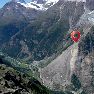
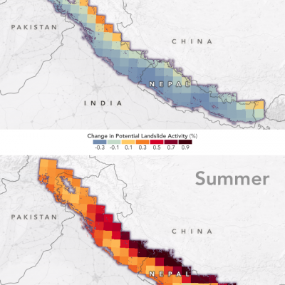
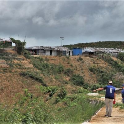
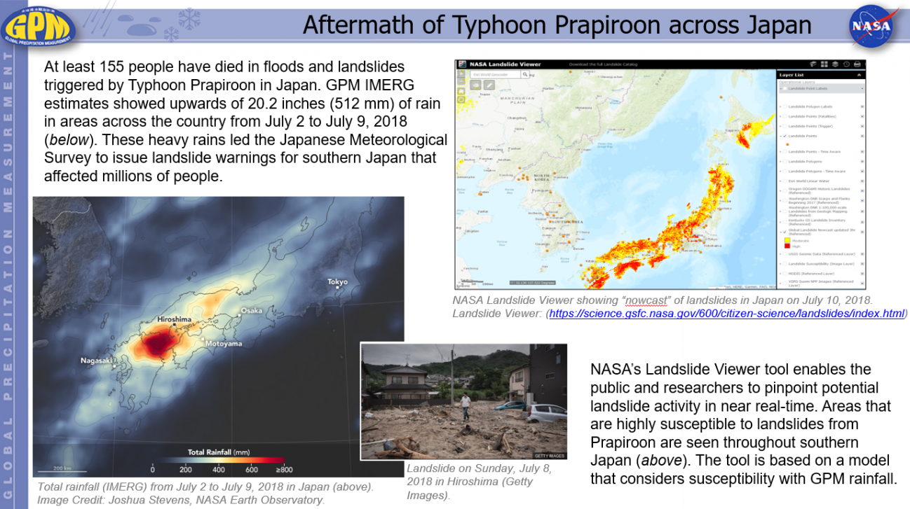
Landslides

Landslides are one of the most pervasive hazards in the world, resulting in more fatalities and economic damage than is generally recognized. Saturating the soil on vulnerable slopes, intense and prolonged rainfall is the most frequent landslide trigger, but seismicity, river undercutting, freeze-thaw processes, and human activity can also cause extensive and devastating landslides. 

Photo of Simon Ageet
Overview: Hydrometeorological natural hazards are on the rise globally, yet in Africa, rainfall data which is crucial in mitigation efforts is lacking. Understanding the amount and distribution of rainfall and how it plays a role in causing these natural hazards is critical to improve disaster response and mitigation efforts. This project uses GPM IMERG data together with resources like NASA's Landslide Viewer to determine a precipitation threshold for landslides in the Mt. Elgon region of Uganda. Mentors: Vasco Mantas , Zhong Liu , Andrea Portier , Dorian Janney
IMERG rainfall totals from the Nov. 2021 atmospheric river.
The Pacific Northwest coast saw two atmospheric rivers (ARs) bring heavy rains from Nov. 10-16, 2021, resulting in severe flooding, landslides, and damage to infrastructure in the British Columbia province of Canada. ARs are long, narrow corridors of water vapor that travel vast distances above the ocean from warm, tropical regions to higher latitudes, where they often release their moisture as rainfall when they reach land areas. While ARs occur across the globe, this year has been notable for several strong events that have impacted the Pacific Northwest coast. The two atmospheric rivers in
World Resources Institute Ethiopia
NASA’s Earth observation data are used in a wide variety of ways to improve life for humans and other animals across the world every day. Our climate is changing, and these changes include differences in temperature and precipitation patterns around the globe. As you might imagine, these changes bring about both anticipated and unanticipated consequences that have a profound impact on people around the world. Many organizations are responding to the amazing yet complicated wealth of data that can be used to successfully monitor many aspects of our global environment. The World Resources
Landslide Risk in Central America
On November 3, 2020, Hurricane Eta made landfall as one of the most powerful hurricanes to hit Central America in years. The category 4 storm destroyed hundreds of homes, killed more than 100 people, and brought torrential rains that triggered large and numerous landslides in Guatemala and Honduras. Less than two weeks later, Hurricane Iota —an even more powerful category 4 storm—nearly retraced Eta’s path. Within hours of Eta’s landfall and flooding rains , researchers at NASA’s Goddard Space Flight Center worked to predict landslides and map the storm’s aftermath. One team assessed potential
Hurricane Eta IMERG Screenshot
The extremely active 2020 Atlantic hurricane season, aided by the ongoing La Niña, continues on. After Hurricane Zeta made landfall along the northern part of the Gulf Coast, yet another hurricane has arisen - Hurricane Eta, the strongest of the season. Like Zeta, Eta also formed in the Caribbean, where sea surface temperatures are still running quite warm at around 29° C, almost a full degree above average and well above the typical 26° C needed for tropical cyclone development. But while Zeta turned north into the Gulf of Mexico, Eta moved westward where it delivered powerful winds and
Photograph of a landslide on a mountain.
Landslides are one of the most pervasive hazards in the world, resulting in more fatalities and economic damage than is generally recognized. Every year they block roads, damage infrastructure, and cause thousands of fatalities. Intense and prolonged rainfall is the most frequent landslide trigger around the world, but earthquakes and human influence can also cause significant and widespread landsliding. Using satellite data, we can identify the conditions under which landslides typically occur, helping to improve monitoring and modeling of these hazards
Landslide Risk in High Mountain Asia
More frequent and intense rainfall events due to climate change could cause more landslides in the High Mountain Asia region of China, Tibet and Nepal, according to the first quantitative study of the link between precipitation and landslides in the region. The model shows landslide risk for High Mountain Asia increasing in the summer months in the years 2061-2100, thanks to increasingly frequent and intense rainfall events. Summer monsoon rains can destabilize steep mountainsides, triggering landslides. Credits: NASA's Earth Observatory/Joshua Stevens High Mountain Asia stores more fresh...
GPM Data Mitigates Landslide Risks in Bangladesh
Camp managers and other local officials overseeing Rohingya refugee camps in Bangladesh are now incorporating NASA satellite observations into their decision making in order to reduce the risk to refugees from landslides and other natural hazards. Information like daily rain totals can help inform how to lay out refugee camps and store supplies. More than 740,000 Rohingya refugees have fled to Bangladesh since August 2017. Many of them have sought shelter in camps located in the hilly countryside, where landslide risk may be the greatest. Increasing this danger is Bangladesh’s intense monsoon season. Approximately 80 percent of Bangladesh's yearly rain falls in just five months, from June to October, bringing with it an increased risk of flash flooding and landslides.