Vietnam

NASA's IMERG Used To Analyze Tropical Storm Usagi's Rainfall

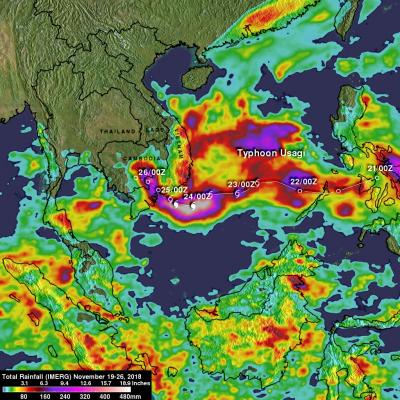
Usagi strengthened to hurricane intensity as it approached Vietnam from the South China Sea but weakened to tropical storm intensity when coming ashore. Very heavy rainfall and damaging winds accompanied tropical storm Usagi when it hit Vietnam's southern coast. More than 350 mm (14 inches) of rainfall was reported causing widespread flooding around Ho Chi Minh City. NASA's Integrated Multi-satellitE Retrievals for GPM (IMERG) data were used to show estimates of rainfall accumulation produced by Usagi as the tropical cyclone moved across the South China Sea into Southeast Asia. This IMERG

GPM Sees Remnants Of Tropical Storm Haikui Affecting Vietnam

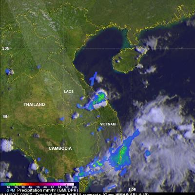
The GPM core observatory satellite provided information about rainfall associated with the remnants of tropical storm Haikui on November 2017 at 0929 UTC. Earlier this month, typhoon Damrey caused widespread destruction when it hit Vienam on November 4, 2017. Fortunately tropical storm Haikui dissipated over the South China Sea before it reached Vietnam. Rainfall data collected by GPM's Microwave Imager (GMI) and Dual Frequency Precipitation Radar (DPR) instruments revealed that some storms with tropical storm Haikui's remnants contained light to moderate precipitation. A small cluster of

Intensifying Typhoon Damrey Threatens Vietnam

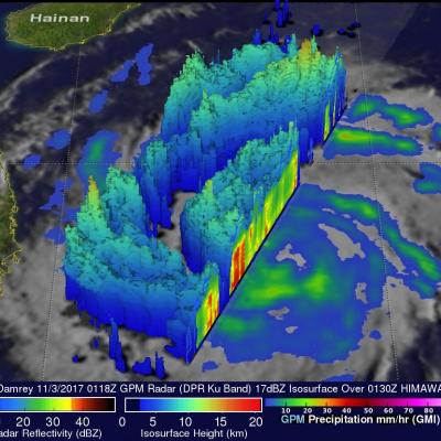
Typhoon Damrey has been increasing in intensity since forming in the South China sea west of the Philippines on November 1, 2017. Damrey has moved westward through the South China Sea and is now threatening southern Vietnam. The GPM core observatory satellite passed above Damrey on November 3, 2017 at 0118 UTC when the typhoon's winds had reached about 65 kts (75 mph). The satellite's Microwave Imager (GMI) and Dual Frequency Precipitation Radar (DPR) instruments collected data showing the locations of rainfall within the typhoon. Damrey's center of circulation was evident but the typhoon didn