Jose

GPM Sees Hurricanes Maria and Jose
GPM passed over both Hurricane Maria and Hurricane Jose on September 18th, 2017. As the camera moves in on the Maria, DPR's volumetric view of the storm is revealed. A slicing plane moves across the volume to display precipitation rates throughout the storm. Shades of green to red represent liquid precipitation extending down to the ground. The Global Precipitation Measurement (GPM) mission shows the rainfall distribution for two major storms churning in the Atlantic and Caribbean basins. The visualization shows Hurricane Jose as it continues to slowly move northward off the US East Coast east...

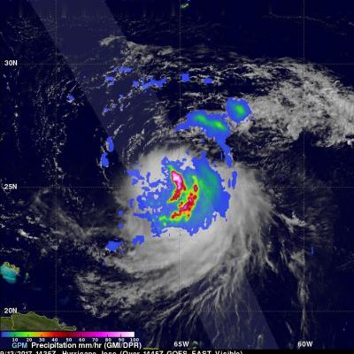
Jose Continues to Meander off the East Coast

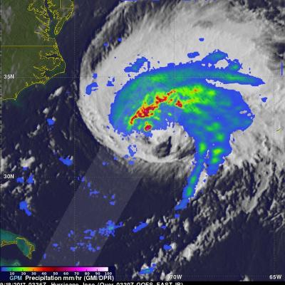
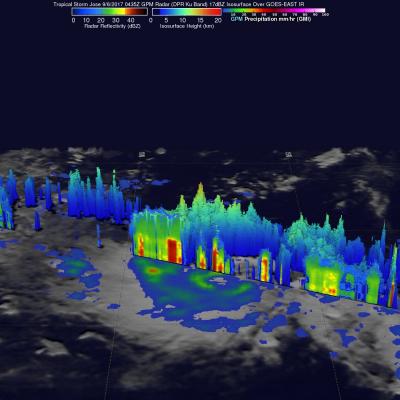
Jose has been a named storm for nearly two weeks now as it continues to slowly move northward off the US East Coast east of the Outer Banks of North Carolina. At one time, Jose was a powerful category 4 border line category 5 storm with maximum sustained winds reported at 155 mph by the National Hurricane Center back on the 9th of September as it was approaching the northern Leeward Islands. Jose passed northeast of the Leeward Islands as a category 4 storm on a northwest track and then began to weaken due to the effects of northerly wind shear. Jose then made a counterclockwise loop about

GPM Finds Sheared Hurricane Jose Has Very Tall Storms

On Wednesday September 13, 2017 at 10:35 AM AST (1435 UTC) the GPM core observatory satellite traveled above persistent hurricane Jose as it was meandering in the Atlantic Ocean. GPM found that even though Jose was affected by strong northwesterly shear it contained very powerful convective storms. GPM's Dual-Frequency Precipitation Radar (DPR) found extremely intense downpours within these storms where rain was measured by DPR falling at a rate of over 8.9 inches (227 mm) per hour. GPM's radar (DPR Ku Band) was used to show a 3-D cross-section of the precipitation within hurricane Jose. This

Intensifying Tropical Storm Jose

On September 5, 2017 tropical Storm Jose became the tenth named storm of the Atlantic hurricane season. The GPM core observatory satellite passed above the intensifying tropical cyclone on September 6, 2017 at 00:45 AM AST (0435 UTC). Data collected by GPM's Microwave Imager (GMI) at that time showed that weak bands of rain were starting to develop around Jose's center of circulation. GPM's Dual-Frequency Precipitation Radar (DPR) data swath revealed the location of heavy rain in a feeder band on Jose's western side. DPR found that rain in this area was falling at a rate of over 5.3 inches