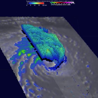
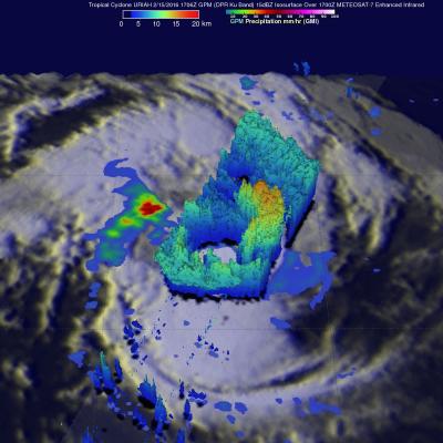
GPM Again Examines Powerful Tropical Cyclone Uriah
Both yesterday and today the GPM core observatory satellite had excellent views of tropical cyclone Uriah in the South Indian Ocean. Uriah was intensifying with winds of about 115 kts (132 mph) on February 17, 2016 at 1651 UTC when the GPM satellite passed above. A rainfall analysis derived from GPM's Microwave Imager (GMI) and Dual-frequency Precipitation Radar (DPR) data collected with that pass revealed that Uriah had a well defined circular eye. Rain was measured by DPR falling at a rate of over 179 mm (7 inches) per hour on the southern side of Uriah's eye wall. GPM passed over again on


