Bangladesh

Screenshot of the High-Impact Weather Assessment Toolkit (HIWAT),
Bangladesh has a long history of deadly and costly storms. Because these storms are so localized, they can be notoriously difficult to forecast, especially without access to the most advanced weather prediction technology. Researchers have created a new tool to boost the country’s ability to forecast severe weather. The SERVIR program - a joint initiative of NASA, USAID, and leading geospatial organizations in Asia, Africa, and Latin America - and the Bangladesh Meteorological Department ( BMD ) recently launched the High-Impact Weather Assessment Toolkit ( HIWAT ), a web-based tool that

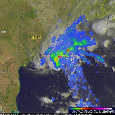
Bangladesh's Heavy Rainfall Examined With IMERG

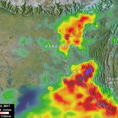
At least 156 people in Bangladesh were killed during the past week by landslides and floods caused by heavy rainfall. Monsoon rainfall has been especially heavy over this area that includes southeastern Bangladesh, northeastern India and western Burma (Myanmar). This disaster follows quickly on the heels of deadly cyclone Mora which hit the same area a couple weeks ago. This rainfall analysis was made at Goddard Space Flight Center using NASA's near-real time Integrated Multi-satelliE Retrievals for GPM (IMERG) data. Those IMERG data were assembled during the period from June 12-14, 2017. The

Tropical Disturbance Threatens India and Bangladesh

A tropical disturbance that recently formed in the Bay Of Bengal may cause heavy rainfall in the next few days along coastal India's eastern state of Odisha and southern Bangladesh. The low is predicted to move northeastward over the warm waters of the Bay Of Bengal but according to the Joint Typhoon Warning Center (JTWC) has only a medium chance of developing into a tropical cyclone. High vertical wind shear is forecast to keep the tropical disturbance from intensifying. The GPM core observatory flew above the low on November 4, 2016 at 0026 UTC. GPM saw that the low contained some strong

GPM Sees Tropical Cyclone Drenching Bangladesh

Bangladesh was already soaked by monsoon rainfall before recently formed tropical storm Komen started drenching the area. The GPM core observatory satellite collected data above the tropical cyclone on on July 30, 2015 at 0436 UTC ( 10:36 AM BDT). GPM's Microwave Imager (GMI) measured rain falling at the extreme rate of close to 150 mm (5.9 inches) per hour in powerful storms over the Bay Of Bengal. A 3-D view of thunderstorm tops based on radar reflectivity day from GPM's Dual-Frequency Precipitation Radar (DPR) is shown here. DPR (Ku band) radar data were used in this simulated cross section